world.wikisort.org - Australia
The Roxby Council, formerly Roxby Downs Council and before that the Municipal Council of Roxby Downs, is the local government area covering the town of Roxby Downs and the Olympic Dam mine in South Australia. It has an area of 110 km².[citation needed] At the 2016 census, it had a population of 3884.[1] The municipality was constituted on 15 May 1986.[2] It is the only local government area in South Australia to not have an elected council.[citation needed]
| Roxby Council South Australia | |
|---|---|
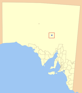 Location of the Municipal Council of Roxby Downs in blue | |
| Coordinates | 30.5079°S 136.9157°E |
| Population | 3,884 (2016 census)[1] |
| • Density | 39.0/km2 (101/sq mi) |
| Established | 15 May 1986[2] |
| Area | 110 km2 (42.5 sq mi)[citation needed] |
| Council seat | Roxby Downs |
| Region | Far North[3] |
| State electorate(s) | Giles |
| Federal division(s) | Grey |
| Website | Roxby Council |
It covers most of the locality of Roxby Downs, except a portion to the east of the town, while also including a section of the adjacent locality of Olympic Dam.[4]
See also
- Local government areas of South Australia
- List of parks and gardens in rural South Australia
References
- Australian Bureau of Statistics (27 June 2017). "Roxby Downs". 2016 Census QuickStats. Retrieved 11 September 2019.
- Blevins, F.T. (15 May 1986). "LOCAL GOVERNMENT ACT, 1934, ROXBY DOWNS (INDENTURE RATIFICATION) ACT, 1982—OLYMPIC DAM AND STUART SHELF INDENTURE—CONSTITUTION OF MUNICIPAL COUNCIL" (PDF). The South Australian Government Gazette. Government of South Australia. p. 1254. Retrieved 11 September 2019.
- "Far North SA Government Region" (PDF). Department of Planning, Transport and Infrastructure. Retrieved 10 October 2014.
- "Location SA Map Viewer". Government of South Australia. Retrieved 12 April 2016.
External links
This Australian government-related article is a stub. You can help Wikipedia by expanding it. |
На других языках
[de] Roxby Downs Municipal Council
-30.563055555556136.89555555556 Der Municipal Council of Roxby Downs ist ein lokales Verwaltungsgebiet (LGA) im australischen Bundesstaat South Australia. Das Gebiet ist 110 km² groß und hat etwa 3900 Einwohner (2016).- [en] Roxby Council
Текст в блоке "Читать" взят с сайта "Википедия" и доступен по лицензии Creative Commons Attribution-ShareAlike; в отдельных случаях могут действовать дополнительные условия.
Другой контент может иметь иную лицензию. Перед использованием материалов сайта WikiSort.org внимательно изучите правила лицензирования конкретных элементов наполнения сайта.
Другой контент может иметь иную лицензию. Перед использованием материалов сайта WikiSort.org внимательно изучите правила лицензирования конкретных элементов наполнения сайта.
2019-2026
WikiSort.org - проект по пересортировке и дополнению контента Википедии
WikiSort.org - проект по пересортировке и дополнению контента Википедии