world.wikisort.org - Australia
Barossa Council is a local government area in the Barossa Valley in South Australia. The council area covers 912 square kilometres and had a population of over 23,000 as at the 2016 Census.
| Barossa District Council South Australia | |||||||||||||||
|---|---|---|---|---|---|---|---|---|---|---|---|---|---|---|---|
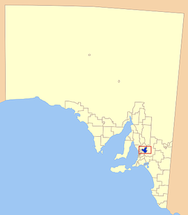 Location of the Barossa Council in blue | |||||||||||||||
| Population | 23,558 (2016 census)[1] | ||||||||||||||
| • Density | 25.831/km2 (66.90/sq mi) | ||||||||||||||
| Established | 1996 | ||||||||||||||
| Area | 912 km2 (352.1 sq mi) | ||||||||||||||
| Mayor | Michael "Bim" Lange [2] | ||||||||||||||
| Council seat | Nuriootpa | ||||||||||||||
| Region | Barossa Light and Lower North[3] | ||||||||||||||
| State electorate(s) | Schubert | ||||||||||||||
| Federal division(s) |
| ||||||||||||||
| Website | Barossa District Council | ||||||||||||||
| |||||||||||||||
History
It was proclaimed on 1 July 1996 following the amalgamation of the District Council of Angaston, the District Council of Barossa and the District Council of Tanunda. It also gained a portion of the former District Council of Mount Pleasant on 1 July 1997.[4]
Description
Townships in the council area include
- Angaston
- Eden Valley
- Lyndoch
- Moculta
- Mount Pleasant
- Nuriootpa
- Penrice
- Springton
- Stockwell
- Tanunda
- Williamstown
Mayors
- Brian Hurn - 1996-2014
- Bob Sloane - 2014-2018
- Michael "Bim" Lange - 2018 - present
See also
- List of parks and gardens in rural South Australia
- Hoffnungsthal, South Australia
References
- Australian Bureau of Statistics (27 June 2017). "Barossa (DC)". 2016 Census QuickStats. Retrieved 29 November 2017.
- "Your Elected Members". Barossa Council. Retrieved 30 April 2019.
- "Barossa, Light and Lower North SA Government region" (PDF). The Government of South Australia. Retrieved 10 October 2014.
- "About Council Fact Sheet" (PDF). Barossa Council. Retrieved 31 March 2016.
External links
This Australian government-related article is a stub. You can help Wikipedia by expanding it. |
Текст в блоке "Читать" взят с сайта "Википедия" и доступен по лицензии Creative Commons Attribution-ShareAlike; в отдельных случаях могут действовать дополнительные условия.
Другой контент может иметь иную лицензию. Перед использованием материалов сайта WikiSort.org внимательно изучите правила лицензирования конкретных элементов наполнения сайта.
Другой контент может иметь иную лицензию. Перед использованием материалов сайта WikiSort.org внимательно изучите правила лицензирования конкретных элементов наполнения сайта.
2019-2026
WikiSort.org - проект по пересортировке и дополнению контента Википедии
WikiSort.org - проект по пересортировке и дополнению контента Википедии