world.wikisort.org - Australia
The Monga National Park is a 251.44-square-kilometre (97.08 sq mi) national park located 230 kilometres (140 mi) south west of Sydney, New South Wales, Australia. The closest town nearby is Braidwood.[1]
| Monga National Park New South Wales | |
|---|---|
IUCN category II (national park) | |
 Eucalyptus forest at Monga National Park | |
 Monga National Park | |
| Nearest town or city | Braidwood. |
| Coordinates | 35°39′47″S 149°58′16″E |
| Established | 1 January 2001 |
| Area | 251.44 km2 (97.1 sq mi) |
| Managing authorities | National Parks and Wildlife Service |
| Website | Monga National Park |
| See also | Protected areas of New South Wales |
Monga features outstanding high altitude eucalyptus forest and temperate rainforest. It contains the Corn Trail, a historic bridle-track, built in the 1830s, that has been restored and reopened as a walking track.[2][3]
In the park you can find many cultural sites of the ancient Aboriginal peoples of Yuin and Walbunja.[4]
The park has an elevation of 686 meters.[5]
Gallery
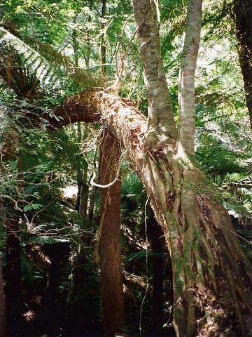
 Pinkwood growing as a hemiepiphyte on a Soft Tree Fern at Monga National Park
 Southern Sassafras at Monga National Park; a seldom seen plant in New South Wales
 The Monga Waratah at Monga National Park
 A stand of Eucalyptus trees at Monga National park


See also
- Protected areas of New South Wales
References
![]() Media related to Monga National Park at Wikimedia Commons
Media related to Monga National Park at Wikimedia Commons
- "Monga National Park".
- "Corn Trail walking track". NSW National Parks. Retrieved 29 March 2021.
- "Corn Trail offers up rich plenitude of flora and fauna". Canberra Times (ACT : 1926 - 1995). 8 November 1992. p. 20. Retrieved 28 March 2021.
- "Monga National Park | Learn more". NSW National Parks. Retrieved 3 November 2021.
- "Worldwide Elevation Finder". elevation.maplogs.com. Retrieved 3 November 2021.
This New South Wales protected areas related article is a stub. You can help Wikipedia by expanding it. |
Текст в блоке "Читать" взят с сайта "Википедия" и доступен по лицензии Creative Commons Attribution-ShareAlike; в отдельных случаях могут действовать дополнительные условия.
Другой контент может иметь иную лицензию. Перед использованием материалов сайта WikiSort.org внимательно изучите правила лицензирования конкретных элементов наполнения сайта.
Другой контент может иметь иную лицензию. Перед использованием материалов сайта WikiSort.org внимательно изучите правила лицензирования конкретных элементов наполнения сайта.
2019-2026
WikiSort.org - проект по пересортировке и дополнению контента Википедии
WikiSort.org - проект по пересортировке и дополнению контента Википедии