world.wikisort.org - Australia
Milvale is a small village in southern New South Wales, Australia. The locality is in the Hilltops Council local government area.
| Milvale New South Wales | |||||||||||||||
|---|---|---|---|---|---|---|---|---|---|---|---|---|---|---|---|
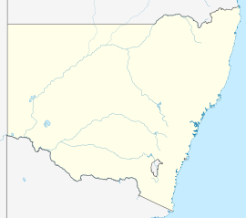  Milvale | |||||||||||||||
| Coordinates | 34°19′S 147°55′E | ||||||||||||||
| Population | 89 (SAL 2021)[1] | ||||||||||||||
| Postcode(s) | 2594 | ||||||||||||||
| Location | |||||||||||||||
| LGA(s) | Hilltops Council | ||||||||||||||
| State electorate(s) | Cootamundra | ||||||||||||||
| Federal division(s) | Riverina | ||||||||||||||
| |||||||||||||||
At the 2016 census the population of Milvale was 67,[2] which had increased to 89 at the 2021 census.[3]
Transport
In 2011, the short crossing loops were extended to 1,850 metres (6,070 ft).[4][why?]
| Preceding station | Former Services | Following station | ||
|---|---|---|---|---|
| Stockinbingal Terminus |
Stockinbingal-Parkes Line | Forbes towards Parkes | ||
References
- Australian Bureau of Statistics (28 June 2022). "Milvale (Suburb and Locality)". Australian Census 2021 QuickStats. Retrieved 28 June 2022.
- Australian Bureau of Statistics (27 June 2017). "Milvale (State Suburb)". 2016 Census QuickStats. Retrieved 21 December 2019.
- "2021 Milvale, Census All persons QuickStats". Australian Bureau of Statistics. Retrieved 15 August 2022.
- "Yet Another Economic Stimulus Rail Project Completed". Archived from the original on 27 February 2012. Retrieved 20 October 2012.

  | This article about a railway station in New South Wales is a stub. You can help Wikipedia by expanding it. |
Текст в блоке "Читать" взят с сайта "Википедия" и доступен по лицензии Creative Commons Attribution-ShareAlike; в отдельных случаях могут действовать дополнительные условия.
Другой контент может иметь иную лицензию. Перед использованием материалов сайта WikiSort.org внимательно изучите правила лицензирования конкретных элементов наполнения сайта.
Другой контент может иметь иную лицензию. Перед использованием материалов сайта WikiSort.org внимательно изучите правила лицензирования конкретных элементов наполнения сайта.
2019-2026
WikiSort.org - проект по пересортировке и дополнению контента Википедии
WikiSort.org - проект по пересортировке и дополнению контента Википедии