world.wikisort.org - Australia
Maimuru is a small village in southern New South Wales, Australia. The locality is in the Hilltops Council local government area.[2]
| Maimuru New South Wales | |
|---|---|
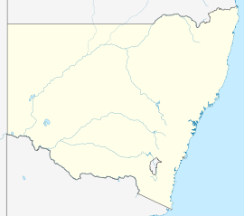  Maimuru | |
| Coordinates | 34°13′S 148°13′E |
| Population | 145 (SAL 2021)[1] |
| Postcode(s) | 2594 |
| Location | 10 km (6 mi) NW of Young |
| LGA(s) | Hilltops Council |
| State electorate(s) | Cootamundra |
| Federal division(s) | Riverina |
At the 2016 census, Maimuru had a population of 137,[3] which had increased to 145 at the 2021 census.[4]
Maimuru Public School, located in School Road, celebrated its centenary in 2021.[5]
References
- Australian Bureau of Statistics (28 June 2022). "Maimuru (Suburb and Locality)". Australian Census 2021 QuickStats. Retrieved 28 June 2022.
- "NSW Place and Road Naming Proposals System: Maimuru". proposals.gnb.nsw.gov.au. Retrieved 26 September 2021.
{{cite web}}: CS1 maint: url-status (link) - Australian Bureau of Statistics (27 June 2017). "Maimuru (State Suburb)". 2016 Census QuickStats. Retrieved 26 September 2021.
- "2021 Maimuru, Census All persons QuickStats". Australian Bureau of Statistics. Retrieved 15 August 2022.
- "Maimuru Centenary". Maimuru Public School. Retrieved 26 September 2021.
{{cite web}}: CS1 maint: url-status (link)

Текст в блоке "Читать" взят с сайта "Википедия" и доступен по лицензии Creative Commons Attribution-ShareAlike; в отдельных случаях могут действовать дополнительные условия.
Другой контент может иметь иную лицензию. Перед использованием материалов сайта WikiSort.org внимательно изучите правила лицензирования конкретных элементов наполнения сайта.
Другой контент может иметь иную лицензию. Перед использованием материалов сайта WikiSort.org внимательно изучите правила лицензирования конкретных элементов наполнения сайта.
2019-2026
WikiSort.org - проект по пересортировке и дополнению контента Википедии
WikiSort.org - проект по пересортировке и дополнению контента Википедии