world.wikisort.org - Australia
Kragra is a rural locality in the Western Downs Region, Queensland, Australia.[3] In the 2016 census, Kragra had a population of 27 people.[1]
| Kragra Queensland | |||||||||||||||
|---|---|---|---|---|---|---|---|---|---|---|---|---|---|---|---|
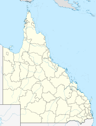  Kragra | |||||||||||||||
| Coordinates | 26.1175°S 150.7902°E | ||||||||||||||
| Population | 27 (2016 census)[1] | ||||||||||||||
| • Density | 0.0448/km2 (0.1161/sq mi) | ||||||||||||||
| Postcode(s) | 4413[2] | ||||||||||||||
| Area | 602.5 km2 (232.6 sq mi) | ||||||||||||||
| Time zone | AEST (UTC+10:00) | ||||||||||||||
| Location |
| ||||||||||||||
| LGA(s) | Western Downs Region | ||||||||||||||
| State electorate(s) | Callide | ||||||||||||||
| Federal division(s) |
| ||||||||||||||
| |||||||||||||||
Kragra's postcode is 4413.[2]
Geography
The ridgline of the Great Dividing Range roughly bounds Kragra to the south. Part of the Koko State Forest (26.0571°S 150.8687°E) is in the north of the locality; the state forest extends into neighbouring Hawkwood. Part of the Jarrah State Forest is in the south-east of the locality (26.2210°S 150.8329°E), extending into neighbouring Durah.[4]
Apart from the state forests, the predominant land use is grazing on native vegetation.[4]
History
Kragra Provisional School opened on 18 July 1955. It closed on 31 December 1974.[5]
In the 2016 census, Kragra had a population of 27 people.[1]
Economy
There are a number of homesteads in the locality:[6]
- Aqua Downs (26.0856°S 150.8684°E)
- Araluen (26.1110°S 150.7339°E)
- Bawnduggi (26.1589°S 150.8437°E)
- Glenroy (26.0715°S 150.8999°E)
- Koala (26.1088°S 150.9104°E)
- Kraga (26.1212°S 150.8652°E)
- Lismore (26.1835°S 150.7003°E)
- Ormonde (26.1457°S 150.6704°E)
- Overstone (26.1418°S 150.8397°E)
- Rawdenvale (26.1344°S 150.9027°E)
- Wambalano (26.0215°S 150.6877°E)
- Wonga Hills (26.0906°S 150.8230°E)
Education
There are no schools in Kragra. The nearest primary school is Monogorilby State School in Monogorilby to the east. There are no nearby secondary schools; distance education or boarding school would be options.[4]
References
- Australian Bureau of Statistics (27 June 2017). "Kragra (SSC)". 2016 Census QuickStats. Retrieved 20 October 2018.
- Kragra Postcode Australia Post
- "Kragra – locality in Western Downs Region (entry 47721)". Queensland Place Names. Queensland Government. Retrieved 19 September 2020.
- "Queensland Globe". State of Queensland. Retrieved 14 December 2020.
- Queensland Family History Society (2010), Queensland schools past and present (Version 1.01 ed.), Queensland Family History Society, ISBN 978-1-921171-26-0
- "Homesteads - Queensland". Queensland Open Data. Queensland Government. 18 November 2020. Archived from the original on 24 November 2020. Retrieved 24 November 2020.

Further reading
- History of Cadarga-Kragra and Monogorilby districts 1862-1959, Mondarga Branch Q.C.W.A, 1959
- Monogorilby State School golden jubilee : 1936 - 1986 : incorporating Allies Creek State School, Brovinia Creek State School and Kragra Provisional School, Monogorilby State School, 1986
Другой контент может иметь иную лицензию. Перед использованием материалов сайта WikiSort.org внимательно изучите правила лицензирования конкретных элементов наполнения сайта.
WikiSort.org - проект по пересортировке и дополнению контента Википедии