world.wikisort.org - Australia
Innisfail (from Irish: Inis Fáil) is a regional town and locality in the Cassowary Coast Region, Queensland, Australia.[6][7] The town was originally called Geraldton until 1910. In the 2016 census, the town of Innisfail had a population of 7,236 people,[1] while the locality of Innisfail had a population of 1,145 people.[2]
| Innisfail Queensland | |||||||||||||||
|---|---|---|---|---|---|---|---|---|---|---|---|---|---|---|---|
 The township of Innisfail, as seen from Coquette Point | |||||||||||||||
 Innisfail | |||||||||||||||
| Coordinates | 17.5238°S 146.0311°E | ||||||||||||||
| Population | |||||||||||||||
| • Density | 703/km2 (1,820/sq mi) | ||||||||||||||
| Established | 1882/83[3][4] | ||||||||||||||
| Postcode(s) | 4860 | ||||||||||||||
| Elevation | 10 m (33 ft)[5] | ||||||||||||||
| Area | 10.3 km2 (4.0 sq mi) | ||||||||||||||
| Time zone | AEST (UTC+10:00) | ||||||||||||||
| Location |
| ||||||||||||||
| LGA(s) | Cassowary Coast Region | ||||||||||||||
| State electorate(s) | Hill | ||||||||||||||
| Federal division(s) | Kennedy | ||||||||||||||
| |||||||||||||||
| |||||||||||||||
Innisfail is the major township of the Cassowary Coast Region and is known for its sugar and banana industries, as well as for being one of Australia's wettest towns. In March 2006, Innisfail gained worldwide attention when severe Tropical Cyclone Larry passed over causing extensive damage.[8][9]
Geography
Innisfail's town centre is situated at the junction of the Johnstone River and South Johnstone River, approximately 5 km (3 mi) from the coast.[10] It is located near large tracts of old-growth tropical rainforest surrounded by vast areas of extensive farmlands. Queensland's highest mountain, Mount Bartle Frere; part of Australia's Great Dividing Range, is 15 kilometres (9 mi) to the north.[11]
The town's central business district is in the vicinity of Edith Street and Rankin Street (17.5241°S 146.0311°E).[12]
Climate

| Innisfail, Queensland, Australia | ||||||||||||||||||||||||||||||||||||||||||||||||||||||||||||
|---|---|---|---|---|---|---|---|---|---|---|---|---|---|---|---|---|---|---|---|---|---|---|---|---|---|---|---|---|---|---|---|---|---|---|---|---|---|---|---|---|---|---|---|---|---|---|---|---|---|---|---|---|---|---|---|---|---|---|---|---|
| Climate chart (explanation) | ||||||||||||||||||||||||||||||||||||||||||||||||||||||||||||
| ||||||||||||||||||||||||||||||||||||||||||||||||||||||||||||
| ||||||||||||||||||||||||||||||||||||||||||||||||||||||||||||
Innisfail experiences a tropical rainforest climate (Köppen: Af) and has no month with an average temperature below 18 °C (64.4 °F) or with less than 60 millimetres (2.4 in) of rainfall.[13][14] However, as a trade-wind climate that experiences frequent cyclones, it is not equatorial. Consistently, humid, very warm to hot weather dominates in Innisfail. In particular Innisfail is reputed as being among the wettest towns in Australia.[15] Babinda, 30 kilometres (19 mi) north of Innisfail is generally considered to be the wettest.
Unlike most of tropical Australia,[16] the southern winter or "dry" season is not completely dry as moist easterly winds bring frequent showers;[17] rainfall is, however, still far lower than during the southern summer. Monthly totals of over 1,000 mm (39 in) are a routine occurrence in the region between January and April and some months will not experience a day without rain if the monsoon is unusually heavy. The town gets around 63.5 clear days per year.[5]
During the summer ‘cyclone season’, Innisfail is frequently under threat from tropical cyclones developing in the Coral Sea.[18] Furthermore, high rainfall associated with aforementioned cyclones and monsoons, combined with Innisfail settlement on adjoining rivers causes flooding to be commonplace, occurring to varied degrees of severity annually.[19]
| Climate data for Innisfail, Queensland, Australia (1991-2020 normals, extremes 1881-present); 10 m AMSL | |||||||||||||
|---|---|---|---|---|---|---|---|---|---|---|---|---|---|
| Month | Jan | Feb | Mar | Apr | May | Jun | Jul | Aug | Sep | Oct | Nov | Dec | Year |
| Record high °C (°F) | 40.1 (104.2) |
40.8 (105.4) |
37.8 (100.0) |
34.2 (93.6) |
31.2 (88.2) |
29.5 (85.1) |
30.0 (86.0) |
30.4 (86.7) |
32.2 (90.0) |
35.6 (96.1) |
41.0 (105.8) |
40.3 (104.5) |
41.0 (105.8) |
| Mean maximum °C (°F) | 32.8 (91.0) |
33.0 (91.4) |
31.7 (89.1) |
30.1 (86.2) |
28.3 (82.9) |
26.7 (80.1) |
26.1 (79.0) |
27.0 (80.6) |
28.4 (83.1) |
30.0 (86.0) |
31.2 (88.2) |
32.6 (90.7) |
33.0 (91.4) |
| Average high °C (°F) | 31.1 (88.0) |
31.0 (87.8) |
30.0 (86.0) |
28.5 (83.3) |
26.5 (79.7) |
24.7 (76.5) |
24.2 (75.6) |
25.1 (77.2) |
27.0 (80.6) |
28.3 (82.9) |
29.8 (85.6) |
30.8 (87.4) |
28.1 (82.6) |
| Daily mean °C (°F) | 27.4 (81.3) |
27.4 (81.3) |
26.5 (79.7) |
25.0 (77.0) |
22.9 (73.2) |
21.1 (70.0) |
20.3 (68.5) |
20.8 (69.4) |
22.6 (72.7) |
24.2 (75.6) |
25.8 (78.4) |
27.0 (80.6) |
24.3 (75.6) |
| Average low °C (°F) | 23.6 (74.5) |
23.7 (74.7) |
22.9 (73.2) |
21.4 (70.5) |
19.3 (66.7) |
17.5 (63.5) |
16.3 (61.3) |
16.5 (61.7) |
18.1 (64.6) |
20.1 (68.2) |
21.8 (71.2) |
23.1 (73.6) |
20.4 (68.6) |
| Mean minimum °C (°F) | 21.7 (71.1) |
21.8 (71.2) |
20.7 (69.3) |
18.9 (66.0) |
15.9 (60.6) |
12.4 (54.3) |
11.4 (52.5) |
12.8 (55.0) |
14.5 (58.1) |
17.0 (62.6) |
19.2 (66.6) |
20.6 (69.1) |
11.4 (52.5) |
| Record low °C (°F) | 17.2 (63.0) |
18.0 (64.4) |
17.2 (63.0) |
10.5 (50.9) |
9.4 (48.9) |
6.5 (43.7) |
6.2 (43.2) |
8.2 (46.8) |
10.1 (50.2) |
12.2 (54.0) |
16.0 (60.8) |
17.2 (63.0) |
6.2 (43.2) |
| Average precipitation mm (inches) | 505.9 (19.92) |
581.5 (22.89) |
596.8 (23.50) |
385.2 (15.17) |
303.1 (11.93) |
180.2 (7.09) |
167.4 (6.59) |
123.8 (4.87) |
78.3 (3.08) |
114.5 (4.51) |
166.8 (6.57) |
283.7 (11.17) |
3,487.2 (137.29) |
| Average precipitation days (≥ 1.0 mm) | 17.3 | 17.1 | 19.9 | 19.2 | 17.3 | 13.9 | 12.0 | 9.7 | 7.2 | 8.3 | 10.3 | 12.8 | 165 |
| Average relative humidity (%) | 76.0 | 80.0 | 78.0 | 79.0 | 79.0 | 77.5 | 76.0 | 75.0 | 70.5 | 69.5 | 71.0 | 73.0 | 75.4 |
| Average dew point °C (°F) | 23.6 (74.5) |
24.0 (75.2) |
22.7 (72.9) |
21.6 (70.9) |
19.5 (67.1) |
17.5 (63.5) |
16.2 (61.2) |
17.0 (62.6) |
18.4 (65.1) |
20.1 (68.2) |
21.6 (70.9) |
23.0 (73.4) |
20.4 (68.8) |
| Source 1: Australian Bureau of Meteorology (1991-2020 normals)[20] | |||||||||||||
| Source 2: Australian Bureau of Meteorology (1881-present extremes)[21] | |||||||||||||
History
Prior to European settlement the Innisfail area was occupied by five separate societies of the Mamu people. These Aboriginal people followed migratory lifestyles in the rainforest and traversed rivers in string-bark canoes.
The first arrival of European people came in January 1872 when survivors of the shipwreck, the "Maria" arrived on the coastal areas surrounding what is now the Johnstone River. Sub-Inspector Robert Arthur Johnstone of the Native Police came with the intention of rescuing remaining survivors and collectively punishing Aboriginals thought to have killed a number of the shipwrecked crew. In mid 1873, Johnstone returned to the area as part of another punitive mission and ventured further upriver between what is today Flying Fish Point and Coquette Point.[22] Johnstone wrote very highly of the area, stating:
A most glorious view appeared – a noble reach of fresh water, studded with blacks with their canoes and catamarans, others on the sandy beaches; deep blue fresh water expanding to an imposing breadth.
— Robert Johnstone (1873), [3]

In October 1873, Johnstone again returned as part of the Northeast Coast Expedition led by the explorer George Elphinstone Dalrymple. British settlement was first established at the junction of the north and south branches of the Johnstone River by this expedition on 5 October 1873. It was named Nind's Camp after Philip Henry Nind who accompanied the party.[23]
Later in 1879, Irishman Thomas Henry Fitzgerald arrived in the area to establish a sugar industry at his Innisfail Estate (now the locality of that name).[24] He was accompanied by large numbers of Kanaka South Sea Islanders workers accompanied by smaller numbers of Irish labourers. The house built by Fitzgerald and thus the first establishment in the area was called Innisfallen, after the largest island in the Lakes of Killarney, Ireland. Inis Fáil (Island of Destiny) is an ancient Irish name for Ireland itself.[6] The name is used in the rarely sung third verse of "The Soldier's Song", the Irish national anthem. The stone mentioned may be the stone at Tara, Co Meath, at which high kings of Ireland were crowned.
From 1879, the settlement was named Geraldton (officially in July 1883) by Fitzgerald, but on 20 August 1910 it was renamed "Innisfail" to avoid confusion with the town of the same name in Western Australia.[4][25] It was Margaret-Mary Noone a long time resident of the area who suggested the name Innisfail as a way to honour T.H Fitzgerald's pioneering efforts and Ireland[26][27]
Johnstone River Post Office opened on 1 November 1882 (a receiving office had been open from 1880), was renamed Geraldton two months later and Innisfail in 1910.[28]

In May 1885, the Queensland Government called for tenders to build the Geraldton Hospital to replace the existing tent hospital;[29] however, the tenders submitted were more expensive than the government was willing to pay, so they called again for tenders in September 1885 resulting in a contract with E. Couchman for £1527.[30][31]
Geraldton Provisional School opened on 18 July 1887. On 1 August 1894 it became Geraldton State School. In 1913 the name was changed to Innisfail State School to reflect the renaming of the town.[32]
The Innisfail Parish within the Roman Catholic Vicariate Apostolic of Cooktown (now the Roman Catholic Diocese of Cairns) was established in 1898.[33] It is now merged with the Mourilyian and South Johnstone parishes.[34]
Sacred Heart Catholic School opened on 2 November 1902 with an enrolment of 42 students. It was operated by the Sisters of the Good Samaritan. It was renamed Good Counsel Catholic Primary School in 1975. When the Sisters were no longer able to lead the school, it was briefly led by the Marist Brothers until the first lay principal was appointed in 1982. The Sisters withdrew from teaching in the school in 1990.[35]
In 1906, Patrick Leahy established the Johnstone River Advocate newspaper, with the first issue published in December that year.[36] Later it was renamed the Johnstone River Advocate and Innisfail News, the Evening Advocate, and the Innisfail Chronicle. The newspaper continues to be published as the Innisfail Advocate.[37]
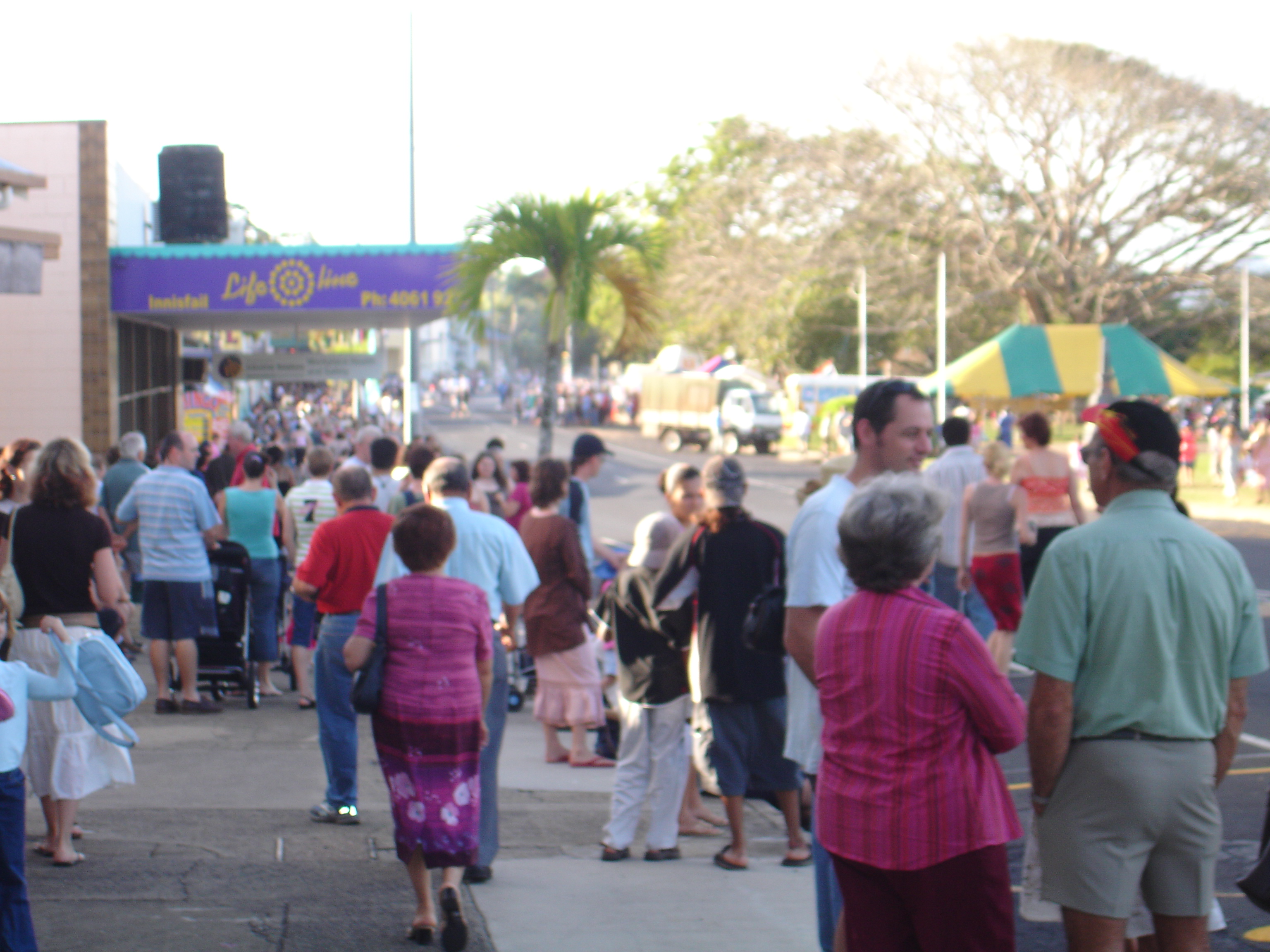
In June 1912 there was a meeting that resulted in the creation of the Johnstone River Agricultural Association with the intention to hold their first agricultural show that same year.[38] The first show was held on Friday 11 and Saturday 12 October 1912 in recreation ground (now Callender Park) with exhibits in the Shire Hall and the Oddfellows Hall. In 1935 the show needed more space and the present showgrounds were established (in present-day Goondi Hill) with purpose-built buildings and a show ring. The show was held annually apart from 1942 and 1942 when, due to World War II, the army was using the showground. In 1986 many of the showgound's buildings were badly damaged by Cyclone Winifred with further damage sustained during Cyclone Larry in 2006. In 2002 the show introduced a banana packing competition which was very popular.[39]
A huge cyclone swept through Innisfail on 10 March 1918, causing immense damage and killing many people.[40] So many buildings were severely damaged, that many new buildings were erected after the cyclone using concrete rather than the more traditional timber with tin roof. As Art Deco architecture was popular at that time, many of the new buildings were built in the Art Deco style.[40] As a result, Innisfail is now considered one of the best Australian towns for Art Deco and Streamline Moderne architecture.[41]
The 1920s and 1930s saw the beginning of a major period of settlement by Italian immigrants and noteworthy populations from Greece and Malta. Later in this period populations from Yugoslavia, India and the Philippines would also settle in the area.[3][42]

On Sunday 1 July 1928 Bishop John Heavey officially opened and blessed the new Catholic presbytery, built of reinforced concrete to protect it from cyclones, after the Catholic church and associated buildings were all destroyed in the cyclone of 1918.[43] Heavey returned some week later to officially open and bless the new Mother of Good Counsel Catholic Church which cost £20,000 and was described as the largest Catholic church in Queensland outside of its capital Brisbane.[44]
Innisfail East State School opened on 3 February 1936.[45]
Innisfail State High School opened on 24 January 1955 and operated until the end of 2009 at 2 Stitt Street (Mighell, 17.5367°S 146.0280°E).[46] In 2010, it was amalgamated with the Innisfail Inclusive Education Centre (a special education facility) and Tropical North Queensland TAFE (Innisfail Campus) to form Innisfail State College using the site of the TAFE campus at Innisfail Estate.[45][47][48] Innisfail State High School's website was archived.[49]
On 3 July 1970, Innisfail State School introduced a special education program called Opportunity Classes. In 1980 these were replaced by the opening of Innisfail Special School on 29 January 1980. On 7 March 2003 the school was renamed Innisfail Inclusive Education Centre.[32] In 2010 it was amalgamated into the Innisfail State College.[45][47]
Radiant Life Christian College opened on 13 February 1982 and closed on 1 November 1991.[32]
In 2001 Los Angeles band Sugar Ray filmed part of their music DVD "Music in High Places" at the Johnstone Crocodile Farm in Innisfail.[citation needed]
The Innisfail War Memorial in Jack Fossey Park on Fitzgerald Esplanade was dedicated on 16 April 2005; it commemorates those who served in all wars.[50]
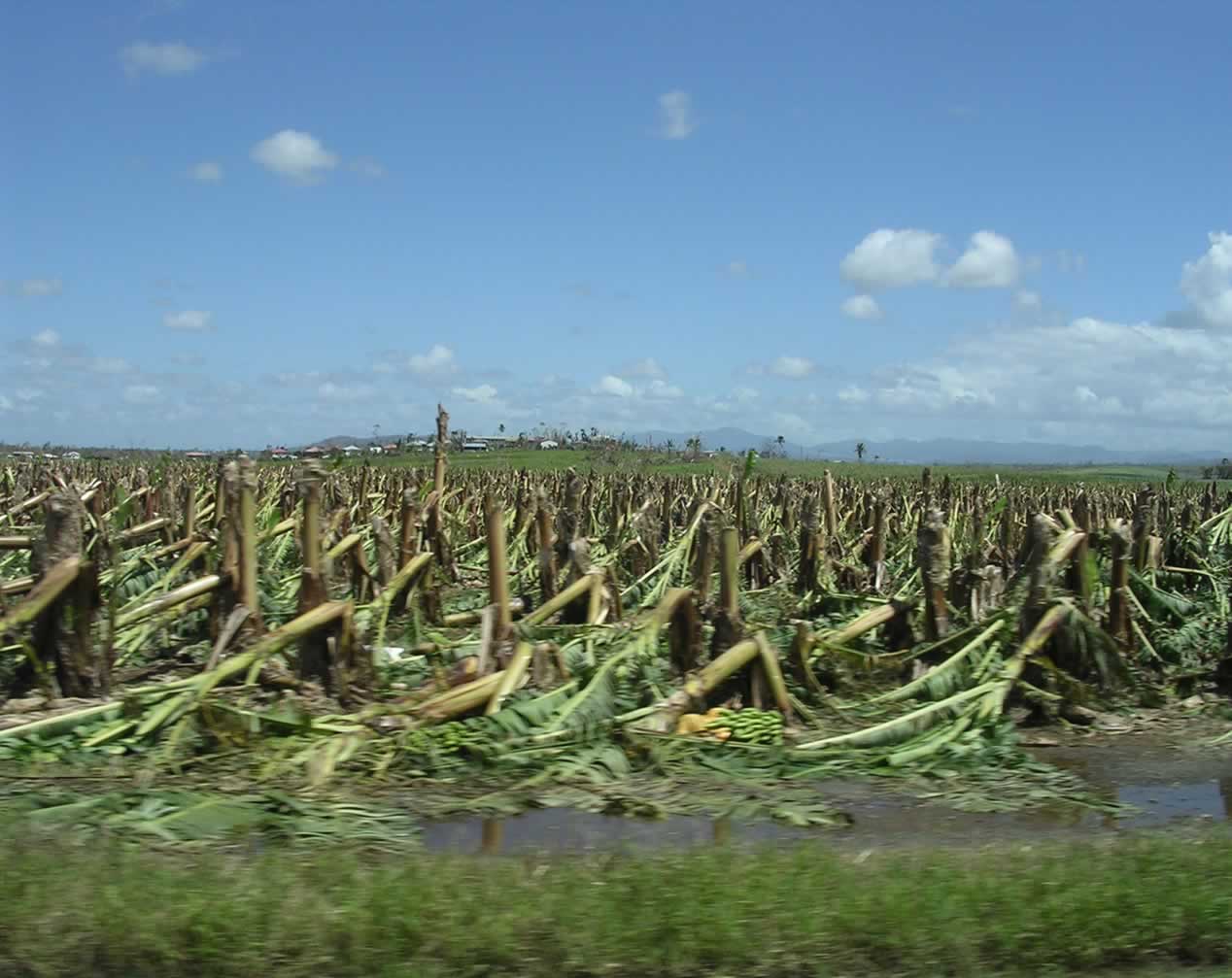
Innisfail suffered extensive damage in 2006 due to tropical Cyclone Larry, an Australian Category 5 cyclone with over 100mm of rain in the span of three hours. It struck Innisfail at 7am on 20 March 2006, with the eye of the storm passing over the town.
Severe structural damage occurred over the entirety of the township, the main damage being a portion of houses losing roofs and windows and the cyclone rendered even more homes structurally unsound. Power was effectively eliminated from the town and generators became a luxury in many homes. Clean drinking water was also compromised in many homes leading to health fears. The swift response of the Australian Defence Force was praised by many and the cleanup campaign they orchestrated allowed for total utilities restoration within 3 weeks. Severe damage was done to crops and plantations (mainly bananas) which had a serious economic impact on the region. Only one indirect death was record as a result of the cyclone. While Innisfail was always reputed to have a positive sense of community spirit, the aftermath of Tropical Cyclone Larry and the unified cleanup effort acted to promote this spirit through shared suffering.[51]
Cyclone Larry was a direct and primary cause of the widely reported and dramatic surge in banana prices in Australia. Inflated cost remained until farmers were able to meet demand again in early 2007.[52][53][54] After the cyclone the township underwent something of an economic boom that stemmed from an influx of tradespeople and business eager to capitalise upon relatively significant insurance payouts. According to reports local trade had increased some 30 – 40% opposed to expected increases of 10%.[55][56]
On 8 February 2007 the Johnstone Shire Council was sacked by the Queensland Government by the Local Government Minister, Andrew Fraser because of internal conflict, inappropriate behaviour and financial problems.[57][58]
In 2011, in the early morning of 3 February, Cyclone Yasi crossed the far north Queensland coast causing damage to the Innisfail area. Although the damage was not as severe as Cyclone Larry, Cyclone Yasi still had a huge impact on Innisfail bringing strong winds of possibly 285 kilometres per hour.[59]
In the 2016 census, the town of Innisfail had a population of 7,236 people, which includes the urban and suburban parts of the localities of Innisfail, Cullinane, Innisfail Estate, East Innisfail, Webb, South Innisfail, Mighell, Goondi Hill, Hudson, and Goondi Bend.[1] The locality of Innisfail had a population of 1,145 people.[2]
Darlinga Forest School opened on 10 February 2020 at 2 Stitt Street, Mighell, part of the former Innisfail State High School site.[60]
Population
According to the 2016 census, there were 7,236 people in the town of Innisfail.[1]
- Aboriginal and Torres Strait Islander people made up 17.3% of the population.
- 72.1% of people were born in Australia. The next most common countries of birth were India 4.0%, Italy 1.9% and England 1.8%.
- 74.8% of people spoke only English at home. Other languages spoken at home included Punjabi 4.4% and Italian 2.8%.
- The most common responses for religion were Catholic 27.0%, No Religion 20.5% and Anglican 13.9%.
Education
Innisfail State School is a government primary (Prep-6) school for boys and girls at 7 Emily Street (17.5183°S 146.0280°E).[61][62] In 2018, the school had an enrolment of 165 students with 22 teachers (19 full-time equivalent) and 20 non-teaching staff (13 full-time equivalent).[63] It includes a special education program known as Canecutters Cluster.[61]
Good Counsel Primary School is a Catholic primary (Prep-6) school for boys and girls at 96 Rankin Street (17.5212°S 146.0288°E).[61][64] In 2018, the school had an enrolment of 279 students with 27 teachers (21 full-time equivalent) and 20 non-teaching staff (13 full-time equivalent).[63]
Good Counsel College is a Catholic secondary (7-12) school for boys and girls at 66 Owen Street (17.5207°S 146.0285°E).[61][65] In 2018, the school had an enrolment of 371 students with 41 teachers (39 full-time equivalent) and 31 non-teaching staff (24 full-time equivalent).[63]
There is no government secondary school within the locality of Innisfail, as the town's government secondary school, Innisfail State College, is located in Innisfail Estate immediately across the river east of the main town centre.[12]
Amenities
The Cassowary Coast Regional Council operates a public library at 49 Rankin Street.[66] The current library opened in 2015.[67]
The Innisfail branch of the Queensland Country Women's Association meets at the CWA Hall at 1 McGowan Drive.[68]
Chinese Australians built the Innisfail Temple/Lit Sing Gung (列聖宮) in Owen Street, which is now open to other races and religions.[69]
The Sikh community has built the Sikh Temple / Guru Nanak Sikh Education Centre in East Innisfail.[70]
Mother of Good Counsel Catholic Church is at 90 Rankin Street. It is within the Innisfail Parish of the Roman Catholic Diocese of Cairns.[33]
The Dormition of Our Lady Greek Orthodox Church is at 133 Ernest Street (17.5189°S 146.0273°E). Their feast day is 15 August.[71]
Economy

The main industries remain predominately banana and sugar cane. Outlying areas of Innisfail also grow tea, pawpaws and other exotic fruits.[72]
Innisfail remains a popular destination for backpackers seeking employment in the fruit picking industry. Tourism is of importance to the township and the town consistently seeks to attract visitors passing through on the Bruce Highway.[73] The town's Art Deco architecture is a drawcard for many tourists.[41]
Heritage listings


Innisfail has a number of heritage-listed sites, including:
- 10 Edith Street: Innisfail Courthouse[74]
- 134 Edith Street: See Poy House[75]
- Fitzgerald Esplanade: Canecutters Memorial[76]
- 70 Rankin Street: Johnstone Shire Hall[77]
- 90 Rankin Street: Mother of Good Counsel Catholic Church
- 114 Rankin Street: St Andrew's Presbyterian Memorial Church[78]
Events
Popular annual events to celebrate Innisfail's diversity include:[79]
- Kulture Karnival
- Festival Innisfail
- Feast of the Senses
- Feast of the Three Saints
There are many events that act predominantly as community events, the main ones include:
- The Innisfail Rodeo
- Harvest Festival
- Innisfail Agricultural Show[80]
Notable residents
- Natarsha Williams, BMX rider, grew up in Innisfail. Natarsha was one of the first members of the Innisfail club and started racing BMX in 1981 at the age of 5 and had an extremely successful junior and senior BMX career that spanned 25 years. During her senior racing years she was given a lot of recognition in Europe and the USA particularly for her strength and jumping skills. Natarsha is the first Elite female to rack up a complete winning profile of 2 European Titles, 2 Pro girl Titles in the US, 3 World Cup Titles and 2 World Championships. Due to timing the only thing she missed doing was to compete in the Olympics. Natarsha was also the first Australian female rider to make the move to live in the US and make BMX a full-time career, she became the driving force for females at the time to develop their jumping skills and to improve female racing. Natarsha still lives in the US and is now the assistant cycling coach at the Marian University in Indianapolis.[81]
- Scott Bolton, rugby league player for the North Queensland Cowboys, grew up in Innisfail. Bolton debuted with the Cowboys in 2007 and has spent his entire career with the club, winning a premiership in 2015.Barring injury, the 32-year-old Innisfail product and Cowboys life member will play his final game against the Storm in Melbourne in Round 25, 2019. Green said Bolton was one of a kind. "He’s one of those no-nonsense sort of blokes, he goes about his business, doesn't like too much fuss made of him," Green said. "He’s one of nine life members, he played his 200th game in 2017, he’s played 244 games for the club, played in two grand finals and will always be a premiership player too. "He came here out of school, so he's been a fantastic contributor over the years, and a big part of the legacy the club has left so far is down to guys like him."[82]
- Kerry Boustead: former Queensland and Australian Rugby league great, Queensland's first ever try scorer in State of Origin rugby league. Kerry Boustead was also the only player from outside the Sydney and Brisbane Leagues selected to represent Australia on the 1978 Kangaroo tour.
- Jessica-Rose Clark, mixed martial artist currently signed to the UFC.
- Steve Corica: retired footballer who was capped numerous times for Australia and played in England, notably for Wolverhampton Wanderers, was also capped over 100 times for Marconi Stallions in the ex-NSL and Sydney FC in the A-League.
- Brent Cockbain former international rugby player (2003 World cup for Wales) grew up in Innisfail.
- Joseph Costa, BMX rider, grew up in Innisfail. Costa is a consistent BMX competitor.[83]
- Ben Dunk,born 1987 Australia T20 and ODI cricket player
- Karl Gehringer, former Australian National and Commonwealth team Greco-Roman Wrestling 2005–2006, went to school in Innisfail. [1][84]
- Shannon McCann, Australian 100m Hurdler competed at the 2014 Commonwealth Games, grew up in Innisfail[85]
- Billy Slater, rugby league player, grew up in Innisfail. Billy Slater played for the Melbourne Storm for sixteen seasons in the NRL and was an Australian International and Queensland State of Origin representative fullback. He played his whole NRL career at Melbourne and won four grand finals, two Clive Churchill Medals and the Dally M Medal with the Storm before his retirement from the sport in 2018. He has an autobiography and has been called the best fullback ever to have played the game by rugby league greats and fans alike
- Norman Stevens, Australian boxer at 1980 Moscow Olympics
- Ty Williams, former professional rugby league footballer for the North Queensland Cowboys and Queensland grew up in Innisfail. Williams returned to Innisfail to captain/coach the Innisfail Leprechauns in 2014.
In popular culture
- Elizabeth Haran's 2003 novel Sunset over Eden is set in the town.
- In March 2017, an Innisfail teenager survived a crocodile attack after entering the Johnstone River. Subsequent interviews with the survivor went viral online.[86]
See also
- Devil's Pool
- Innisfail railway station
- North Queensland
- Jubilee Bridge
References
- Australian Bureau of Statistics (27 June 2017). "Innisfail (UCL)". 2016 Census QuickStats. Retrieved 1 October 2020.
- Australian Bureau of Statistics (27 June 2017). "Innisfail (SSC)". 2016 Census QuickStats. Retrieved 1 October 2020.
- "Walkabout – Innisfail". Archived from the original on 30 June 2006. Retrieved 2 June 2006.
- J. W. Collinson. "Innisfail – History" (PDF). Text Queensland. Journal of the Royal Historical Society of Queensland. pp. 10, 16. Retrieved 19 April 2019.
- "Innisfail – climate statistics". Climate Data Online. Bureau of Meteorology. Archived from the original on 19 April 2019. Retrieved 19 April 2019.
- "Innisfail – town in Cassowary Coast Region (entry 40993)". Queensland Place Names. Queensland Government. Retrieved 18 September 2020.
- "Innisfail – locality in Cassowary Coast Region (entry 45710)". Queensland Place Names. Queensland Government. Retrieved 18 September 2020.
- "Tourism and Regional Information". Archived from the original on 23 May 2006. Retrieved 2 June 2006.
- "Australian Bureau of Meteorology Severe Tropical Cyclone Larry Report". Archived from the original on 3 September 2012. Retrieved 2 June 2006.
- "Innisfail – Google Maps". Archived from the original on 30 September 2020. Retrieved 2 June 2006.
- "Mt. Bartle Frere Trail". Archived from the original on 18 June 2006. Retrieved 2 June 2006.
- "Queensland Globe". State of Queensland. Retrieved 30 September 2020.
- Linacre, Edward; Geerts, Bart (1997). Climates and Weather Explained. London: Routledge. p. 379. ISBN 0-415-12519-7. Archived from the original on 24 June 2016. Retrieved 22 September 2016.
- "Interactive Australia / New Zealand Koppen-Geiger Climate Classification Map". www.plantmaps.com. Archived from the original on 6 March 2019. Retrieved 6 March 2019.
- "Tully – Cairns Connect". Archived from the original on 2 May 2006. Retrieved 2 June 2006.
- "Median Rainfall for July". Archived from the original on 24 September 2015. Retrieved 2 June 2010.
- See Mean rainfall May to September Archived 24 September 2015 at the Wayback Machine for an explanation
- "List of Queensland Cyclones – Windworker Roof Renovations". Archived from the original on 29 April 2006. Retrieved 2 June 2006.
- "Flood Warning system for the Johnstone River". Archived from the original on 16 June 2006. Retrieved 2 June 2006.
- "Innisfail, QLD Climate (1991-2020 normals)". Australian Bureau of Meteorology. Retrieved 22 May 2022.
- "Innisfail, QLD Climate (1881-present extremes)". Australian Bureau of Meteorology. Retrieved 22 May 2022.
- "SKETCHER". The Queenslander. No. 1984. Queensland, Australia. 19 March 1904. p. 2 (Unknown). Archived from the original on 30 September 2020. Retrieved 3 September 2018 – via National Library of Australia.
- "SKETCHER". The Queenslander. No. 2015. Queensland, Australia. 22 October 1904. p. 8. Archived from the original on 30 September 2020. Retrieved 4 September 2018 – via National Library of Australia.
- "SUGAR GROWING AT INNISFAIL". The Telegraph. Queensland, Australia. 25 April 1934. p. 13 (MEMORIAL ISSUE). Archived from the original on 1 October 2020. Retrieved 2 October 2020 – via National Library of Australia.
- "CHANGE OF NAME". Cairns Post (Qld. : 1909–1954). Qld.: National Library of Australia. 19 August 1910. p. 5. Archived from the original on 30 September 2020. Retrieved 9 March 2011.
- Radiant Green, Fallon, M., 1990, p62
- Hurricane Lamps and Blue Umbrellas, Jones, D., 1973 p304,305
- Phoenix Auctions History. "Post Office List". Phoenix Auctions. Archived from the original on 19 December 2021. Retrieved 3 February 2021.
- "OFFICIAL NOTIFICATIONS". The Brisbane Courier. Vol. XXXIX, no. 8, 527. Queensland, Australia. 9 May 1885. p. 3. Archived from the original on 30 September 2020. Retrieved 21 October 2017 – via National Library of Australia.
- "JOHNSTONE RIVER". The Brisbane Courier. Vol. XL, no. 8, 635. Queensland, Australia. 14 September 1885. p. 3. Archived from the original on 30 September 2020. Retrieved 21 October 2017 – via National Library of Australia.
- "Official Notifications". The Queenslander. Vol. XXVIII, no. 522. Queensland, Australia. 26 September 1885. p. 504. Archived from the original on 30 September 2020. Retrieved 22 October 2017 – via National Library of Australia.
- Queensland Family History Society (2010), Queensland schools past and present (Version 1.01 ed.), Queensland Family History Society, ISBN 978-1-921171-26-0
- "Innisfail Parish". Roman Catholic Diocese of Cairns. Archived from the original on 18 November 2020. Retrieved 18 November 2020.
- "Innisfail Parish". Roman Catholic Diocese of Cairns. Archived from the original on 18 November 2020. Retrieved 18 November 2020.
- "Our History". Good Counsel Primary School, Innisfail. 20 October 2014. Archived from the original on 30 September 2020. Retrieved 30 September 2020.
- "NEWSPAPER LOSSES". Cairns Post. No. 10, 513. Queensland, Australia. 18 October 1935. p. 16. Archived from the original on 30 September 2020. Retrieved 24 April 2019 – via National Library of Australia.
- "Historical Notes on North Queensland Newspapers". www.jcu.edu.au. 19 October 2015. Archived from the original on 9 November 2017. Retrieved 2 December 2015.
- "NEW SHOW ASSOCIATION". Cairns Post. Vol. XXVI, no. 1341. Queensland, Australia. 21 June 1912. p. 10. Archived from the original on 30 September 2020. Retrieved 30 September 2020 – via National Library of Australia.
- "History". The Innisfail Show. Archived from the original on 30 September 2020. Retrieved 30 September 2020.
- Briggs, Casey (9 March 2018). "'It appears to be dangerous': The 100-year-old cyclone warning that proved prophetic". ABC News. Archived from the original on 30 September 2020. Retrieved 30 September 2020.
- Mounter, Brendan (2 June 2017). "Far north town claims as the art deco capital of Australia". ABC News Australia. Archived from the original on 30 September 2020. Retrieved 30 September 2020.
- "History of the Innisfail Region". Archived from the original on 14 May 2006. Retrieved 2 June 2006.
- "BLESSED AND OPENED". Cairns Post. No. 8251. Queensland, Australia. 3 July 1928. p. 5. Archived from the original on 25 December 2020. Retrieved 20 November 2020 – via National Library of Australia.
- "NEW CATHOUC CHURCH". Cairns Post. No. 8280. Queensland, Australia. 6 August 1928. p. 5. Archived from the original on 25 December 2020. Retrieved 20 November 2020 – via National Library of Australia.
- "Opening and closing dates of Queensland Schools". Queensland Government. Retrieved 18 April 2019.
- "Local government meeting: Agenda" (PDF). Cassowary Coast Regional Council. 28 March 2013. pp. 176–180. Archived (PDF) from the original on 1 October 2020.
- "About us". Innisfail State College. 16 April 2020. Archived from the original on 1 October 2020. Retrieved 1 October 2020.
- "Queensland state school - centre closures" (PDF). Queensland Government. 20 August 2013. Archived (PDF) from the original on 20 March 2022. Retrieved 6 April 2022.
- "Innisfail State High School". Innisfail State High School. 25 October 2009. Archived from the original on 25 October 2009. Retrieved 8 April 2022.
- "Innisfail Cenotaph". Monument Australia. Archived from the original on 7 April 2014. Retrieved 5 April 2014.
- "Community Spirit – Winter 2007". Archived from the original on 28 September 2007. Retrieved 2 June 2006.
- "ABC news – Innisfail Devastated". Australian Broadcasting Corporation. Archived from the original on 21 April 2006. Retrieved 2 June 2006.
- "Australian Banana Growers Council – Cyclone Larry Report". Archived from the original on 15 October 2006. Retrieved 2 June 2006.
- "Sydney Morning Herald – Disaster drives big price surge". The Sydney Morning Herald. 21 March 2006. Archived from the original on 18 June 2006. Retrieved 2 June 2006.
- "Innisfail Business booming after cyclone – ABC report". Australian Broadcasting Corporation. Archived from the original on 30 September 2020. Retrieved 2 June 2006.
- "APIA set up in Innisfail". Archived from the original on 19 August 2006. Retrieved 2 June 2006.
- "ABC – Sacking of JSC". Australian Broadcasting Corporation. Archived from the original on 20 April 2008. Retrieved 2 June 2006.
- "Queensland Government – Show Cause Issued". Archived from the original on 21 August 2006. Retrieved 2 June 2006.
- "Severe Tropical Cyclone Yasi". Bureau of Meteorology. Bureau of Meteorology. Archived from the original on 20 January 2017. Retrieved 2 February 2017.
- "Changes to the Register of Non-State Schools (Qld)" (PDF). Non-State Schools Accreditation Board. January 2020. Archived (PDF) from the original on 1 October 2020. Retrieved 1 October 2020.
- "State and non-state school details". Queensland Government. 9 July 2018. Archived from the original on 21 November 2018. Retrieved 21 November 2018.
- "Innisfail State School". Archived from the original on 1 April 2020. Retrieved 21 November 2018.
- "ACARA School Profile 2018". Australian Curriculum, Assessment and Reporting Authority. Archived from the original on 27 August 2020. Retrieved 28 January 2020.
- "Good Counsel Primary School". Archived from the original on 5 December 2018. Retrieved 21 November 2018.
- "Good Counsel College". Archived from the original on 7 December 2018. Retrieved 21 November 2018.
- "Innisfail Library". Public Libraries Connect. 10 January 2018. Archived from the original on 19 January 2018. Retrieved 19 January 2018.
- "Queensland Public Libraries Statistical Bulletin 2016–17" (PDF). Public Libraries Connect. November 2017. Archived (PDF) from the original on 30 January 2018. Retrieved 19 January 2018.
- "Branch Locations". Queensland Country Women's Association. Archived from the original on 26 December 2018. Retrieved 26 December 2018.
- "Innisfail Temple". Innisfail Temple. Archived from the original on 4 February 2019. Retrieved 30 September 2020.
- "Home". Guru Nanak Sikh Education Centre(Innisfail). Archived from the original on 30 September 2020. Retrieved 30 September 2020.
- "The Dormition of Our Lady, Innisfail, QLD". Greek Orthodox Archdiocese of Australia. Archived from the original on 25 December 2020. Retrieved 25 December 2020.
- "Australian Tropical Fruits". Archived from the original on 4 May 2006. Retrieved 2 June 2006.
- "Innisfail tourism". Archived from the original on 31 December 2012. Retrieved 2 June 2006.
- "Innisfail Court House (entry 601578)". Queensland Heritage Register. Queensland Heritage Council. Retrieved 7 July 2013.
- "See Poy House (entry 602759)". Queensland Heritage Register. Queensland Heritage Council. Retrieved 7 July 2013.
- "Canecutters Memorial (entry 602041)". Queensland Heritage Register. Queensland Heritage Council. Retrieved 7 July 2013.
- "Johnstone Shire Hall (entry 601579)". Queensland Heritage Register. Queensland Heritage Council. Retrieved 7 July 2013.
- "St Andrew's Presbyterian Memorial Church (entry 602332)". Queensland Heritage Register. Queensland Heritage Council. Retrieved 7 July 2013.
- "About Johnstone Shire Council". Archived from the original on 15 June 2005. Retrieved 2 June 2006.
- "The Innisfail Show". Innisfail Show. Archived from the original on 30 September 2020. Retrieved 30 September 2020.
- "Natarsha Williams – Profile". Australian BMX Museum. Archived from the original on 4 August 2020. Retrieved 28 August 2019.
"Natarsha Williams". Australian BMX Hall of Fame. Archived from the original on 28 August 2019. Retrieved 28 August 2019. - "Scott Bolton". Cowboys. National Rugby League. Archived from the original on 28 August 2019. Retrieved 28 August 2019.
Jason Wolfgram (27 August 2019). "'A big part of our legacy': Green pays tribute to departing Bolton". Archived from the original on 28 August 2019. Retrieved 28 August 2019. - "Joseph Costa". Rival Racing. Archived from the original on 21 December 2014. Retrieved 16 September 2014.
- "Geringer, Karl". International Federation of Associated Wrestling Styles. Archived from the original on 14 July 2014. Retrieved 22 June 2014.
- "Shannon McCann". Glasgow 2014 Ltd. Archived from the original on 18 July 2018. Retrieved 11 June 2017.
- "Teen explains why he jumped into croc-infested waters in far north Queensland". Brisbane Times. 20 March 2017. Archived from the original on 12 November 2020. Retrieved 22 February 2021.
External links
- "Innisfail". Queensland Places. Centre for the Government of Queensland, University of Queensland.
- Innisfail Homepage
- Detailed History of Innisfail
Authority control | |
|---|---|
| General |
|
| National libraries | |
| Other |
|
На других языках
[de] Innisfail (Queensland)
Innisfail ist eine Stadt mit etwa 8.300 Einwohnern im australischen Bundesstaat Queensland am Johnstone River. Innisfail befindet sich 89 Kilometer südlich von Cairns und 256 Kilometer nördlich von Townsville am Bruce Highway. Die Stadt ist der Sitz des Verwaltungsgebiet (LGA) Cassowary Coast Region und erlangte Bekanntheit als eine der regenreichsten Städte Australiens. Mit dem Zuckerrohr- und Bananenanbau ist Landwirtschaft der vorherrschende Industriezweig. Weltweite Aufmerksamkeit erhielt die Region im März 2006 als der tropische Zyklon Larry - möglicherweise der verheerendste Wirbelsturm in der Geschichte Queenslands - den Landstrich verwüstete.[3][4]- [en] Innisfail, Queensland
Другой контент может иметь иную лицензию. Перед использованием материалов сайта WikiSort.org внимательно изучите правила лицензирования конкретных элементов наполнения сайта.
WikiSort.org - проект по пересортировке и дополнению контента Википедии