world.wikisort.org - Australia
Halls Gap is a town in Victoria, Australia. It is located on Grampians Road, adjacent to the Grampians National Park, in the Shire of Northern Grampians local government area. The town is set in the Fyans Valley at the foot of the Wonderland and Mount William ranges.[2] At the 2016 census Halls Gap had a population of 430.[1] The approximate driving time from Melbourne is 3 hours.
| Halls Gap Victoria | |
|---|---|
 | |
 Halls Gap | |
| Coordinates | 37°07′0″S 142°33′0″E |
| Population | 430 (2016 census)[1] |
| Postcode(s) | 3381 |
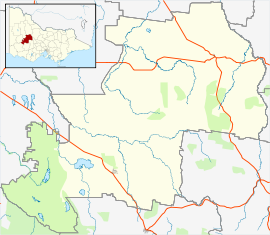
| Location | |
| LGA(s) | Shire of Northern Grampians |
| State electorate(s) | Lowan |
| Federal division(s) | Wannon |
History
The first settler was Charles Browning Hall who set out in search of a suitable grazing run when he found the cattle market at Port Phillip overstocked in 1841. Establishing a station just east of the Grampians in a spot known as "Mokepilli" to the indigenous inhabitants the Mukjarawaint.[3] Halls Gap was originally located at where the now Lake Bellfield Reservoir is now located.
Hall discovered the gap by following Aboriginal tracks.[4]
Hall's Gap Post Office opened on 3 February 1893, closed in 1896, and reopened in 1902.[5]
Indigenous Peoples
The indigenous people of the area are the Mukjarawaint.[3], who referred to the area as "Mokepilli". The indigenous people speak the djab Wurrung language [6]


Today
Its chief industry is tourism, due to its location in the Grampians National Park. Australia's longest running Aboriginal cultural centre, Brambuk, is located in the town.[7] The Halls Gap Zoo is located 7 kilometres (4.3 mi) from town. There is now a local chemist in town located at the Stoney Creek shops.
Golfers play at the course of the Halls Gap Golf Club on Red Gum Lease Track.[8]
Food and Wine Festival
Halls Gap is home to one of Australia's longest running food and wine festivals, held over the first weekend of May every year. Launched in 1992, Grampians Grape Escape is a hallmark event for Victoria and provides food and wine offerings by more than 100 local artisan producers, live music and family entertainment.[9]
Climate
| Climate data for Halls Gap | |||||||||||||
|---|---|---|---|---|---|---|---|---|---|---|---|---|---|
| Month | Jan | Feb | Mar | Apr | May | Jun | Jul | Aug | Sep | Oct | Nov | Dec | Year |
| Average high °C (°F) | 29.2 (84.6) |
28.7 (83.7) |
25.4 (77.7) |
20.7 (69.3) |
16.3 (61.3) |
13.2 (55.8) |
12.4 (54.3) |
13.9 (57.0) |
16.7 (62.1) |
20.0 (68.0) |
23.8 (74.8) |
26.6 (79.9) |
20.6 (69.0) |
| Average low °C (°F) | 13.6 (56.5) |
13.7 (56.7) |
11.5 (52.7) |
8.5 (47.3) |
6.3 (43.3) |
4.7 (40.5) |
4.2 (39.6) |
4.7 (40.5) |
6.0 (42.8) |
7.4 (45.3) |
9.8 (49.6) |
11.3 (52.3) |
8.5 (47.3) |
| Average precipitation mm (inches) | 37.6 (1.48) |
30.6 (1.20) |
20.7 (0.81) |
30.0 (1.18) |
39.8 (1.57) |
55.0 (2.17) |
57.6 (2.27) |
53.9 (2.12) |
54.3 (2.14) |
36.1 (1.42) |
41.0 (1.61) |
35.9 (1.41) |
492.5 (19.38) |
| Source: [10] | |||||||||||||
References
- "2016 Census QuickStats Halls Gap". Australian Bureau of Statistics. Retrieved 16 March 2019.
- "Visit Victoria". Halls Gap. Tourism Victoria. Retrieved 22 August 2011.
- "Native Tribes of South-East Australia". Wikisource. Retrieved 25 January 2021.
- Shawfactor. "Local history of Halls Gap".
- Phoenix Auctions History, Post Office List, retrieved 29 March 2021
- "Victorian Aboriginal Corporation for Languages Djab Wurrung". Victorian Aboriginal Corporation for Languages. Retrieved 1 June 2021.
{{cite web}}: CS1 maint: url-status (link) - "Visit Victoria". Halls Gap. Tourism Victoria. Retrieved 22 August 2011.
- Golf Select, Halls Gap, retrieved 11 May 2009
- "2014 Grampians Grape Escape | Victorian Government". Archived from the original on 5 December 2014. Retrieved 31 January 2015.
- "Climate History".
External links
![]() Media related to Halls Gap, Victoria at Wikimedia Commons
Media related to Halls Gap, Victoria at Wikimedia Commons
Authority control | |
|---|---|
| General |
|
| National libraries | |
На других языках
[de] Halls Gap
Halls Gap ist ein Ort im Grampians-Nationalpark im australischen Bundesstaat Victoria. Der Ort zählt nur knapp 300 Einwohner (Stand 2016[1]), ist aber ein touristisches Zentrum der Grampians. Nach der Great Ocean Road ist Halls Gap der Ort mit der zweithöchsten Zahl von Tagesbesuchern in ganz Victoria.- [en] Halls Gap
Другой контент может иметь иную лицензию. Перед использованием материалов сайта WikiSort.org внимательно изучите правила лицензирования конкретных элементов наполнения сайта.
WikiSort.org - проект по пересортировке и дополнению контента Википедии