world.wikisort.org - Australia
Fernlees is a rural town in the locality of Gindie, Central Highlands Region, Queensland, Australia.[1]
| Fernlees Gindie, Queensland | |
|---|---|
 Fernlees | |
| Coordinates | 23.8566°S 148.125°E |
| Postcode(s) | 4702 |
| Time zone | AEST (UTC+10:00) |
| Location |
|
| LGA(s) | Central Highlands Region |
| State electorate(s) | Gregory |
| Federal division(s) | Flynn |
Geography
The Gregory Highway passes north-south through the town.[2]
History
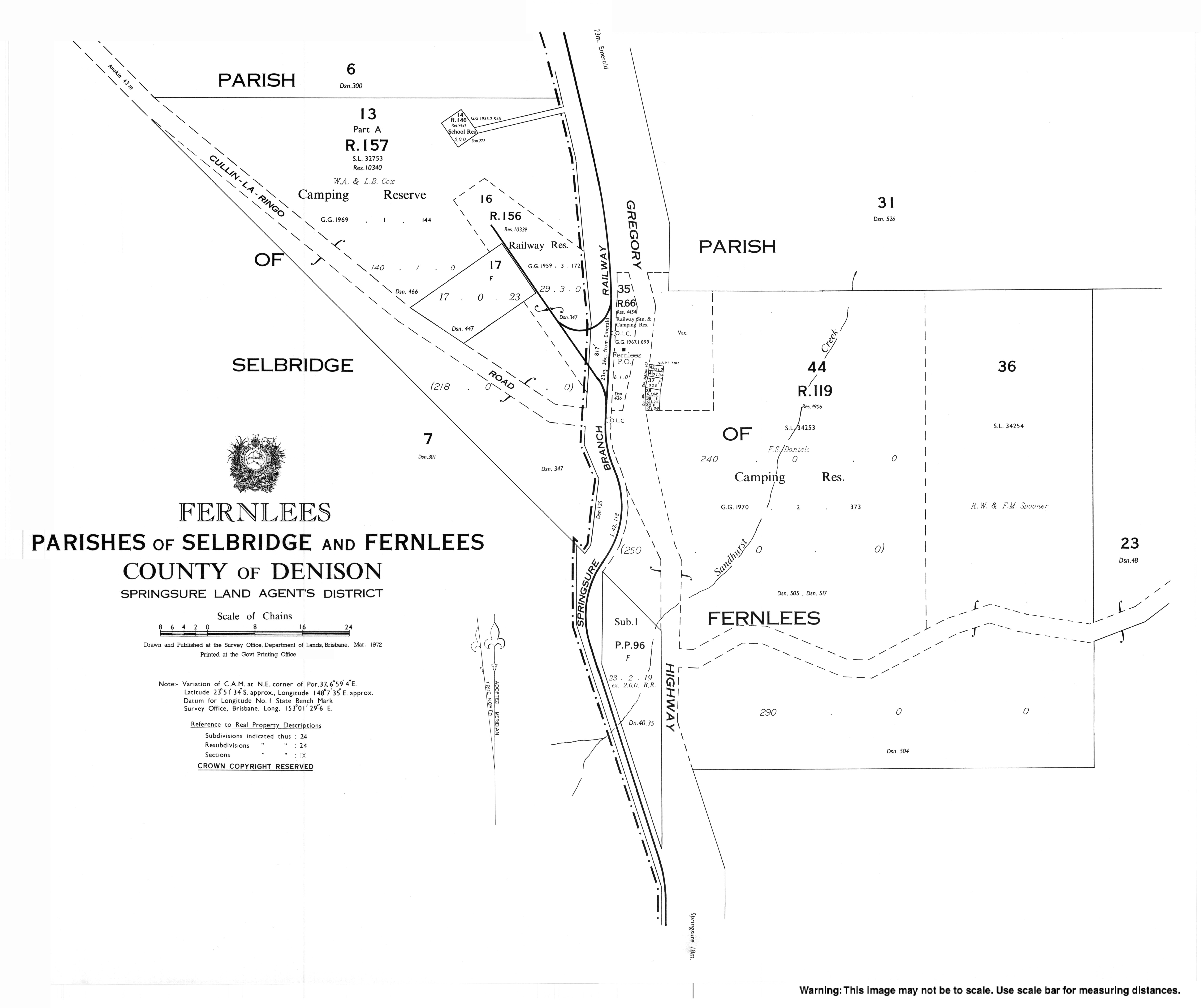
Fernlees railway station (23.8554°S 148.1241°E) was on the Springsure railway branch line which opened on 15 August 1887.[3]
Fernlees State School opened on 20 September 1951 and closed in 1953.[4] It was on a 2-acre (0.81 ha) site off to the west the Gregory Highway north of the town (approx 23.8479°S 148.1214°E).[5][2]
Fernlees Methodist Church was established in 1959 at 2780 Gregory Highway (23.8564°S 148.1252°E). Following the amalgamation of the Methodist Church into the Uniting Church in Australia in 1977, it became the Fernlees Uniting Church. It closed in 2007. It is now a private residence.[6][7][8]
Education
There are no schools in Fernlees. The nearest government primary school is Gindie State School in Gindie to the north. The nearest government secondary schools are Springsure State School (to Year 10) in Springsure to the south and Emerald State High School (to Year 12) in Emerald to the north.[2]
References
- "Fernlees – town in Central Highlands Region (entry 12307)". Queensland Place Names. Queensland Government. Retrieved 29 December 2017.
- "Queensland Globe". State of Queensland. Retrieved 22 July 2022.
- "Our history: 1880s". Queensland Rail. Archived from the original on 25 June 2021. Retrieved 22 July 2022.
- Queensland Family History Society (2010), Queensland schools past and present (Version 1.01 ed.), Queensland Family History Society, ISBN 978-1-921171-26-0
- "Town of Fernlees" (Map). Queensland Government. 1972. Archived from the original on 17 July 2020. Retrieved 22 July 2022.
- Blake, Thom. "Fernlees Methodist Church". Queensland religious places database. Archived from the original on 17 September 2021. Retrieved 17 September 2021.
- "Gift of a Church – a mix of mission and service | Emerald Uniting Church". Archived from the original on 23 March 2021. Retrieved 17 September 2021.
- "Emerald Uniting Church". Churches Australia. Archived from the original on 17 September 2021. Retrieved 17 September 2021.
External links
- "Town map of Fernlees". Queensland Government. 1972.
Другой контент может иметь иную лицензию. Перед использованием материалов сайта WikiSort.org внимательно изучите правила лицензирования конкретных элементов наполнения сайта.
WikiSort.org - проект по пересортировке и дополнению контента Википедии