world.wikisort.org - Australia
Bingegang is a rural locality in the Central Highlands Region, Queensland, Australia.[2] In the 2016 census Bingegang had a population of 18 people.[1]
| Bingegang Queensland | |||||||||||||||
|---|---|---|---|---|---|---|---|---|---|---|---|---|---|---|---|
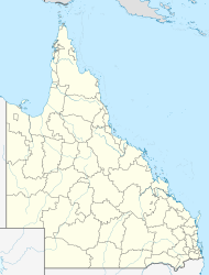  Bingegang | |||||||||||||||
| Coordinates | 23.1177°S 149.1575°E | ||||||||||||||
| Population | 18 (2016 census)[1] | ||||||||||||||
| • Density | 0.0422/km2 (0.1092/sq mi) | ||||||||||||||
| Postcode(s) | 4702 | ||||||||||||||
| Area | 426.9 km2 (164.8 sq mi) | ||||||||||||||
| Time zone | AEST (UTC+10:00) | ||||||||||||||
| Location |
| ||||||||||||||
| LGA(s) | Central Highlands Region | ||||||||||||||
| State electorate(s) | Gregory | ||||||||||||||
| Federal division(s) | Flynn | ||||||||||||||
| |||||||||||||||
Geography
Bingegang is about 613 km away from Brisbane.[3]
The Mackenzie River (the river) forms the northern and north-western boundary of the locality. Parker Creek forms part of the south-western boundary of the locality and then flows in a northerly direction through the locality to becomes a tributary of the Mackenzie River on the northern boundary (23.05°S 149.2°E).[4] The south-eastern, southern and part of the south-western boundary of the locality roughly follows Return Creek (23.25°S 149.1666°E), which is a tributary of Parker Creek.[5][6]
The Fitzroy Developmental Road enters the locality from the south (Jellinbah) and exits to the north-west (the locality of Mackenzie River).[6]
Bingegang Weir (23.0725°S 149.0338°E) impounds the Mackenzie River. It is reached via Bingegan Weir Access Road.[7]
The land use is predominantly grazing on native vegetation with some cropping in the north and south of the locality.[6]
History
Bingebgang Weir was completed in 1975 and raised in 1998.[7]
In the 2016 census Bingegang had a population of 18 people.[1]
Education
There are no schools in Bingegang. The nearest primary schools at Dingo State Schol in Dingo to the south and Middlemount Community School in Middlemount to the north-west. The nearest secondary schools are Middlemount Community School in Middlemount to the north-west and Blackwater State High School in Blackwater to the south-west. However, all of these schools are sufficiently distant that distance education and boarding schools would be other options.[6]
Attractions
There is no public access allowed to the Bingegang Weir itself but boating and fishing is permitted if more than 200 metres (660 ft) from the weir (or as signed).[7]
References
- Australian Bureau of Statistics (27 June 2017). "Bingegang (SSC)". 2016 Census QuickStats. Retrieved 20 October 2018.
- "Bingegang – locality in Central Highlands Region (entry 46916)". Queensland Place Names. Queensland Government. Retrieved 26 December 2020.
- "Bingegang". Queensland. Retrieved 6 May 2021.
- "Parker Creek – watercourse in Isaac Regional (entry 26082)". Queensland Place Names. Queensland Government. Retrieved 26 December 2020.
- "Return Creek – watercourse in Central Highlands Regional (entry 28399)". Queensland Place Names. Queensland Government. Retrieved 26 December 2020.
- "Queensland Globe". State of Queensland. Retrieved 11 May 2021.
- "Nogoa Mackenzie Weirs & Barrages". Sunwater. Archived from the original on 27 February 2020. Retrieved 11 May 2021.

Другой контент может иметь иную лицензию. Перед использованием материалов сайта WikiSort.org внимательно изучите правила лицензирования конкретных элементов наполнения сайта.
WikiSort.org - проект по пересортировке и дополнению контента Википедии