world.wikisort.org - Australia
Dorset Council is a local government body in Tasmania, located in the far north-east of the state mainland. Dorset is classified as a rural local government area and has a population of 6,652.[3] The major towns and localities of the region include Bridport, Derby and Ringarooma with Scottsdale the regional centre.
| Dorset Council Tasmania | |||||||||||||||
|---|---|---|---|---|---|---|---|---|---|---|---|---|---|---|---|
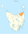
 Map showing the Dorset local government area. | |||||||||||||||
| Coordinates | 41.0706°S 147.7089°E | ||||||||||||||
| Population | 6,829 (LGA 2021)[1] | ||||||||||||||
| • Density | 2.1/km2 (5.4/sq mi) | ||||||||||||||
| Established | 2 April 1993[2] | ||||||||||||||
| Area | 3,231 km2 (1,247.5 sq mi) | ||||||||||||||
| Mayor | Greg Howard | ||||||||||||||
| Council seat | Scottsdale | ||||||||||||||
| Region | North-east Tasmania | ||||||||||||||
| State electorate(s) | Bass | ||||||||||||||
| Federal division(s) | Bass | ||||||||||||||
| Website | Dorset Council | ||||||||||||||
| |||||||||||||||
History and attributes
The municipality was established on 2 April 1993 after the amalgamation of the Scottsdale and Ringarooma municipalities.[2] Dorset is classified as regional, agricultural and large under the Australian Classification of Local Governments.[4]
Suburbs
| Locality | Census population 2016 | Reason |
|---|---|---|
| Bridport | 1568 | |
| Tomahawk | 48 | Includes The Chimneys |
| Boobyalla | 0 | |
| Cape Portland | 0 | |
| Musselroe Bay | 40 | |
| Rushy Lagoon | 30 | |
| The Chimneys | Incl. in Tomahawk | |
| Gladstone | 139 | |
| South Mount Cameron | 15 | |
| Banca | 0 | |
| Waterhouse | 90 | |
| Alberton | 0 | |
| Legunia | Incl. in Ringarooma | |
| South Springfield | 25 | |
| Springfield | 188 | |
| Lisle | 0 | |
| Nabowla | 112 | Includes Koomeela |
| Golconda | 26 | |
| Wyena | 24 | |
| Jetsonville | 137 | |
| Lietinna | 58 | |
| Blumont | 31 | |
| Scottsdale | 2373 | |
| Koomeela | Incl. in Nabowla | |
| Cuckoo | 53 | |
| Tonganah | 26 | |
| Tulendeena | 12 | |
| Legerwood | 193 | |
| Ringarooma | 338 | |
| Talawa | 53 | |
| Trenah | 11 | |
| Forester | 8 | |
| Branxholm | 267 | |
| Telita | 22 | |
| Warrentinna | 0 | |
| Winnaleah | 225 | |
| Moorina | 11 | |
| Herrick | 52 | |
| Pioneer | 89 | |
| North Scottsdale | 122 | |
| Kamona | 11 | |
| West Scottsdale | 58 | |
| Lebrina | 192 | |
| Tunnel | 73 | |
| Total | 6,720 | |
| (103) | Variance | |
| Local government total | 6,617 | Gazetted Dorset local government area |
Not in above list
- North Lilydale
- Pipers Brook
- Tayene
- Upper Esk
- Weldborough
Errors in above list
- Lebrina is wholly within Launceston Council area.
- Tunnel is wholly within Launceston area.
See also
- List of local government areas of Tasmania
References
- Australian Bureau of Statistics (28 June 2022). "Dorset (Local Government Area)". Australian Census 2021 QuickStats. Retrieved 28 June 2022.
- "Agency Details: Dorset Municipal Council". search.archives.tas.gov.au. Tasmanian Government. Retrieved 11 June 2018.
- "3218.0 – Regional Population Growth, Australia, 2017-18: Population Estimates by Local Government Area (ASGS 2018), 2017 to 2018". Australian Bureau of Statistics. Australian Bureau of Statistics. 27 March 2019. Retrieved 25 October 2019. Estimated resident population, 30 June 2018.
- "Local government national report 2014-2015". regional.gov.au. Australian Government. Retrieved 8 June 2018.
External links
- Dorset Council official website
- Local Government Association Tasmania
- Tasmanian Electoral Commission - local government
Текст в блоке "Читать" взят с сайта "Википедия" и доступен по лицензии Creative Commons Attribution-ShareAlike; в отдельных случаях могут действовать дополнительные условия.
Другой контент может иметь иную лицензию. Перед использованием материалов сайта WikiSort.org внимательно изучите правила лицензирования конкретных элементов наполнения сайта.
Другой контент может иметь иную лицензию. Перед использованием материалов сайта WikiSort.org внимательно изучите правила лицензирования конкретных элементов наполнения сайта.
2019-2026
WikiSort.org - проект по пересортировке и дополнению контента Википедии
WikiSort.org - проект по пересортировке и дополнению контента Википедии