world.wikisort.org - Australia
The County of Polwarth is one of the 37 counties of Victoria which are part of the cadastral divisions of Australia, used for land titles. The county is in the Western District of Victoria and includes the Cape Otway area, bounded by the Gellibrand River in the west and the Anglesea River and Barwon River in the east, in the north by a line from Winchelsea, through Colac to Larpent, and by Bass Strait to the south. The largest town is Colac. The county was proclaimed in 1849.
| Polwarth Victoria | |||||||||||||||
|---|---|---|---|---|---|---|---|---|---|---|---|---|---|---|---|
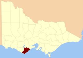 Location in Victoria | |||||||||||||||
| |||||||||||||||
Parishes
Parishes within the county:
- Aire
- Angahook
- Bambra
- Barongarook
- Barramunga
- Barwon Downs
- Barwongemoong
- Birregurra (part in the County of Grenville)
- Boonah
- Colac
- Elliminyt
- Gerangamete
- Irrewarra
- Irrewillipe
- Kaanglang
- Krambruk
- La Trobe (part in the County of Heytesbury)
- Lorne
- Moomowroong
- Moorbanool
- Murroon
- Nalangil
- Natte Murrang
- Newlingrook
- Olangolah
- Otway
- Pirron Yaloak
- Wangerrip
- Warrion (part in the County of Grenville)
- Weeaproinah
- Wensleydale
- Whoorel
- Wongarra
- Wyelangta
- Yan Yan Gourt
- Yaugher
- Yeo
References
- Rootsweb Genealogy, Victorian Counties, retrieved 20 September 2008
External links
- Research aids, Victoria 1910
- Map of the counties of Talbot, Dalhousie, Anglesey, Bourke, Grenville, Grant, Mornington, Polwarth / John Sands
Текст в блоке "Читать" взят с сайта "Википедия" и доступен по лицензии Creative Commons Attribution-ShareAlike; в отдельных случаях могут действовать дополнительные условия.
Другой контент может иметь иную лицензию. Перед использованием материалов сайта WikiSort.org внимательно изучите правила лицензирования конкретных элементов наполнения сайта.
Другой контент может иметь иную лицензию. Перед использованием материалов сайта WikiSort.org внимательно изучите правила лицензирования конкретных элементов наполнения сайта.
2019-2026
WikiSort.org - проект по пересортировке и дополнению контента Википедии
WikiSort.org - проект по пересортировке и дополнению контента Википедии