world.wikisort.org - Australia
Carbrook is a suburb in the City of Logan, Queensland, Australia.[2] Carbrook was previously called Gramzow, a name of German origin. The German name was anglicised in 1916 during World War I.[3][4] In the 2016 census, Carbrook had a population of 1,216 people.[1]
| Carbrook Logan City, Queensland | |||||||||||||||
|---|---|---|---|---|---|---|---|---|---|---|---|---|---|---|---|
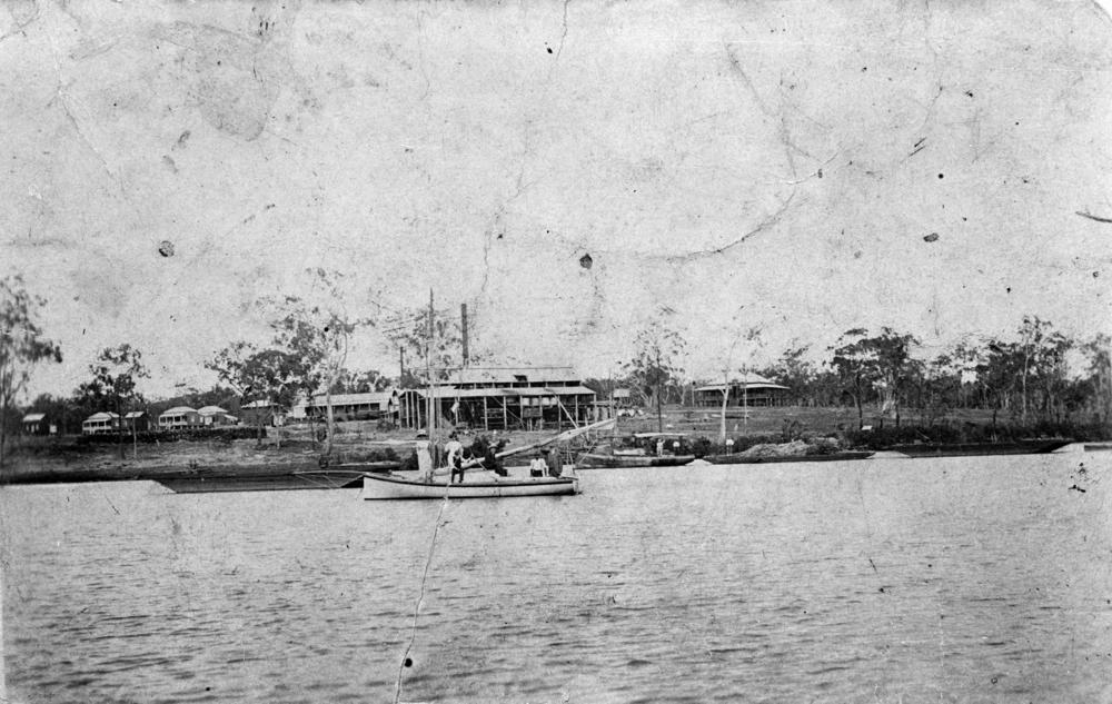
 Logan River at Carbrook Ski Park (left) and Alberton (right), 2014 | |||||||||||||||
 Carbrook | |||||||||||||||
| Coordinates | 27.6725°S 153.2527°E | ||||||||||||||
| Population | 1,216 (2016 census)[1] | ||||||||||||||
| • Density | 54.29/km2 (140.6/sq mi) | ||||||||||||||
| Postcode(s) | 4130 | ||||||||||||||
| Area | 22.4 km2 (8.6 sq mi) | ||||||||||||||
| Time zone | AEST (UTC+10:00) | ||||||||||||||
| Location |
| ||||||||||||||
| LGA(s) | Logan City | ||||||||||||||
| State electorate(s) | Macalister | ||||||||||||||
| Federal division(s) | Forde | ||||||||||||||
| |||||||||||||||
History
Carbrook was originally known as Gramzow after the village of Gramzow, Uckermark, Northern Germany, the name being given to it by the early German settlers who arrived in 1867.[citation needed]
The Alberton Ferry was established 1870 to cross the Logan River between Ferry Road at Carbrook (27.6923°S 153.2608°E) and Alberton Road at Alberton.[5] Following the opening of the Logan Bridge in 1931, usage of the ferry declined and it was closed in 1948.[6]
Gramzow State School opened on 5 November 1877, being renamed Carbrook State School in 1916.[7] It relocated to its present location in 1987 with the former school building still extant and listed on the Queensland Heritage Register.[8][9]
During World War I, German names were unpopular and many German- or German-sounding placenames were changed. In 1916, Gramzow's school and post office were renamed Carbrook.[10]
Until 1949, Carbrook was within the Shire of Tingalpa.[11]
Calvary Christian College opened on 1 February 1978.[12]
Christian Life College opened on 5 February 1979 and closed on 16 December 1993.[12]
Kimberley College opened in January 2000.[12]
The Carbrook campus of the Calvary Christian College opened in 2002.[12]
In the 2011 census, Carbrook had a population of 1,195 people.[13]
In the 2016 census, Carbrook recorded a population of 1,216 people, of whom 49.5% were female and 50.5% were male. The median age of the Carbrook population was 48 years old, 10 years above the national median of 38. 78.3% of people living in Carbrook were born in Australia. The other top responses for country of birth were England (5.2%), New Zealand (3.2%), Scotland (1.1%), India (1.0)%, and the Netherlands (0.7%). 91.6% of people spoke only English at home; the next most common languages were Punjabi (1.7%), Dutch and Afrikaans (0.5% each), Italian (0.4%), and Spanish (0.3%).[1]
Road infrastructure
The Beenleigh–Redland Bay Road runs through from west to east.[14]
Heritage listings
Carbrook has a number of heritage-listed sites, including:
- Mount Cotton Road: Carbrook Lutheran Cemetery[15]
- 445 - 469 Beenleigh Redland Bay Road: Fachwerk Farmhouse[16]
- 597 - 605 Beenleigh Redland Bay Road: Old Carbrook State School[9]
Education

Carbrook State School is a government primary (Prep-6) school for boys and girls at Redland Bay Road (27.6780°S 153.2352°E).[17][18] In 2018, the school had an enrolment of 452 students with 34 teachers (29 full-time equivalent) and 19 non-teaching staff (12 full-time equivalent).[19] It includes a special education program.[17]
Kimberley College is a private primary and secondary (Prep-12) school for boys and girls at 35-41 Kruger Road (27.6809°S 153.2356°E).[17][20] In 2018, the school had an enrolment of 855 students with 60 teachers and 28 non-teaching staff (27 full-time equivalent).[19]
Calvary Christian College is a private primary and secondary (Prep-12) school. It has two campuses, one at 559-581 Beenleigh-Redland Bay Road in Carbrook (27.6782°S 153.2404°E) and the other in Springwood.[17][21]
Carbrook Animal Assisted Learning Centre is a private secondary (7-12) special needs school at 597 - 605 Beenleigh Redland Bay Road (the Old Carbrook State School, 27.6792°S 153.2424°E). It provides support for students who have disengaged from mainstream schooling through the use of animal therapy.[22][23]
There is no government secondary school in Carbrook. The nearest government secondary school is Shailer Park State High School in Shailer Park to the west.[24]
Facilities
Great Southern Memorial Park is a cemetery and crematorium at 1774-1794 Mount Cotton Road (27.6532°S 153.2408°E).[25][26]
Wirunya Aged Care Centre is a aged care facility at 559-581 Beenleigh Redland Bay Road (27.6795°S 153.2385°E).[27]
Amenities
Fishing is popular along the Logan River.[28]
There is two boat ramps into the Logan River, both managed by the Logan City Council:
- at the south end of Reidel Road (27.6952°S 153.2794°E)[29]
- at the south end of Skinners Road (27.6812°S 153.2269°E)[30]
There are a number of parks in the area:
- California Creek Park (27.6778°S 153.2200°E)[31]
- Native Dog Creek East Park (27.6617°S 153.2667°E)[31]
- Native Dog Creek Park (27.6510°S 153.2486°E)[31]
- Skinners Park (27.6799°S 153.2267°E)[31]
Attractions
The Carbrook Golf Club is at 653 Beenleigh Redland Bay Road (27.6846°S 153.2471°E) at the confluence of the Logan River and its tributary, the Albert River. More than a dozen bull sharks inhabit a lake at the edge of the golf course, and locals claim that the sharks likely arrived there following a flood in the 1990s.[32][33] The club has embraced the existence of the sharks, having adopted a shark-shaped logo and running monthly Shark Lake Challenge golf competitions.[34]
Carbrook is home to one of three cable skiing parks in Australia. Bayside Wake Park (formerly Cable Ski Logan) is at 80 Ferry Road next to the Logan River (27.6910°S 153.2619°E). It is suitable for the first time kneeboarder to the experienced wakeboarder.[35][36]
Aquatic Gardens Caravan Park is at 833-901 Beenleigh Redland Bay Road near the cable ski (27.6882°S 153.2628°E).[37][38]
See also
- Australian place names changed from German names
References
- Australian Bureau of Statistics (27 June 2017). "Carbrook (SSC)". 2016 Census QuickStats. Retrieved 20 October 2018.
- "Carbrook – suburb in City of Logan (entry 48112)". Queensland Place Names. Queensland Government. Retrieved 27 December 2020.
- "Changing of German place names in Australia". 1301.0 - Year Book Australia, 1926. Australian Bureau of Statistics. 25 January 1926. Archived from the original on 24 December 2014. Retrieved 10 May 2014.
- "Carbrook". Suburbs. Logan City Council. Archived from the original on 13 May 2014. Retrieved 10 May 2014.
- "Beenleigh" (Map). Queensland Government. 1947. Archived from the original on 11 June 2020. Retrieved 4 February 2022.
- "Alberton". Gold Coast City Libraries. 11 April 2017. Archived from the original on 3 June 2021. Retrieved 3 February 2022.
- Queensland Family History Society (2010), Queensland schools past and present (Version 1.01 ed.), Queensland Family History Society, ISBN 978-1-921171-26-0
- "Our school". Carbrook State School. 19 February 2020. Archived from the original on 4 March 2021. Retrieved 3 February 2022.
- "Carbrook State School (former) (entry 600661)". Queensland Heritage Register. Queensland Heritage Council. Retrieved 10 July 2013.
- "Carbrook" (PDF). Local Studies Handout. Logan City Council. Archived (PDF) from the original on 24 April 2013. Retrieved 10 July 2013.
- Mary Howells. "Mount Cotton - a brief history" (PDF). Redland City Council. Archived from the original (PDF) on 29 March 2011. Retrieved 26 June 2014.
- Queensland Family History Society (2010), Queensland schools past and present (Version 1.01 ed.), Queensland Family History Society, ISBN 978-1-921171-26-0
- Australian Bureau of Statistics (31 October 2012). "Carbrook (State Suburb)". 2011 Census QuickStats. Retrieved 16 February 2014.
- Google (13 August 2022). "Carbrook, Queensland" (Map). Google Maps. Google. Retrieved 13 August 2022.
- "Carbrook Lutheran Cemetery (entry 601660)". Queensland Heritage Register. Queensland Heritage Council. Retrieved 10 July 2013.
- "Fachwerk Farmhouse (entry 601647)". Queensland Heritage Register. Queensland Heritage Council. Retrieved 10 July 2013.
- "State and non-state school details". Queensland Government. 9 July 2018. Archived from the original on 21 November 2018. Retrieved 21 November 2018.
- "Carbrook State School". Carbrook State School. 19 February 2020. Archived from the original on 4 March 2021. Retrieved 3 February 2022.
- "ACARA School Profile 2018". Australian Curriculum, Assessment and Reporting Authority. Archived from the original on 27 August 2020. Retrieved 28 January 2020.
- "Kimberley College". Archived from the original on 19 November 2018. Retrieved 21 November 2018.
- "Calvary Christian College". Archived from the original on 14 August 2018. Retrieved 21 November 2018.
- "Carbrook Centre | Animal Assisted Learning |". Carbrook Centre. Archived from the original on 16 December 2021. Retrieved 3 February 2022.
- "Landmark Areas - Queensland". Queensland Open Data. Queensland Government. 18 November 2020. Archived from the original on 21 November 2020. Retrieved 21 October 2020.
- "Queensland Globe". State of Queensland. Retrieved 3 February 2022.
- "Great Southern Memorial Park | Cemetery & Crematorium Carbrook QLD". Archived from the original on 25 December 2021. Retrieved 3 February 2022.
- "Cemetery Areas - Queensland". Queensland Open Data. Queensland Government. 12 November 2020. Archived from the original on 15 November 2020. Retrieved 12 November 2020.
- "Building areas - Queensland". Queensland Open Data. Queensland Government. 17 November 2020. Archived from the original on 17 November 2020. Retrieved 17 November 2020.
- "Fishing in Logan". Logan City Council. Retrieved 3 February 2022.
- "Recreational Boating Facilities Queensland". Queensland Open Data. Queensland Government. 12 November 2020. Archived from the original on 22 November 2020. Retrieved 22 November 2020.
- "Recreational Boating Facilities Queensland". Queensland Open Data. Queensland Government. 12 November 2020. Archived from the original on 22 November 2020. Retrieved 22 November 2020.
- "Land for public recreation - Queensland". Queensland Open Data. Queensland Government. 20 November 2020. Archived from the original on 22 November 2020. Retrieved 22 November 2020.
- Chandler, Rick (13 April 2011). "It's not really a water hazard unless you've got sharks (video)". NBC Sports - Off the Bench. Archived from the original on 17 April 2011. Retrieved 15 April 2011.
- DelVecchio, Steve (13 April 2011). "Australia Golf Course Has Water Hazard with World's Deadliest Sharks". Larry Brown Sports. Archived from the original on 25 April 2011. Retrieved 15 April 2011.
- "Shark-infested course at Brisbane's Carbrook Golf Club believed to be a world first". Fox Sports. 9 October 2011. Archived from the original on 14 October 2021. Retrieved 3 February 2022.
- "Experience The Thrill!". Bayside Wake Park. Archived from the original on 22 December 2021. Retrieved 3 February 2022.
- "Bayside Wakepark". Tourism & Events Queensland. Retrieved 3 February 2022.
- "Building points - Queensland". Queensland Open Data. Queensland Government. 17 November 2020. Archived from the original on 25 November 2020. Retrieved 25 November 2020.
- "ATDW Page". www.queensland.com. Retrieved 3 February 2022.
External links
- "Carbrook". Queensland Places. Centre for the Government of Queensland, University of Queensland.
- "Carbrook". Logan City Council.
Другой контент может иметь иную лицензию. Перед использованием материалов сайта WikiSort.org внимательно изучите правила лицензирования конкретных элементов наполнения сайта.
WikiSort.org - проект по пересортировке и дополнению контента Википедии