world.wikisort.org - Armenia
Aghitu (Armenian: Աղիտու) is a village in the Sisian Municipality of the Syunik Province in Armenia.
Aghitu
Աղիտու | |
|---|---|
 | |
 Aghitu  Aghitu | |
| Coordinates: 39°30′55″N 46°04′51″E | |
| Country | |
| Province | Syunik |
| Municipality | Sisian |
| Area | |
| • Total | 19.44 km2 (7.51 sq mi) |
| Population (2011)[2] | |
| • Total | 436 |
| • Density | 22/km2 (58/sq mi) |
| Time zone | UTC+4 (AMT) |
| Aghitu at GEOnet Names Server | |
Demographics
Population
The Statistical Committee of Armenia reported its population as 304 in 2010,[3] up from 209 at the 2001 census.[4]
Gallery
 Scenery
 Aghitu monument
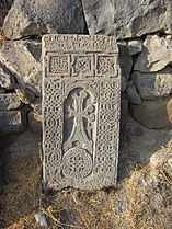 Khachkar in Aghitu
 Scenery


References
Wikimedia Commons has media related to Aghitu.
- "Syunik regional e-Governance System" (in Armenian). syunik Province provincial government. Click on link entitled "Համայնքներ" (community) and search for the place by Armenian name.
- Statistical Committee of Armenia. "The results of the 2011 Population Census of Armenia" (PDF).
- "Marzes of Armenia and Yerevan City in Figures, 2010" (PDF). Statistical Committee of Armenia.
- Report of the results of the 2001 Armenian Census, Statistical Committee of Armenia
Capital: Kapan | ||||||||||||
| Urban municipalities |
|  | ||||||||||
| Rural municipalities |
| |||||||||||
This article about a location in Syunik Province, Armenia is a stub. You can help Wikipedia by expanding it. |
На других языках
[de] Aghitu
Aghitu (armenisch Աղիտու), bis April 1991 Aghudi,[1] ist ein Dorf und eine Landgemeinde (hamaynkner) in der südarmenischen Provinz Sjunik nahe Sissian. Der Ort ist für einen ungewöhnlichen frühchristlichen Grabbau bekannt.- [en] Aghitu
[ru] Агиту
Агиту (арм. Աղիտու, до 1995 г. — Агуди) — село в Сюникской области, в 4 км восточнее Сисиана, на левом берегу реки Воротан.Текст в блоке "Читать" взят с сайта "Википедия" и доступен по лицензии Creative Commons Attribution-ShareAlike; в отдельных случаях могут действовать дополнительные условия.
Другой контент может иметь иную лицензию. Перед использованием материалов сайта WikiSort.org внимательно изучите правила лицензирования конкретных элементов наполнения сайта.
Другой контент может иметь иную лицензию. Перед использованием материалов сайта WikiSort.org внимательно изучите правила лицензирования конкретных элементов наполнения сайта.
2019-2026
WikiSort.org - проект по пересортировке и дополнению контента Википедии
WikiSort.org - проект по пересортировке и дополнению контента Википедии