world.wikisort.org - Argentina
San Luis (Spanish pronunciation: [ˈsan ˈlwis]) is the capital city of San Luis Province in the Cuyo region of Argentina. It is also the seat of the Juan Martín de Pueyrredón Department.
This article needs additional citations for verification. (February 2022) |
San Luis | |
|---|---|
City | |
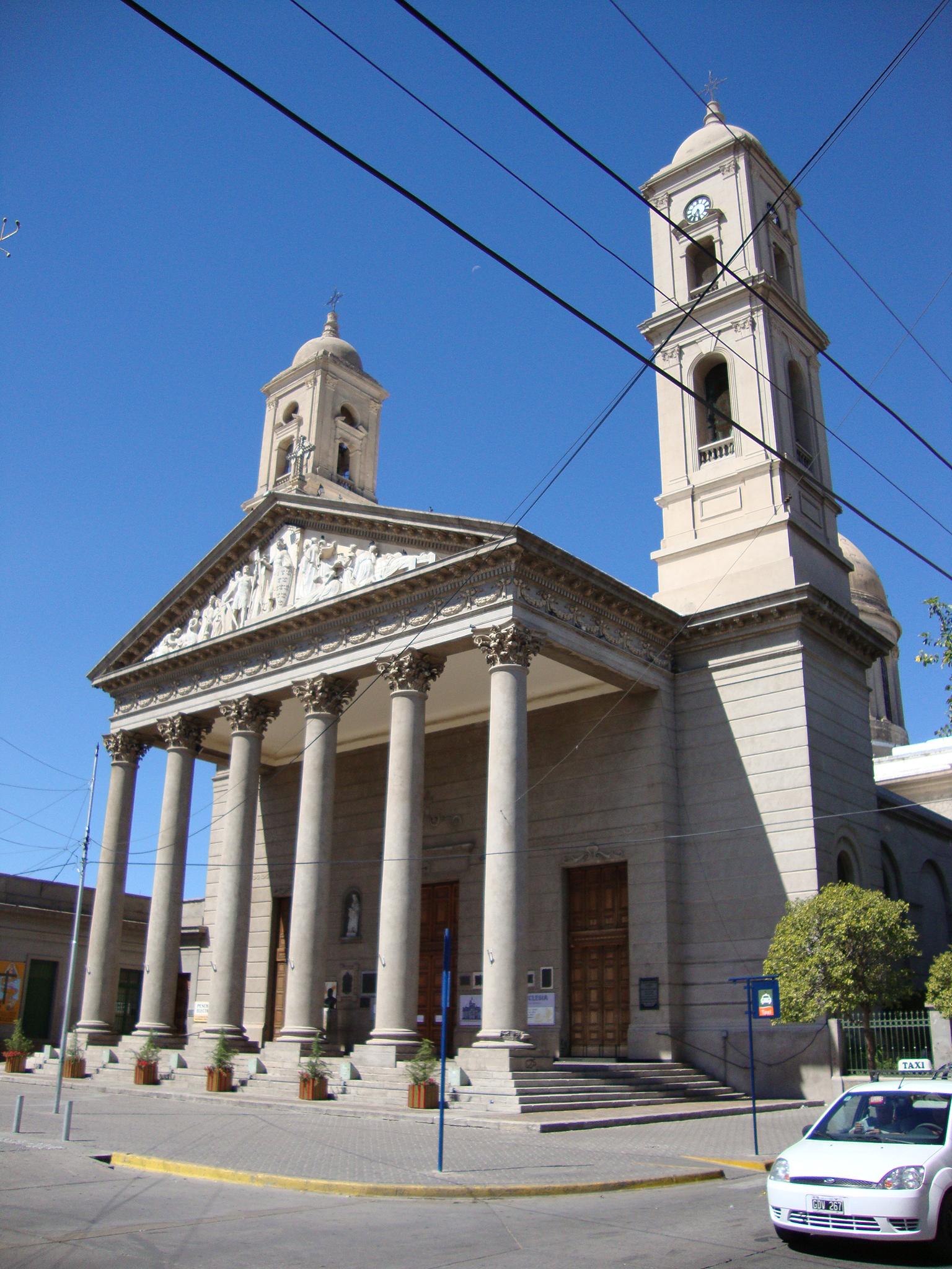 Cathedral of San Luis | |
 Flag  Coat of arms | |
 San Luis Location of San Luis in Argentina | |
| Coordinates: 33°18′S 66°20′W | |
| Country | |
| Province | |
| Department | Juan Martín de Pueyrredón |
| Founded | August 25, 1594 |
| Government | |
| • Mayor (Intendente) | Sergio Tamayo (Frente Justicialista de Todos) |
| Elevation | 709 m (2,326 ft) |
| Population (2010 census) | |
| • Total | 169,947 |
| Demonym | puntano/a |
| Time zone | UTC−3 (ART) |
| CPA base | D5700 |
| Dialing code | +54 0266 |
City information
Points of interest in the city include the Park of the Nations, the neoclassical cathedral, a number of museums including the Dora Ochoa De Masramón Provincial Museum, and the colonial architecture. A number of landmarks honor the Argentine War of Independence, as well. Independence Park features an equestrian monument to General José de San Martín, liberator of Argentina, Chile and Perú. Nearby Pringles Plaza honors Colonel Juan Pascual Pringles, one of San Martín's chief adjutants and, briefly, Governor of San Luis Province.
Fishing in the nearby Lake Potrero de los Funes, and other locations, is also popular. The Sierra de las Quijadas National Park is located 122 km (76 mi) from the city.
Transport
National Route 7 connects San Luis to Mendoza, 255 km (158 mi) to the west, and Buenos Aires, 791 km (492 mi) to the east. San Luis Airport is located less than 3.2 km (2 mi) north of the city centre, and has regular flights to Buenos Aires.
History
San Luis was founded on August 25, 1594, by Luis Jufré de Loaysa y Meneses. The settlement was later abandoned, and was reestablished in 1632 by Martín García Oñez de Loyola as San Luis de Loyola Nueva Medina de Río Seco.
By the end of the 19th century, San Luis had 7,000 inhabitants, and in 1882 the Argentine Great Western Railway reached the city on its way to Chile. The following year, work began on the cathedral. The Governor's Executive Building, designed in French renaissance architecture, was completed in 1911. The city's population reached 40,000 in 1960, and grew rapidly afterwards, when light industry and growing numbers of retirees began to migrate to the area; at the 2001 census [INDEC], its population was 153,322.
Because the city is located at the part of the Sierras Grandes known as Punta de los Venados (Deer Point), the inhabitants of the city are called puntanos.
Geography
San Luis lies at the foot of the Sierras Grandes, along the northern bank of the Chorrillos River, and is set on a dry pampas plateau, around 730 m (2,400 ft) above sea level.
Climate
San Luis has a humid subtropical climate (Cwa, according to the Köppen climate classification) and it closely borders a semi-arid climate (BSk). Summers are hot and humid, and winters are cool and dry, with temperatures falling below 0 °C (32.0 °F) sometimes and snowfalls can occur occasionally. The hottest month, January, has an average temperature of 24.0 °C (75.2 °F), and the coldest month, July, has an average of 8.9 °C (48.0 °F). The annual average temperature is 17.4 °C (63.3 °F).
| Climate data for San Luis (Brigadier Mayor César Raúl Ojeda Airport) 1981-2010, extremes 1901-present[lower-alpha 1] | |||||||||||||
|---|---|---|---|---|---|---|---|---|---|---|---|---|---|
| Month | Jan | Feb | Mar | Apr | May | Jun | Jul | Aug | Sep | Oct | Nov | Dec | Year |
| Record high °C (°F) | 42.0 (107.6) |
39.9 (103.8) |
38.5 (101.3) |
34.7 (94.5) |
32.4 (90.3) |
30.1 (86.2) |
32.2 (90.0) |
34.6 (94.3) |
37.6 (99.7) |
40.0 (104.0) |
41.1 (106.0) |
42.3 (108.1) |
42.3 (108.1) |
| Average high °C (°F) | 31.1 (88.0) |
30.0 (86.0) |
27.3 (81.1) |
23.3 (73.9) |
19.7 (67.5) |
17.0 (62.6) |
16.6 (61.9) |
19.3 (66.7) |
21.8 (71.2) |
25.8 (78.4) |
28.4 (83.1) |
30.5 (86.9) |
24.2 (75.6) |
| Daily mean °C (°F) | 24.4 (75.9) |
23.2 (73.8) |
20.8 (69.4) |
16.6 (61.9) |
12.9 (55.2) |
10.0 (50.0) |
9.4 (48.9) |
11.9 (53.4) |
14.7 (58.5) |
18.9 (66.0) |
21.6 (70.9) |
23.8 (74.8) |
17.4 (63.3) |
| Average low °C (°F) | 17.9 (64.2) |
17.0 (62.6) |
15.3 (59.5) |
11.3 (52.3) |
7.7 (45.9) |
4.5 (40.1) |
3.7 (38.7) |
5.9 (42.6) |
8.5 (47.3) |
12.5 (54.5) |
15.0 (59.0) |
17.1 (62.8) |
11.4 (52.5) |
| Record low °C (°F) | 4.1 (39.4) |
3.9 (39.0) |
2.3 (36.1) |
−2.4 (27.7) |
−6.5 (20.3) |
−9.1 (15.6) |
−10.5 (13.1) |
−8.7 (16.3) |
−4.3 (24.3) |
−4.0 (24.8) |
0.3 (32.5) |
1.6 (34.9) |
−10.5 (13.1) |
| Average precipitation mm (inches) | 119.5 (4.70) |
97.5 (3.84) |
98.9 (3.89) |
41.4 (1.63) |
19.8 (0.78) |
5.7 (0.22) |
11.2 (0.44) |
8.6 (0.34) |
24.3 (0.96) |
40.5 (1.59) |
80.4 (3.17) |
110.1 (4.33) |
657.9 (25.90) |
| Average precipitation days (≥ 0.1 mm) | 10.2 | 8.3 | 7.9 | 5.0 | 3.3 | 1.9 | 2.7 | 2.2 | 4.3 | 5.4 | 7.8 | 10.6 | 69.6 |
| Average relative humidity (%) | 54.4 | 56.7 | 63.7 | 64.6 | 64.2 | 62.4 | 57.6 | 49.6 | 47.0 | 46.9 | 48.3 | 51.4 | 55.6 |
| Mean monthly sunshine hours | 328.8 | 277.5 | 252.2 | 221.6 | 195.7 | 177.8 | 201.1 | 216.8 | 234.1 | 272.1 | 309.1 | 322.1 | 3,051.8 |
| Percent possible sunshine | 73 | 75 | 68 | 68 | 64 | 62 | 65 | 71 | 67 | 73 | 72 | 71 | 69 |
| Source 1: Servicio Meteorológico Nacional[1][2] | |||||||||||||
| Source 2: World Meteorological Organization (sunshine hours 1981–2010),[3] NOAA (percent sun 1961-1990),[4] Secretaria de Mineria (extremes 1901-1960)[5] | |||||||||||||
Gallery
 City Hall
 Former railway station (1907), today a cultural centre
 San Luis National College
 Plaza Pringles


References
- "Estadísticas Climatológicas Normales - período 1981-2010" (in Spanish). Servicio Meteorológico Nacional. Retrieved January 21, 2018.
- "Clima en la Argentina: Guia Climática por San Luis Aero". Caracterización: Estadísticas de largo plazo (in Spanish). Servicio Meteorológico Nacional. Archived from the original on 4 September 2017. Retrieved 5 October 2017.
- "World Meteorological Organization Climate Normals for 1981–2010". World Meteorological Organization. Archived from the original on 16 July 2021. Retrieved 5 October 2021.
- "San Luis Aero Climate Normals 1961-1990". National Oceanic and Atmospheric Administration. Retrieved June 25, 2015.
- "Provincia de San Luis - Clima Y Meteorologia" (in Spanish). Secretaria de Mineria de la Nacion (Argentina). Archived from the original on July 4, 2015. Retrieved April 10, 2013.
Notes
- The record highs and lows are based on the Secretaria de Mineria link for the period 1901–1960 while the Servicio Meteorológico Nacional source provides record highs from 1961-present
External links
- Official Site (Spanish)
- Municipal information: Municipal Affairs Federal Institute (IFAM), Municipal Affairs Secretariat, Ministry of Interior, Argentina. (in Spanish)
- City info (English)
- CuyoNoticias digital newspaper (Spanish-English)
Provincial capitals of Argentina | ||
|---|---|---|
| ||
Authority control | |
|---|---|
| General | |
| National libraries | |
| Other | |
На других языках
[de] San Luis (Argentinien)
San Luis (de la Punta) ist eine Stadt in der Region Cuyo in Argentinien und Hauptstadt der Provinz San Luis und deren Departamento Juan Martín de Pueyrredón. Die Stadt liegt am Fuße der Sierras Grandes auf einer Höhe von 762 m am Río Chorrillos und hat 153.322 Einwohner (2001, INDEC). San Luis liegt an der Ruta Nacional 7, die Mendoza (255 km) mit Buenos Aires (791 km) verbindet. Die nächstgelegenen Provinzhauptstädte sind San Juan (323 km) und Córdoba (412 km). Der Flughafen San Luis befindet sich sieben Kilometer vom Zentrum entfernt und verbindet die Stadt mit Buenos Aires.- [en] San Luis, Argentina
[es] San Luis (Argentina)
La ciudad de San Luis es la capital de la provincia de San Luis, Argentina. Está ubicada al centro-norte de la provincia y es cabecera del departamento Juan Martín de Pueyrredón.[ru] Сан-Луис (Аргентина)
Сан-Луис (исп. San Luis) — город в Аргентине, столица одноимённой провинции — Сан-Луис.Другой контент может иметь иную лицензию. Перед использованием материалов сайта WikiSort.org внимательно изучите правила лицензирования конкретных элементов наполнения сайта.
WikiSort.org - проект по пересортировке и дополнению контента Википедии