world.wikisort.org - Algeria
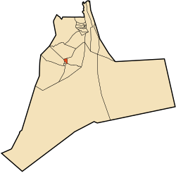
Sidi Khouiled (Arabic: ﺳﻴﺪي ﺧﻮﻳﻠﺪ) is a town and commune, and capital of Sidi Khouiled District, in Ouargla Province, Algeria. It is located near the provincial capital, Ouargla. According to the 2008 census it has a population of 8,803,[2] up from 4,309 in 1998,[3] and has an annual population growth rate of 7.6%, the highest in the province.[2]
Sidi Khouiled
ﺳﻴﺪي ﺧﻮﻳﻠﺪ | |
|---|---|
Commune and town | |
 | |
 Sidi Khouiled | |
| Coordinates: 31°58′47″N 5°25′6″E | |
| Country | |
| Province | Ouargla Province |
| District | Sidi Khouiled District |
| Area | |
| • Total | 131 km2 (51 sq mi) |
| Elevation | 159 m (522 ft) |
| Population (2008)[2] | |
| • Total | 8,803 |
| • Density | 67/km2 (170/sq mi) |
| Time zone | UTC+1 (CET) |
Geography
Sidi Khouiled lies at an elevation of 159 metres (522 ft) above sea level, 9 kilometres (5.6 mi) from the provincial capital Ouargla. The land in the area alternates between sand dunes and flat rocky plains with small areas of fertile oases. Sidi Khouiled is encircled by small palm plantations built upon these oases.
Climate
The climate is dry, with frequent high winds, and very hot temperatures in summer.[1]
Transportation
Sidi Khouleid is connected by local roads to Ouargla to the west, as well as the towns of Ain Beida to the south and Hassi Ben Abdellah to the northeast. From Ouargla the N49 national highway connects to Ghardaia to the west and Hassi Messaoud to the east, while the N56 connects (via the N3) to Biskra to the north.
The commune contains 7 kilometres (4.3 mi) of national roads, 21.6 kilometres (13.4 mi) of provincial roads, and 6 kilometres (3.7 mi) of municipal roads.[1]
Infrastructure
Access to drinking water is available to 90% of the population, and 85% can use the sewer system. 97% have access to electricity, and 85% have access to gas.[1]
Localities
The commune is composed of three localities:[4]
- Sidi Khouiled
- Oum Raneb
- Aouinet Moussa
External links
References
- "Official website of the province of Ouargla - Sidi Khouleid" (in Arabic). Archived from the original on 24 March 2013. Retrieved 1 March 2013.
- "Population: Ouargla Wilaya" (PDF) (in French). Office National des Statistiques Algérie. Retrieved 24 February 2013.
- "Algeria Communes". Statoids. Retrieved 8 March 2013.
- "Décret n° 84-365, fixant la composition, la consistance et les limites territoriale des communes. Wilaya d'El Oued" (PDF) (in French). Journal officiel de la République Algérienne. 19 December 1984. p. 1551. Archived from the original (PDF) on 2 March 2013. Retrieved 2 March 2013.
Places adjacent to Sidi Khouiled | ||||||||||||||||
|---|---|---|---|---|---|---|---|---|---|---|---|---|---|---|---|---|
| ||||||||||||||||
Capital: Ouargla | ||
| Ouargla District | 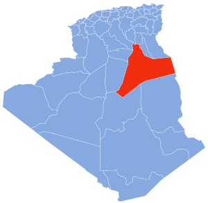 | |
| El Borma District | ||
| El Hadjira District | ||
| Hassi Messaoud District |
| |
| Mégarine District | ||
| N'Goussa District | ||
| Sidi Khouïled District | ||
| Taïbet District | ||
| Témacine District | ||
| Touggourt District | ||
На других языках
- [en] Sidi Khouiled
[ru] Сиди-Хуилед
Сиди-Хуилед (араб. سيدي خويلد) — город и коммуна в восточной части Алжира, в вилайете Уаргла. Административный центр округа Сиди-Хуилед.Другой контент может иметь иную лицензию. Перед использованием материалов сайта WikiSort.org внимательно изучите правила лицензирования конкретных элементов наполнения сайта.
WikiSort.org - проект по пересортировке и дополнению контента Википедии