world.wikisort.org - Algeria
Sidi Slimane (Arabic: ﺳﻴﺪي ﺳﻠﻴﻤﺎن) is a town and commune in Mégarine District, Touggourt Province, Algeria, located near the city of Touggourt. According to the 2008 census it has a population of 8,072,[1] up from 6,822 in 1998,[2] and an annual growth rate of 1.7%.[1]
Sidi Slimane
ﺳﻴﺪي ﺳﻠﻴﻤﺎن | |
|---|---|
Commune and town | |
 | |
 Sidi Slimane | |
| Coordinates: 33°17′19″N 6°5′41″E | |
| Country | |
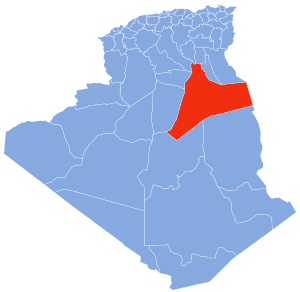
| Province | Touggourt Province |
| District | Mégarine District |
| Area | |
| • Total | 635 km2 (245 sq mi) |
| Elevation | 61 m (200 ft) |
| Population (2008)[1] | |
| • Total | 8,072 |
| • Density | 12.7/km2 (32.9/sq mi) |
| Time zone | UTC+1 (CET) |
Geography
Sidi Slimane lies in a large area of palm plantations on an oasis network that extends from here past Touggourt through to Balidat Ameur. Beyond the oases is the arid and barren landscape of the Sahara, featuring areas of sand dunes (ergs) and flat rocky plains (regs).
Climate
Sidi Slimane has a hot desert climate (Köppen climate classification BWh), with very hot summers and mild winters. Rainfall is light and sporadic, and summers are particularly dry.
Transportation
Sidi Slimane is connected to the N3 national highway by the regional road W305, which is 5 kilometres (3.1 mi) long. From the intersection, the town is connected to Biskra to the north, and Touggourt to the south. The train line from Biskra to Touggourt also runs past the town at the locality of Moggar, but there is no station.
Education
4.4% of the population has a tertiary education, and another 14.8% has completed secondary education.[3] The overall literacy rate is 80.7%, and is 87.0% among males and 74.4% among females.[4]
Localities
The commune is composed of three localities:[5]
- Sidi Slimane
- Moggar
- El Har Ihira
References
- "Population: Ouargla Wilaya" (PDF) (in French). Office National des Statistiques Algérie. Retrieved 24 February 2013.
- "Algeria Communes". Statoids. Retrieved 8 March 2013.
- "Structure relative de la population résidente des ménages ordinaires et collectifs âgée de 6 ans et plus selon le niveau d'instruction et la commune de résidence" (PDF) (in French). Office National des Statistiques Algérie. Retrieved 13 February 2013.
- "Taux d'analphabétisme et taux d'alphabétisation de la population âgée de 15 ans et plus, selon le sexe et la commune de résidence " (PDF) (in French). Office National des Statistiques Algérie. Retrieved 13 February 2013.
- "Décret n° 84-365, fixant la composition, la consistance et les limites territoriale des communes. Wilaya d'El Oued" (PDF) (in French). Journal officiel de la République Algérienne. 19 December 1984. p. 1551. Archived from the original (PDF) on 2013-03-02. Retrieved 2 March 2013.
Places adjacent to Sidi Slimane, Ouargla | |
|---|---|
Capital: Ouargla | ||
| Ouargla District |
|  |
| El Borma District |
| |
| El Hadjira District |
| |
| Hassi Messaoud District |
| |
| Mégarine District |
| |
| N'Goussa District | ||
| Sidi Khouïled District |
| |
| Taïbet District | ||
| Témacine District | ||
| Touggourt District |
| |
На других языках
- [en] Sidi Slimane, Ouargla
[ru] Сиди-Слиман (Уаргла)
Сиди-Слиман (араб. سيدي سليمان) — город и коммуна в северо-восточной части Алжира, в вилайете Уаргла. Входит в состав округа Мегарин.Другой контент может иметь иную лицензию. Перед использованием материалов сайта WikiSort.org внимательно изучите правила лицензирования конкретных элементов наполнения сайта.
WikiSort.org - проект по пересортировке и дополнению контента Википедии