world.wikisort.org - Algeria
Mostaganem (Arabic: ولاية مستغانم) is a province (wilaya) of Algeria. Its capital is Mostaganem.
Mostaganem Province
ولاية مستغانم | |
|---|---|
Province | |
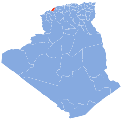 Map of Algeria highlighting Mostaganem | |
| Coordinates: 35°56′N 0°05′E | |
| Country | |
| Capital | Mostaganem |
| Area | |
| • Total | 2,269 km2 (876 sq mi) |
| Population (2008)[1] | |
| • Total | 746,947 |
| • Density | 330/km2 (850/sq mi) |
| Time zone | UTC+01 (CET) |
| Area Code | +213 (0) 45 |
| ISO 3166 code | DZ-27 |
| Districts | 10 |
| Municipalities | 32 |
Geography
The land relief in Mostaganem Province can be divided into four regions: the Dahra Range to the east, the Mostaganem Plateau to the south, the Chelif River valley which separates the two highland regions, and the plains on the province's southern border which lie next to the marshes of the Macta.[2]
The Mostaganem Plateau covers eleven municipalities in the southern part of the province: Mostaganem, Ain Tedles, Sour, Bouguirat, Sirat, Souaflia, Mesra, Ain Sidi Cherif, Mansourah, Touahria and Sayada.[3] It is a semi-arid and sandy plateau, in the shape of a triangle and bounded to the north by the Chelif River.[4] It receives 350 mm of rainfall per year.[3]
During French colonization, viticulture was introduced on the plateau.[4] After the country's independence, it was replaced by irrigated market gardening and the culture of citrus fruits and cereals.[4] However, in certain sectors east of Mostaganem, the replacement of the vineyards caused the appearance of small dunes as a consequence of the resumption of soil movement.[4]
History
In 1984 Relizane Province was carved out of its territory.
Administrative divisions
The province is divided into 10 districts (daïras), which are further divided into 32 communes or municipalities.
Districts
- Achacha
- Aïn Nouïssy
- Aïn Tédelès
- Bouguirat
- Hassi Mamèche
- Kheïr Eddine
- Mesra
- Mostaganem
- Sidi Ali
- Sidi Lakhdar
Communes
- Achacha (Achaacha)
- Aïn Boudinar
- Aïn Nouïssy
- Aïn Sidi Chérif
- Aïn Tédelès (Ain Tedles)
- Benabdelmalek Ramdane (Abdelmalek Ramdane)
- Bouguirat
- El Hassaine
- Fornaka
- Hadjadj
- Hassi Mamèche (Hasi Mameche)
- Khadra
- Kheïr Eddine (Kheiredine)
- Mansourah
- Mazagran (Mazagrain, Mezghrane)
- Mesra
- Mostaganem
- Nékmaria
- Oued El Kheïr
- Ouled Boughalem
- Ouled Malah (Ouled Maalef)
- Safsaf (Saf Saf)
- Sayada
- Sidi Ali
- Sidi Bellater (Sidi Belatar)
- Sidi Lakhdar (Sidi Lakhdaara)
- Sirat
- Souaflia
- Sour
- Stidia
- Tazgait
- Touahria
- addl
References
- Office National des Statistiques, Recensement General de la Population et de l’Habitat 2008 Archived 24 July 2008 at the Wayback Machine Preliminary results of the 2008 population census. Accessed on 2 July 2008.
- "Présentation de la Wilaya: Caractéristique naturelles et conditions climatique". ANIREF. Retrieved 22 June 2021.
- Monographie de la wilaya de Mostaganem (PDF). pp. 2–3. Archived from the original (PDF) on 11 January 2012.
- Côte, Marc (1996). Guide d'Algérie : paysages et patrimoine. Algeria: Média-Plus. p. 319. ISBN 9961-922-00-X.
| Mostaganem District |  | |
|---|---|---|
| Hassi Mamèche District2 | ||
| Aïn Tedles District |
| |
| Bouguirat District | ||
| Sidi Ali District | ||
| Achacha District | ||
| Aïn Nouïssy District | ||
| Mesra District |
| |
| Kheïr Eddine District | ||
| Sidi Lakhdar District | ||
|  | |
Authority control | |
|---|---|
| General |
|
| National libraries | |
| Other |
|
This article about a location in Mostaganem Province is a stub. You can help Wikipedia by expanding it. |
На других языках
- [en] Mostaganem Province
[ru] Мостаганем (вилайет)
Мостагане́м[2][3] (араб. ولاية مستغانم) — вилайет[4] в северо-западной части Алжира, одноимённый своему административному центру, городу Мостаганем.Другой контент может иметь иную лицензию. Перед использованием материалов сайта WikiSort.org внимательно изучите правила лицензирования конкретных элементов наполнения сайта.
WikiSort.org - проект по пересортировке и дополнению контента Википедии