world.wikisort.org - Algeria
Mansoura (Arabic: منصورة) is a town and commune, and the capital of Mansoura District, in Ghardaïa Province, Algeria. According to the 2008 census it has a population of 2,840,[1] up from 1,765 in 1998,[2] with an annual growth rate of 5.0%, the second highest in the province (behind Hassi Fehal).[1]
Mansoura
منصورة | |
|---|---|
Commune and town | |
 Location of Mansoura commune within Ghardaïa Province | |
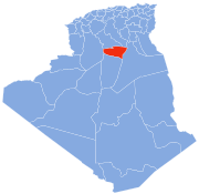
 Mansoura Location of Mansoura within Algeria | |
| Coordinates: 31°58′46″N 3°44′46″E | |
| Country | |
| Province | Ghardaïa Province |
| District | Mansoura District |
| Elevation | 428 m (1,404 ft) |
| Population (2008)[1] | |
| • Total | 2,840 |
| Time zone | UTC+1 (CET) |
Climate
Mansoura has a hot desert climate (Köppen climate classification BWh), with very hot summers and mild winters, and very little precipitation throughout the year.
| Climate data for Mansoura | |||||||||||||
|---|---|---|---|---|---|---|---|---|---|---|---|---|---|
| Month | Jan | Feb | Mar | Apr | May | Jun | Jul | Aug | Sep | Oct | Nov | Dec | Year |
| Average high °C (°F) | 16.8 (62.2) |
19.5 (67.1) |
23.2 (73.8) |
28.7 (83.7) |
33.3 (91.9) |
39.2 (102.6) |
42.9 (109.2) |
41.9 (107.4) |
36.1 (97.0) |
28.8 (83.8) |
21.4 (70.5) |
17.3 (63.1) |
29.1 (84.4) |
| Daily mean °C (°F) | 10.4 (50.7) |
12.7 (54.9) |
16.1 (61.0) |
20.8 (69.4) |
25.4 (77.7) |
31.0 (87.8) |
34.2 (93.6) |
33.4 (92.1) |
28.8 (83.8) |
21.8 (71.2) |
15.1 (59.2) |
11.1 (52.0) |
21.7 (71.1) |
| Average low °C (°F) | 4.1 (39.4) |
6.0 (42.8) |
9.1 (48.4) |
13.0 (55.4) |
17.6 (63.7) |
22.8 (73.0) |
25.5 (77.9) |
25.0 (77.0) |
21.6 (70.9) |
14.9 (58.8) |
8.9 (48.0) |
4.9 (40.8) |
14.5 (58.0) |
| Average precipitation mm (inches) | 6 (0.2) |
3 (0.1) |
9 (0.4) |
4 (0.2) |
3 (0.1) |
1 (0.0) |
1 (0.0) |
1 (0.0) |
4 (0.2) |
5 (0.2) |
7 (0.3) |
6 (0.2) |
50 (1.9) |
| Source: climate-data.org[3] | |||||||||||||
Transportation
Mansoura lies on the Trans-Sahara Highway (also known as the N1 national highway) just north of the town of Hassi Fehal. The highway connects to Ghardaïa to the north, and El Goléa and In Salah to the south.
Education
3.9% of the population has a tertiary education (the equal lowest in the province), and another 12.9% has completed secondary education.[4] The overall literacy rate is 72.5%, and is 77.6% among males and 66.6% among females; all three figures are the second lowest in the province behind Hassi Fehal.[5]
Localities
The commune of Mansoura is composed of two localities:[6]
- El Mansoura
- Aïn Loussig et Chouikat Sud
References
- "Population: Ghardaïa Wilaya" (PDF) (in French). Office National des Statistiques Algérie. Archived from the original (PDF) on 16 May 2013. Retrieved 13 February 2013.
- "Algeria Communes". Statoids. Retrieved 9 March 2013.
- "Climate data for: Mansoura". climate-data.org. Retrieved 29 March 2013.
- "Structure relative de la population résidente des ménages ordinaires et collectifs âgée de 6 ans et plus selon le niveau d'instruction et la commune de résidence" (PDF) (in French). Office National des Statistiques Algérie. Archived from the original (PDF) on 16 May 2013. Retrieved 13 February 2013.
- "Taux d'analphabétisme et taux d'alphabétisation de la population âgée de 15 ans et plus, selon le sexe et la commune de résidence " (PDF) (in French). Office National des Statistiques Algérie. Archived from the original (PDF) on 16 May 2013. Retrieved 13 February 2013.
- "Décret n° 84-365, fixant la composition, la consistance et les limites territoriale des communes. Wilaya d'El Oued" (PDF) (in French). Journal officiel de la République Algérienne. 19 December 1984. p. 1579. Archived from the original (PDF) on 21 October 2013. Retrieved 2 March 2013.
Places adjacent to Mansoura, Ghardaïa | ||||||||||||||||
|---|---|---|---|---|---|---|---|---|---|---|---|---|---|---|---|---|
| ||||||||||||||||
Capital: Ghardaïa | ||
| Ghardaïa District |
|  |
| Bérianne District |
| |
| Bounoura District | ||
| Dhayat Ben Dhahoua District | ||
| El Guerrara District |
| |
| El Ménia District |
| |
| Mansourah District | ||
| Métlili District | ||
| Zelfana District | ||
Другой контент может иметь иную лицензию. Перед использованием материалов сайта WikiSort.org внимательно изучите правила лицензирования конкретных элементов наполнения сайта.
WikiSort.org - проект по пересортировке и дополнению контента Википедии