world.wikisort.org - Algeria
In Eker (also written as I-n-Eker or In Ekker) is a village in the commune of In Amguel,[1] in Tamanrasset District, Tamanrasset Province, Algeria. It lies on the N1 national highway 39 kilometres (24 mi) north of In Amguel and 145 kilometres (90 mi) north of Tamanrasset city.[2]
In Eker | |
|---|---|
Village | |
 In Eker | |
| Coordinates: 24°1′23″N 5°4′51″E | |
| Country | |
| Province | Tamanrasset Province |
| District | Tamanrasset District |
| Commune | In Amguel[1] |
| Elevation | 991 m (3,251 ft) |
| Time zone | UTC+1 (CET) |
Climate
In Eker has a hot desert climate (Köppen climate classification BWh), with hot summers and mild winters, and very little precipitation throughout the year.
| Climate data for In Eker | |||||||||||||
|---|---|---|---|---|---|---|---|---|---|---|---|---|---|
| Month | Jan | Feb | Mar | Apr | May | Jun | Jul | Aug | Sep | Oct | Nov | Dec | Year |
| Record high °C (°F) | 25 (77) |
28 (82) |
32 (90) |
34 (93) |
36 (97) |
37 (99) |
37 (99) |
37 (99) |
36 (97) |
33 (91) |
29 (84) |
26 (79) |
37 (99) |
| Average high °C (°F) | 20 (68) |
22 (72) |
25 (77) |
29 (84) |
32 (90) |
34 (93) |
34 (93) |
33 (91) |
32 (90) |
28 (82) |
25 (77) |
20 (68) |
28 (82) |
| Daily mean °C (°F) | 12 (54) |
14 (57) |
17 (63) |
21 (70) |
25 (77) |
27 (81) |
28 (82) |
27 (81) |
26 (79) |
22 (72) |
18 (64) |
13 (55) |
21 (70) |
| Average low °C (°F) | 5 (41) |
7 (45) |
10 (50) |
14 (57) |
18 (64) |
21 (70) |
22 (72) |
21 (70) |
20 (68) |
16 (61) |
11 (52) |
6 (43) |
14 (58) |
| Record low °C (°F) | −1 (30) |
−1 (30) |
1 (34) |
6 (43) |
7 (45) |
15 (59) |
17 (63) |
16 (61) |
14 (57) |
9 (48) |
2 (36) |
−4 (25) |
−4 (25) |
| Average precipitation mm (inches) | 2.5 (0.1) |
0 (0) |
0 (0) |
5.1 (0.2) |
5.1 (0.2) |
10 (0.4) |
2.5 (0.1) |
18 (0.7) |
18 (0.7) |
2.5 (0.1) |
5.1 (0.2) |
5.1 (0.2) |
73.9 (2.9) |
| Source: Weatherbase (period of record 10 years)[3] | |||||||||||||
Testing Site
In the 1960s In Eker was the scene of several underground nuclear tests conducted by the French military. They included the now infamous Béryl incident which released a cloud of radioactive dust outside the tunnel entrance, contaminating officials viewing the test.[4][5]
In 1999 the International Atomic Energy Agency conducted tests at the site and found that some radioactive contamination remained on the surface. This was in the form of several isotopes with Caesium-137 being the most prominent. Their report concluded that Nomadic pastoralism through the adjacent areas would result in exposures of around 50µSV/a, however
Persons scavenging metals in the immediate vicinity of the E2 [test] tunnel might receive doses up to 0.5mSv in 8 hours. Currently, external exposure rates are less than one-tenth those existing in 1966.[6]
The study further found alpha particle emission from the solidified lava is roughly the same as the surrounding natural rock, which has some naturally occurring uranium. To date, some limited follow up by French personnel has taken place, but no long-term study of the native population, nor the aquifers in the area has been done.
References
- "Décret n° 84-365, fixant la composition, la consistance et les limites territoriale des communes. Wilaya d'El Oued" (PDF) (in French). Journal officiel de la République Algérienne. 19 December 1984. p. 1496. Archived from the original (PDF) on 5 May 2015. Retrieved 6 June 2013.
- "I-n-Eker, Algeria". Geonames.org. Retrieved 18 June 2013.
- "Climate data for: I-n-Eker, Algeria Travel Weather Averages". Weatherbase. Retrieved 1 August 2013.
- Bellec, Jean, Sahara In Eker, archived from the original on 4 April 2014, retrieved 4 March 2017
- Les essais nucléaires français au Sahara, archived from the original on 3 November 2013, retrieved 27 March 2014
- Radiological Conditions at the Former French Nuclear Test Sites in Algeria: Preliminary Assessment and Recommendations (PDF), Vienna: International Atomic Energy Agency, 2005, p. 33
Places adjacent to In Eker | ||||||||||||||||
|---|---|---|---|---|---|---|---|---|---|---|---|---|---|---|---|---|
| ||||||||||||||||
| Tamanrasset District | 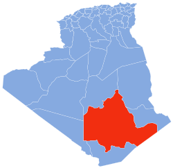 | |||||
|---|---|---|---|---|---|---|
| In Salah District | ||||||
| Tazrouk District | ||||||
| Abalessa District |
| |||||
| In Ghar District |
| |||||
| Tin Zaouatine District | ||||||
| In Guezzam District | ||||||
На других языках
[de] In Ekker
In Ekker (arabisch عين أكر) (weitere Schreibweisen: In Ecker oder In Eker) ist ein algerischer Ort am westlichen Rand des Hoggar-Gebirges in der Sahara, etwa 150 km nord-nord-westlich von Tamanrasset.[1] Der Ort liegt direkt an der Nationalstraße 1 bzw. dem Algier-Lagos-Highway.- [en] In Eker
Другой контент может иметь иную лицензию. Перед использованием материалов сайта WikiSort.org внимательно изучите правила лицензирования конкретных элементов наполнения сайта.
WikiSort.org - проект по пересортировке и дополнению контента Википедии