world.wikisort.org - Algeria
Amguid is a village in the commune of Idlès,[1] in Tazrouk District, Tamanrasset Province, Algeria. It is located in the remote north-eastern part of the province, about 400 kilometres (250 mi) north of Tamanrasset and 310 kilometres (190 mi) west of Illizi.[2][3]
Amguid | |
|---|---|
Village | |
 Amguid | |
| Coordinates: 26°25′17″N 5°21′47″E | |
| Country | |
| Province | Tamanrasset Province |
| District | Tazrouk District |
| Commune | Idlès[1] |
| Elevation | 609 m (1,998 ft) |
| Time zone | UTC+1 (CET) |
Climate
Amguid has a hot desert climate (Köppen climate classification BWh), with very hot summers and mild winters, and very little precipitation throughout the year.
| Climate data for Amguid | |||||||||||||
|---|---|---|---|---|---|---|---|---|---|---|---|---|---|
| Month | Jan | Feb | Mar | Apr | May | Jun | Jul | Aug | Sep | Oct | Nov | Dec | Year |
| Average high °C (°F) | 20.1 (68.2) |
23.4 (74.1) |
27.4 (81.3) |
32.2 (90.0) |
36.1 (97.0) |
40.8 (105.4) |
42.2 (108.0) |
41.1 (106.0) |
38.5 (101.3) |
33.3 (91.9) |
27.0 (80.6) |
21.8 (71.2) |
32.0 (89.6) |
| Daily mean °C (°F) | 12.3 (54.1) |
15.3 (59.5) |
19.2 (66.6) |
23.9 (75.0) |
28.2 (82.8) |
33.0 (91.4) |
34.2 (93.6) |
33.3 (91.9) |
30.9 (87.6) |
25.5 (77.9) |
19.1 (66.4) |
14.0 (57.2) |
24.1 (75.3) |
| Average low °C (°F) | 4.6 (40.3) |
7.2 (45.0) |
11.0 (51.8) |
15.7 (60.3) |
20.4 (68.7) |
25.3 (77.5) |
26.2 (79.2) |
25.6 (78.1) |
23.3 (73.9) |
17.8 (64.0) |
11.3 (52.3) |
6.3 (43.3) |
16.2 (61.2) |
| Average precipitation mm (inches) | 3 (0.1) |
1 (0.0) |
2 (0.1) |
2 (0.1) |
1 (0.0) |
1 (0.0) |
0 (0) |
1 (0.0) |
1 (0.0) |
1 (0.0) |
2 (0.1) |
4 (0.2) |
19 (0.6) |
| Source: climate-data.org[4] | |||||||||||||
References
- "Décret n° 84-365, fixant la composition, la consistance et les limites territoriale des communes. Wilaya d'El Oued" (PDF) (in French). Journal officiel de la République Algérienne. 19 December 1984. p. 1496. Archived from the original (PDF) on 5 May 2015. Retrieved 6 June 2013.
- "Amguid, Algeria". Geonames.org. Retrieved 25 June 2013.
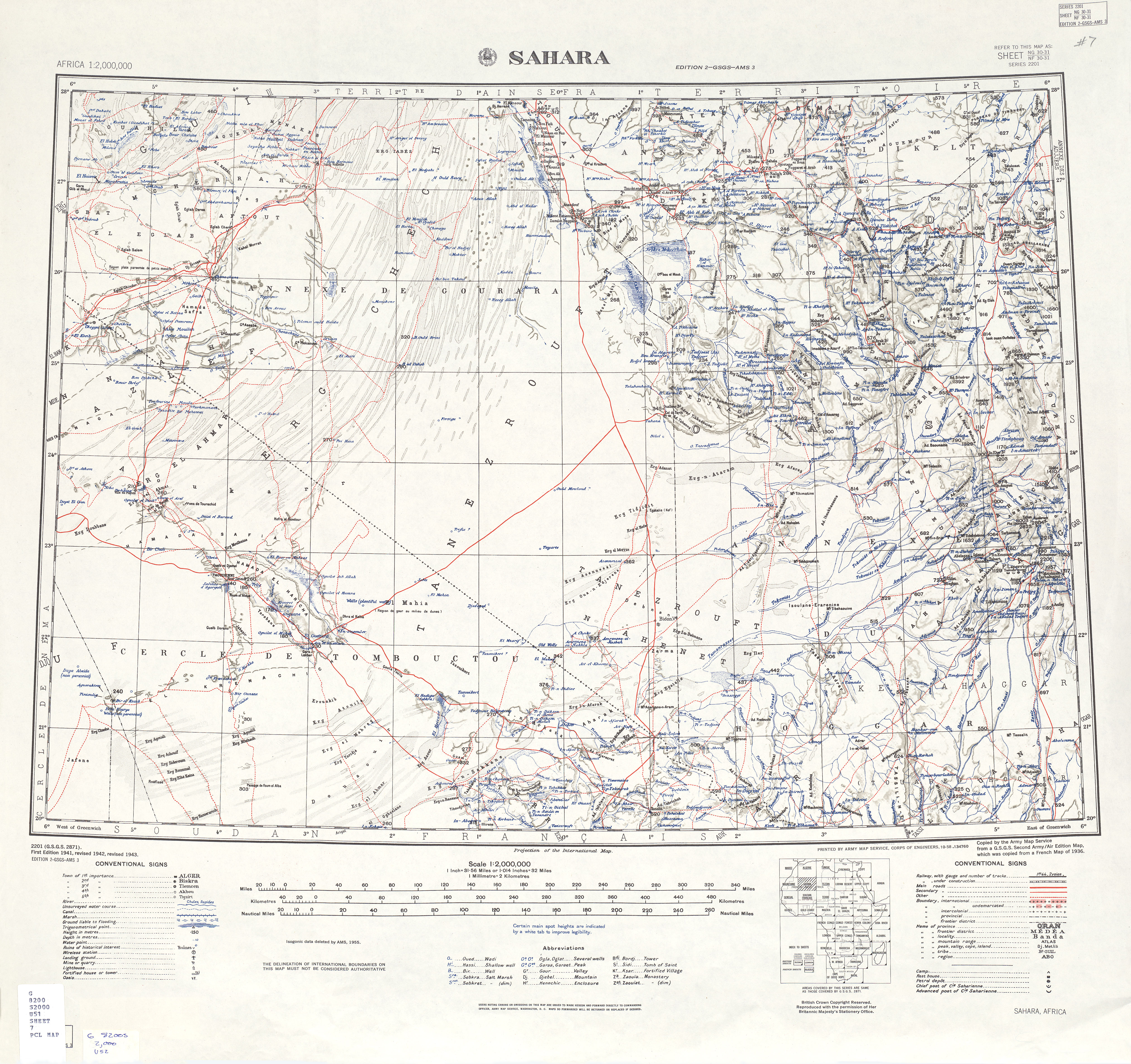
- "U.S. Army Map Service: Sahara". University of Texas Libraries. Retrieved 25 June 2013.
- "Climate data for: Amguid". climate-data.org. Retrieved 25 June 2013.
Neighbouring towns and cities
Places adjacent to Amguid | ||||||||||||||||
|---|---|---|---|---|---|---|---|---|---|---|---|---|---|---|---|---|
| ||||||||||||||||
| Tamanrasset District | 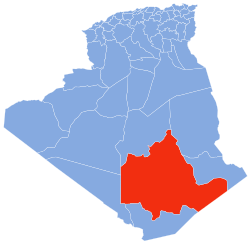 | |||||
|---|---|---|---|---|---|---|
| In Salah District | ||||||
| Tazrouk District | ||||||
| Abalessa District |
| |||||
| In Ghar District |
| |||||
| Tin Zaouatine District | ||||||
| In Guezzam District | ||||||
Текст в блоке "Читать" взят с сайта "Википедия" и доступен по лицензии Creative Commons Attribution-ShareAlike; в отдельных случаях могут действовать дополнительные условия.
Другой контент может иметь иную лицензию. Перед использованием материалов сайта WikiSort.org внимательно изучите правила лицензирования конкретных элементов наполнения сайта.
Другой контент может иметь иную лицензию. Перед использованием материалов сайта WikiSort.org внимательно изучите правила лицензирования конкретных элементов наполнения сайта.
2019-2026
WikiSort.org - проект по пересортировке и дополнению контента Википедии
WikiSort.org - проект по пересортировке и дополнению контента Википедии