world.wikisort.org - Afghanistan
Nili (Dari: نیلی) is the capital city of Nili District in Daykundi Province of Afghanistan. The town of Nili is at 2,022 m altitude. The Nili Airport is located next to the town. The weather conditions in the winter are severe and the roads are difficult.
Nili
نیلی | |
|---|---|
City | |
 A distant view of Nili in 2011 | |
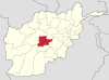
 Nili The location of Nili within Afghanistan | |
| Coordinates: 33°43′N 66°7′E | |
| Country | |
| Province | Daykundi |
| District | Nili |
| Elevation | 2,022 m (6,634 ft) |
| Population (2015) | |
| • Total | 17,946 [1] |
| Time zone | UTC+4:30 (Afghanistan Standard Time) |
Due to Nili's geographical inaccessibility and acute security problems, it was not until April 2007 that the United Nations opened an office in Nili of UNAMA (United Nations Assistance Mission in Afghanistan). The town lies almost in the geographical center of the country and the Hazarajat region. The entire population of the district and the town consists of the Hazara ethnic group.
In December 2008, Ms. Azra Jafari was named by President Hamid Karzai to be the mayor of Nili, thus becoming Afghanistan's first female mayor.
The city of Nili has a population of 17,946 (2015 estimate),[1] and has a total land area of 9,022 hectares.[1] There are 1,994 total number of dwellings in Nili city.[1]
Nili is an urban village in central Afghanistan in which the majority of the land (98%) is not built-up.[1] Barren land is the largest land use and accounts for 79% of total land area.[1] There are only 239 hectares of built-up land use, of which 35% is residential and 40% is vacant plots.[1]
On 14 August 2021, Nili was seized by Taliban fighters, becoming the twenty-fourth provincial capital to be captured by the Taliban as part of the wider 2021 Taliban offensive.[2]
Climate
Nili has a hot-summer humid continental climate (Dsa) in the Köppen climate classification, with dry summers and cold, snowy winters. Precipitation mostly falls in spring and winter.
| Climate data for Nili, Daykundi Province | |||||||||||||
|---|---|---|---|---|---|---|---|---|---|---|---|---|---|
| Month | Jan | Feb | Mar | Apr | May | Jun | Jul | Aug | Sep | Oct | Nov | Dec | Year |
| Average high °C (°F) | −1.7 (28.9) |
0.0 (32.0) |
6.1 (43.0) |
15.6 (60.1) |
21.7 (71.1) |
27.8 (82.0) |
31.1 (88.0) |
30.0 (86.0) |
26.1 (79.0) |
18.9 (66.0) |
9.4 (48.9) |
3.3 (37.9) |
15.7 (60.2) |
| Daily mean °C (°F) | −6.9 (19.6) |
−4.7 (23.5) |
1.4 (34.5) |
9.8 (49.6) |
15.6 (60.1) |
21.4 (70.5) |
24.7 (76.5) |
23.4 (74.1) |
19.2 (66.6) |
12.5 (54.5) |
3.9 (39.0) |
−2.5 (27.5) |
9.8 (49.7) |
| Average low °C (°F) | −12.2 (10.0) |
−9.4 (15.1) |
−3.3 (26.1) |
3.9 (39.0) |
9.4 (48.9) |
15.0 (59.0) |
18.3 (64.9) |
16.7 (62.1) |
12.2 (54.0) |
6.1 (43.0) |
−1.7 (28.9) |
−8.3 (17.1) |
3.9 (39.0) |
| Average precipitation mm (inches) | 62 (2.4) |
105 (4.1) |
102 (4.0) |
72 (2.8) |
37 (1.5) |
1 (0.0) |
1 (0.0) |
0 (0) |
0 (0) |
2 (0.1) |
46 (1.8) |
25 (1.0) |
453 (17.7) |
| Source: Nomadseason[3] | |||||||||||||
See also
References
- "The State of Afghan Cities Report 2015". Archived from the original on 31 October 2015. Retrieved 21 October 2015.
- "Afghan lawmaker says central province of Daykundi surrendered to Taliban, with only two gunshots heard in capital, Nili". Star Tribune. Retrieved 2021-08-14.
- "Monthly climate in Nili, Afghanistan". Retrieved 18 September 2022.
External links
- The Secret Behind Nili Market's Success in Daikundi on YouTube, February 5, 2017, United Nations Development Programme (UNDP).
Capital: Nili | ||
| Districts |
|  |
| Landforms | ||
| Other |
| |
На других языках
[de] Nili (Stadt)
Nili (Dari: نیلی) ist die Hauptstadt des Distrikts Nili und der Provinz Daikondi in Afghanistan. Die Stadt Nili liegt auf 2022 m Höhe. Der Flugplatz von Nili befindet sich in unmittelbarer Nähe der Stadt. Die Wetterbedingungen im Winter sind sehr streng und die Stadt ist dann über Straßen schwierig zu erreichen.- [en] Nili, Afghanistan
Другой контент может иметь иную лицензию. Перед использованием материалов сайта WikiSort.org внимательно изучите правила лицензирования конкретных элементов наполнения сайта.
WikiSort.org - проект по пересортировке и дополнению контента Википедии