world.wikisort.org - Afghanistan
Chishti Sharif District, also known as Chisht District, is the most easterly district in Herat Province, Afghanistan, situated along the Hari River and one of its northern tributaries. It borders with Obe District to the west, Badghis Province to the north and Ghor Province to the east and south. The population was estimated at 23,100 in 2012.[1] The district administrative center is the village of Chishti Sharif.
Chishti Sharif
چشت شریف | |
|---|---|
District | |
 Mosque of Chishti Sharif | |
 Chishti Sharif Location within Afghanistan | |
| Coordinates: 34°21′12″N 63°44′28″E | |
| Country | |
| Province | Herat Province |
| Population (2012)[1] | |
| • Total | 23,100 |
Infrastructure
The district contains 170 km of gravel roads.[2]
See also
- Districts of Afghanistan
References
- "Settled Population of Herat Province" (PDF). Central Statistics Organization. Retrieved 31 December 2015.
- "Herat Provincial Profile" (PDF). Ministry of Rural Rehabilitation and Development. Retrieved 31 December 2015.
External links
- Map of Settlements IMMAP, September 2011
Herat Province | ||
|---|---|---|
Capital: Herat | ||
| Districts | 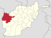 | |
| Populated places |
| |
| Landmarks |
| |
This Herat Province, Afghanistan location article is a stub. You can help Wikipedia by expanding it. |
Текст в блоке "Читать" взят с сайта "Википедия" и доступен по лицензии Creative Commons Attribution-ShareAlike; в отдельных случаях могут действовать дополнительные условия.
Другой контент может иметь иную лицензию. Перед использованием материалов сайта WikiSort.org внимательно изучите правила лицензирования конкретных элементов наполнения сайта.
Другой контент может иметь иную лицензию. Перед использованием материалов сайта WikiSort.org внимательно изучите правила лицензирования конкретных элементов наполнения сайта.
2019-2025
WikiSort.org - проект по пересортировке и дополнению контента Википедии
WikiSort.org - проект по пересортировке и дополнению контента Википедии