world.wikisort.org - Vereinigte_Staaten
Gonzales ist eine US-amerikanische Stadt im Monterey County im Bundesstaat Kalifornien.
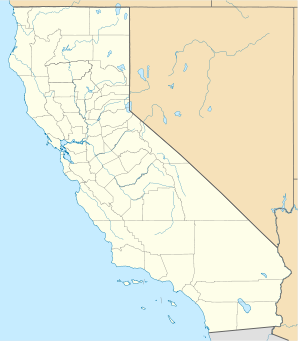
| Gonzales | |||
|---|---|---|---|
Lage in Kalifornien | |||
| Basisdaten | |||
| Gründung: | 14. Januar 1947 | ||
| Staat: | Vereinigte Staaten | ||
| Bundesstaat: | Kalifornien | ||
| County: | Monterey County | ||
| Koordinaten: | 36° 31′ N, 121° 27′ W | ||
| Zeitzone: | Pacific (UTC−8/−7) | ||
| Einwohner: | 8.647 (Stand: 2020) | ||
| Haushalte: | 2.166 (Stand: 2020) | ||
| Fläche: | 3,7 km² (ca. 1 mi²) davon 3,6 km² (ca. 1 mi²) Land | ||
| Bevölkerungsdichte: | 2.402 Einwohner je km² | ||
| Höhe: | 41 m | ||
| Postleitzahl: | 93926 | ||
| Vorwahl: | +1 831 | ||
| FIPS: | 06-30392 | ||
| GNIS-ID: | 1659726 | ||
| Website: | gonzalesca.gov | ||
Sie hat etwa 8700 Einwohner (Stand: 2004) und befindet sich bei den geographischen Koordinaten 36,51° Nord, 121,44° West. Das Stadtgebiet hat eine Größe von 3,7 km².
Weblinks
| Cities |
Carmel-by-the-Sea • Del Rey Oaks • Gonzales • Greenfield • King City • Marina • Monterey • Pacific Grove • Salinas • Sand City • Seaside • Soledad |
|
| CDPs |
Aromas • Boronda • Bradley • Carmel Valley Village • Castroville • Chualar • Del Monte Forest • Elkhorn • Fort Hunter Liggett • Las Lomas • Lockwood • Moss Landing • Pajaro • Pine Canyon • Prunedale • San Ardo • San Lucas • Spreckels | |
| Unincorporated Communities |
Ambler Park • Big Sur • Blanco • Bolsa Knolls • Camphora • Carmel Highlands • Carmel Woods • Cooper • Corral de Tierra • Dean • East Garrison • Fort Romie • Gabilan Acres • Gorda • Jamesburg • Jolon • Lonoak • Lucia • Metz • Moss • Nacimiento • Natividad • Oak Hills • Old Hilltown • Palo Colorado Canyon • Parkfield • Pebble Beach • Plaskett • Pleyto • Posts • Robles del Rio • San Benancio • Santa Lucia Preserve • Slates Hot Springs • Springtown • Tassajara Hot Springs • Valleton |

На других языках
- [de] Gonzales (Kalifornien)
[en] Gonzales, California
Gonzales is a city in Monterey County, California, United States. Gonzales is located 16 miles (26 km) southeast of Salinas,[8] at an elevation of 135 feet (41 m).[5] The population was 8,187 at the 2010 census, up from 7,525 at the 2000 census. Gonzales is a member of the Association of Monterey Bay Area Governments. Gonzales won the Culture of Health Prize from the Robert Wood Johnson Foundation in 2019.[9]Другой контент может иметь иную лицензию. Перед использованием материалов сайта WikiSort.org внимательно изучите правила лицензирования конкретных элементов наполнения сайта.
WikiSort.org - проект по пересортировке и дополнению контента Википедии