world.wikisort.org - India
Poonch or Punch (Prūntčh In Kashmiri) is a district in the Jammu Division of Jammu and Kashmir, India. With headquarters in the town of Poonch, it is bounded by the Line of Control (boundary between Indian and Pakistan administered Kashmir) on three sides (north, west and south). The 1947-48 war between India and Pakistan divided the earlier district into two parts. One went to Pakistan and the other became part of the then Indian state of Jammu and Kashmir.
Poonch district | |
|---|---|
District of Jammu and Kashmir | |
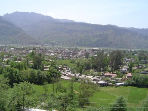
 View of Mandi Town in Poonch | |
 Poonch district in Jammu and Kashmir | |
| Country | |
| Union Territory | |
| Division | Jammu |
| Capital | Poonch |
| Headquarters | Poonch |
| Tehsils[1] | 1. Balakote, 2. Haveli, 3. Mandi, 4. Mankote, 5. Mendhar, 6. Surankote |
| Government | |
| • Lok Sabha Constituency | Jammu |
| • MP | Jugal Kishore Sharma, BJP[2] |
| • Vidhan Sabha constituencies | 3 constituences |
| • District Magistrate | Sh. Inder Jeet, JKAS |
| Area | |
| • Total | 1,674 km2 (646 sq mi) |
| Elevation | 1,000 m (3,300 ft) |
| Population (2011) | |
| • Total | 476,835 |
| • Density | 280/km2 (740/sq mi) |
| • Urban | 8.1% |
| Demographics | |
| • Literacy[4] | 66.74% |
| • Sex ratio[4] | 893 ♀/ 1000 ♂ |
| Languages | |
| • Official | Dogri, English, Hindi, Kashmiri, Urdu |
| • Spoken | Gojri, Pahari, Hindi, English, Punjabi |
| Time zone | UTC+05:30 (IST) |
| Vehicle registration | JK-12 |
| Major highways | |
| Website | poonch |
Geography
Poonch district has a total area of 1,674 square kilometres (646 sq mi). The district is bordered by Kulgam district, Shopian district and Budgam district in the east, Rajouri district to the south and Baramulla district and Haveli district, Pakistan administered Jammu and Kashmir to the north and Poonch district, Pakistani administered Kashmir to the west.
Administration
The district headquarters is in the Poonch city. Mr Inder Jeet is the current District Magistrate. Presently, district Poonch in Jammu and Kashmir is divided into six tehsils:
- Haveli Tehsil
- Mandi Tehsil
- Mendhar Tehsil
- Surankote Tehsil
- Mankote Tehsil
- Balakote Tehsil
Each tehsil has its Tehsildar, who is the administrative head. The district is further divided into eleven. blocks: Poonch, Mandi, Loran Sathra Mendhar, Mankote Balakote, Surankote and Buffliaz.[7] The administrative head of each block is the Block Development Officer (BDO). Each block consists of a number of panchayats. Recently added One Sub Division(Surnkote), other is Mendhar. Poonch district has a total of 179 villages.
Economy
In 2006 the Ministry of Panchayati Raj named Poonch one of the country's 250 most backward districts (out of a total of 640).[8] It is one of the three districts in Jammu and Kashmir currently receiving funds from the Backward Regions Grant Fund Programme (BRGF).[8]
Politics
Poonch district has 3 assembly constituencies: Surankote, Mendhar and Poonch Haveli. On 19 November 2018, the assembly was dissolved by Governor Satya Pal Malik. The former MLA of Poonch Haveli is Shah Mohammed Tantray of JKPDP, Mohammed Akram of Indian National Congress represented the Surankote constituency and Mendhar was represented by Javid Rana of Jammu & Kashmir National Conference. Poonch district comes in Jammu-Poonch Lok Sabha constituency. The present MP of Jammu–Poonch constituency is Jugal Kishore Sharma of the BJP.[2][9]
Demographics
| Year | Pop. | ±% |
|---|---|---|
| 1901 | 102,011 | — |
| 1911 | 112,009 | +9.8% |
| 1921 | 117,759 | +5.1% |
| 1931 | 127,477 | +8.3% |
| 1941 | 140,446 | +10.2% |
| 1951 | 147,489 | +5.0% |
| 1961 | 154,532 | +4.8% |
| 1971 | 170,787 | +10.5% |
| 1981 | 224,197 | +31.3% |
| 1991 | 290,727 | +29.7% |
| 2001 | 372,613 | +28.2% |
| 2011 | 476,835 | +28.0% |
| † 1951 and 1991 populations are estimated Source: Census of India[10] | ||
According to the 2011 census Poonch district, India has a population of 476,835,[11] roughly equal to the nation of Suriname.[13] This gives it a ranking of 548th in India (out of a total of 640). The district has a population density of 285 inhabitants per square kilometre (740/sq mi). Its population growth rate over the decade 2001-2011 was 27.97%. Poonch has a sex ratio of 893 females for every 1000 males (which varies with religion),[11] and a literacy rate of 68.69%. The district is 90.45% Muslim.[11]
Religion
As of 2011[update], the proportions of different religions in the district were as follows: Islam (90.45%), Hinduism (6.84%), Sikhism (2.35%), Christianity (0.20%), not stated (0.15%), and others (0.02%).[11]
Only 8.1% of the district's population lived in urban areas. The proportions of religions in urban areas differed from the district as a whole, being: Islam (51.38%), Hinduism (32.82%), Sikhism (14.62%), Christianity (0.96%), not stated (0.20%), and others (0.03%).[11]
| Poonch district: religion, gender ratio, and % urban of population, according to the 2011 Census.[11] | |||||||||
|---|---|---|---|---|---|---|---|---|---|
| Hindu | Muslim | Christian | Sikh | Buddhist | Jain | Other | Not stated | Total | |
| Total | 32,604 | 431,279 | 958 | 11,188 | 83 | 10 | 2 | 711 | 476,835 |
| 6.84% | 90.45% | 0.20% | 2.35% | 0.02% | 0.00% | 0.00% | 0.15% | 100.00% | |
| Male | 23,684 | 220,636 | 614 | 6,497 | 76 | 5 | 1 | 386 | 251,899 |
| Female | 8,920 | 210,643 | 344 | 4,691 | 7 | 5 | 1 | 325 | 224,936 |
| Gender ratio (% female) | 27.4% | 48.8% | 35.9% | 41.9% | 8.4% | 50.0% | 50.0% | 45.7% | 47.2% |
| Sex ratio (no. of females per 1,000 males) |
377 | 955 | 560 | 722 | – | – | – | 842 | 893 |
| Urban | 12,677 | 19,848 | 371 | 5,647 | 8 | 3 | 0 | 76 | 38,630 |
| Rural | 19,927 | 411,431 | 587 | 5,541 | 75 | 7 | 2 | 635 | 438,205 |
| % Urban | 38.9% | 4.6% | 38.7% | 50.5% | 9.6% | 30.0% | 0.0% | 10.7% | 8.1% |
Resident ethnicities include Gujjars, Bakerwals, Jatts , Mughals, Syed, Punjabis, Pahari Speaking People, Kashmiris and Rajputs. mostly reside on the slopes of mountains. The inhabitants typically cultivate small plots of land, and own some cattle. Gujjars and Bakerwals (nomadic tribes) speak Gojri, apart from Kashmiris the rest of the population speak Pahari-Pothwari, Poonchi, Kaghani besides Punjabi and only a minuscule population may be speaking Dogri.[14][15]
Transportation
Air
The Poonch Airport is a non-operational airstrip located in Poonch which is mainly used by the Indian Army. The nearest airport is Sheikh ul-Alam International Airport in Srinagar which is located around 180 kilometres from Poonch town.
Rail
There is no railway connectivity to Poonch yet. There are plans to build the Jammu–Poonch line in the near future to connect Poonch with Jammu.[16] The nearest major railway station is Jammu Tawi railway station which is located 235 kilometres from district headquarters Poonch.
Road
Poonch district is connected to the summer capital Jammu by the NH 144A alongside other intra-district roads. It also has road connectivity with Srinagar through the picturesque Mughal Road. There are plans to upgrade the existing NH 144A to four-lane for faster movement of traffic.[17] A bus across the LOC, the Poonch–Rawalakot bus has helped to re-establish ties across the border.
Gallery


See also
- 1947 Poonch Rebellion
- 1963 Poonch Indian Air Force helicopter crash
- Poonchi (disambiguation)
- Moghul road
- Pir Panjal
- Poonch Division (Pakistan)
References
- "Administrative Setup Tehsil wise District Poonch | District Poonch, Government of Jammu and Kashmir | India".
- "Lok Sabha Members". Lok Sabha. Retrieved 13 July 2021.
- "Agriculture", District Administration, Poonch, Jammu and Kashmir. Developed and hosted by National Informatics Centre, Ministry of Electronics & Information Technology, Government of India, retrieved 19 January 2021
- "Poonch Census 2011" (PDF). Govt of India Census. Retrieved 13 July 2021.
- "The Jammu and Kashmir Official Languages Act, 2020" (PDF). The Gazette of India. 27 September 2020. Retrieved 27 September 2020.
- "Parliament passes JK Official Languages Bill, 2020". Rising Kashmir. 23 September 2020. Retrieved 23 September 2020.
- Statement showing the number of blocks in respect of 22 Districts of Jammu and Kashmir State including newly Created Districts Archived 2008-09-10 at the Wayback Machine dated 2008-03-13, accessed 2008-08-30
- Ministry of Panchayati Raj (8 September 2009). "A Note on the Backward Regions Grant Fund Programme" (PDF). National Institute of Rural Development. Archived from the original (PDF) on 5 April 2012. Retrieved 27 September 2011.
- "ERO's and AERO's". Chief Electoral Officer, Jammu and Kashmir. Archived from the original on 22 October 2008. Retrieved 28 August 2008.
- "A-2 Decadal Variation In Population Since 1901". Censusindia.gov.in. Retrieved 9 August 2019.
- C-1 Population By Religious Community – Jammu & Kashmir (Report). Office of the Registrar General & Census Commissioner, India. Retrieved 28 July 2020.
- C-16 Population By Mother Tongue – Jammu & Kashmir (Report). Office of the Registrar General & Census Commissioner, India. Retrieved 18 July 2020.
- US Directorate of Intelligence. "Country Comparison:Population". Archived from the original on 13 June 2007. Retrieved 1 October 2011.
Suriname 491,989 July 2011 est.
- "Dogri". Ethnologue.
- Baba, Yasar Muhammad (2007). My land my people: Kashmir in perspective. Gulshan Books. p. 85. ISBN 9788183390705.
- "Start work on Jammu-Poonch rail link". Daily Excelsior. 12 June 2021. Retrieved 13 June 2021.
- "Akhnoor-Poonch national highway to be four-lane soon". Amar Ujala. Retrieved 2 April 2021.
External links
Capital: Srinagar (Summer); Jammu (Winter) | |||||
| History |
| ||||
| Government and politics |
| ||||
| Culture and places | |||||
| Districts and divisions |
| ||||
| Cities | |||||
| Towns |
| ||||
| Famous villages | |||||
| Regions |
| ||||
| Railways | |||||
| Roads |
| ||||
| Local elections |
| ||||
| Sports |
| ||||
| Other topics |
| ||||
Places adjacent to Poonch district, India | ||||||||||||||||
|---|---|---|---|---|---|---|---|---|---|---|---|---|---|---|---|---|
| ||||||||||||||||
Authority control | |
|---|---|
| General |
|
| National libraries | |
На других языках
[de] Punch (Distrikt, Indien)
Der Distrikt Punch (auch Poonch; Urdu ضلع پونچھ, Hindi .mw-parser-output .Deva{font-size:120%}@media all and (min-width:800px){.mw-parser-output .Deva{font-size:calc(120% - ((100vw - 800px)/80))}}@media all and (min-width:1000px){.mw-parser-output .Deva{font-size:100%}}पुंछ ज़िला) ist ein Verwaltungsdistrikt im indischen Unionsterritorium Jammu und Kashmir.- [en] Poonch district, India
[ru] Пунч (округ, Джамму и Кашмир)
Пунч (англ. Poonch; урду ضلع پونچ) — округ в индийской союзной территории Джамму и Кашмир, в регионе Кашмир. Образован в 1948 году в результате разделения единого округа Пунч между Индией и Пакистаном. Административный центр — город Пунч. Площадь округа — 1674 км². По данным всеиндийской переписи 2001 года население округа составляло 372 613 человек. Уровень грамотности взрослого населения составлял 51,2 %, что ниже среднеиндийского уровня (59,5 %). Доля городского населения составляла 6,4 %. 91,92 % населения округа исповедовали ислам.Другой контент может иметь иную лицензию. Перед использованием материалов сайта WikiSort.org внимательно изучите правила лицензирования конкретных элементов наполнения сайта.
WikiSort.org - проект по пересортировке и дополнению контента Википедии