world.wikisort.org - France
Évisa (French pronunciation: [eviza]) is a commune in the Corse-du-Sud department of France on the island of Corsica.
This article may be expanded with text translated from the corresponding article in French. (January 2009) Click [show] for important translation instructions.
|
Évisa | |
|---|---|
Commune | |
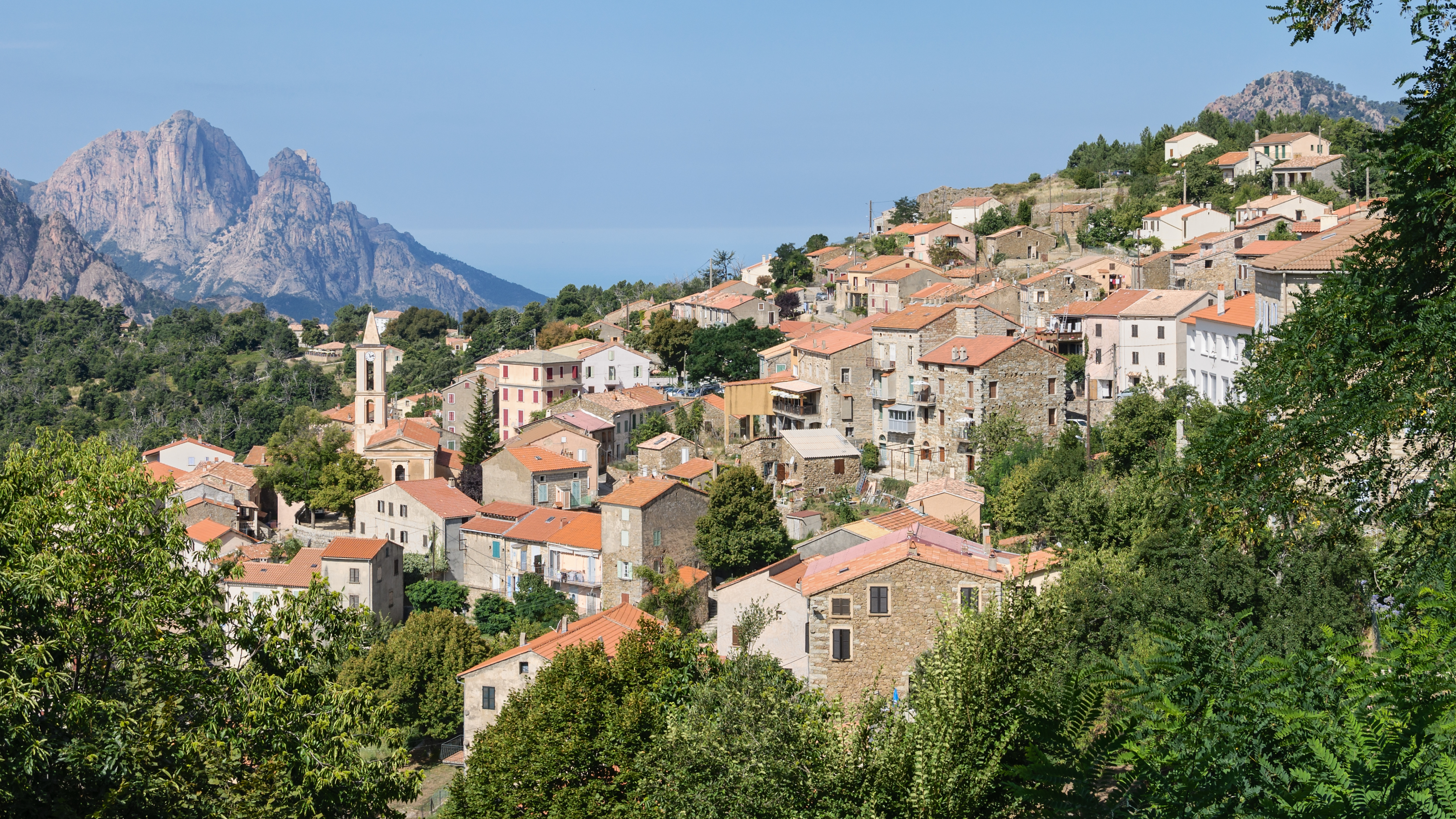 A general view of Évisa. The Capu d'Ortu e Tre Signore is in the left background | |
 Coat of arms | |
Location of Évisa  | |
 Évisa  Évisa | |
| Coordinates: 42°15′16″N 8°48′07″E | |
| Country | France |
| Region | Corsica |
| Department | Corse-du-Sud |
| Arrondissement | Ajaccio |
| Canton | Sevi-Sorru-Cinarca |
| Government | |
| • Mayor (2020–2026) | Jean Jacques Gianni[1] |
| Area 1 | 67.28 km2 (25.98 sq mi) |
| Population | 214 |
| • Density | 3.2/km2 (8.2/sq mi) |
| Time zone | UTC+01:00 (CET) |
| • Summer (DST) | UTC+02:00 (CEST) |
| INSEE/Postal code | 2A108 /20126 |
| Elevation | 239–2,103 m (784–6,900 ft) (avg. 850 m or 2,790 ft) |
| 1 French Land Register data, which excludes lakes, ponds, glaciers > 1 km2 (0.386 sq mi or 247 acres) and river estuaries. | |
Geography
Climate
Évisa has a warm-summer mediterranean climate (Köppen climate classification Csb). The average annual temperature in Évisa is 12.6 °C (54.7 °F). The average annual rainfall is 1,181.2 mm (46.50 in) with November as the wettest month. The temperatures are highest on average in July, at around 21.7 °C (71.1 °F), and lowest in January, at around 5.3 °C (41.5 °F). The highest temperature ever recorded in Évisa was 40.0 °C (104.0 °F) on 11 July 1984; the coldest temperature ever recorded was −13.0 °C (8.6 °F) on 10 February 2013.
| Climate data for Évisa (Village[3]) (1981–2010 averages, extremes 1978−2012) | |||||||||||||
|---|---|---|---|---|---|---|---|---|---|---|---|---|---|
| Month | Jan | Feb | Mar | Apr | May | Jun | Jul | Aug | Sep | Oct | Nov | Dec | Year |
| Record high °C (°F) | 21.0 (69.8) |
22.0 (71.6) |
27.0 (80.6) |
28.0 (82.4) |
32.5 (90.5) |
36.0 (96.8) |
37.0 (98.6) |
38.0 (100.4) |
33.5 (92.3) |
28.5 (83.3) |
23.0 (73.4) |
22.3 (72.1) |
38.0 (100.4) |
| Average high °C (°F) | 9.2 (48.6) |
9.8 (49.6) |
12.2 (54.0) |
14.7 (58.5) |
19.6 (67.3) |
23.5 (74.3) |
27.5 (81.5) |
27.4 (81.3) |
22.8 (73.0) |
18.4 (65.1) |
13.2 (55.8) |
10.0 (50.0) |
17.4 (63.3) |
| Daily mean °C (°F) | 5.3 (41.5) |
5.5 (41.9) |
7.7 (45.9) |
9.9 (49.8) |
14.5 (58.1) |
18.1 (64.6) |
21.7 (71.1) |
21.5 (70.7) |
17.4 (63.3) |
13.9 (57.0) |
9.2 (48.6) |
6.3 (43.3) |
12.6 (54.7) |
| Average low °C (°F) | 1.3 (34.3) |
1.3 (34.3) |
3.2 (37.8) |
5.0 (41.0) |
9.4 (48.9) |
12.8 (55.0) |
15.8 (60.4) |
15.5 (59.9) |
12.0 (53.6) |
9.5 (49.1) |
5.2 (41.4) |
2.5 (36.5) |
7.8 (46.0) |
| Record low °C (°F) | −9.6 (14.7) |
−10.0 (14.0) |
−5.0 (23.0) |
−4.0 (24.8) |
−0.1 (31.8) |
1.6 (34.9) |
7.3 (45.1) |
2.5 (36.5) |
4.0 (39.2) |
1.0 (33.8) |
−7.0 (19.4) |
−8.0 (17.6) |
−10.0 (14.0) |
| Average precipitation mm (inches) | 118.2 (4.65) |
90.4 (3.56) |
96.6 (3.80) |
119.1 (4.69) |
81.5 (3.21) |
47.2 (1.86) |
13.2 (0.52) |
27.6 (1.09) |
101.4 (3.99) |
147.8 (5.82) |
187.1 (7.37) |
151.1 (5.95) |
1,181.2 (46.50) |
| Average precipitation days (≥ 1.0 mm) | 9.3 | 8.7 | 8.6 | 10.5 | 7.4 | 4.5 | 1.7 | 3.1 | 7.0 | 9.2 | 11.2 | 10.7 | 91.9 |
| Source: Meteociel[4] | |||||||||||||
| Climate data for Évisa (Maison Forestière d'Aitone[5]) (1991–2020 averages, extremes 1974−present) | |||||||||||||
|---|---|---|---|---|---|---|---|---|---|---|---|---|---|
| Month | Jan | Feb | Mar | Apr | May | Jun | Jul | Aug | Sep | Oct | Nov | Dec | Year |
| Record high °C (°F) | 17.6 (63.7) |
21.8 (71.2) |
25.0 (77.0) |
26.4 (79.5) |
31.0 (87.8) |
35.5 (95.9) |
40.0 (104.0) |
36.5 (97.7) |
33.5 (92.3) |
27.0 (80.6) |
23.9 (75.0) |
20.0 (68.0) |
40.0 (104.0) |
| Average high °C (°F) | 7.1 (44.8) |
7.9 (46.2) |
11.0 (51.8) |
13.5 (56.3) |
17.8 (64.0) |
22.3 (72.1) |
25.8 (78.4) |
26.0 (78.8) |
20.8 (69.4) |
16.8 (62.2) |
11.2 (52.2) |
7.8 (46.0) |
15.7 (60.3) |
| Daily mean °C (°F) | 3.2 (37.8) |
3.3 (37.9) |
6.0 (42.8) |
8.5 (47.3) |
12.3 (54.1) |
16.2 (61.2) |
19.0 (66.2) |
19.3 (66.7) |
15.0 (59.0) |
11.7 (53.1) |
7.0 (44.6) |
3.9 (39.0) |
10.4 (50.7) |
| Average low °C (°F) | −0.8 (30.6) |
−1.2 (29.8) |
1.0 (33.8) |
3.4 (38.1) |
6.8 (44.2) |
10.1 (50.2) |
12.2 (54.0) |
12.6 (54.7) |
9.2 (48.6) |
6.6 (43.9) |
2.9 (37.2) |
0.1 (32.2) |
5.2 (41.4) |
| Record low °C (°F) | −11.6 (11.1) |
−13.0 (8.6) |
−11.4 (11.5) |
−6.2 (20.8) |
−2.0 (28.4) |
1.0 (33.8) |
3.5 (38.3) |
4.5 (40.1) |
2.0 (35.6) |
−4.0 (24.8) |
−8.0 (17.6) |
−9.9 (14.2) |
−13.0 (8.6) |
| Average precipitation mm (inches) | 152.3 (6.00) |
130.3 (5.13) |
129.0 (5.08) |
130.5 (5.14) |
96.1 (3.78) |
59.3 (2.33) |
25.3 (1.00) |
36.6 (1.44) |
124.0 (4.88) |
179.2 (7.06) |
252.2 (9.93) |
209.9 (8.26) |
1,524.7 (60.03) |
| Average precipitation days (≥ 1.0 mm) | 11.0 | 9.8 | 9.4 | 10.5 | 7.8 | 5.4 | 2.7 | 3.3 | 7.2 | 10.1 | 12.5 | 12.5 | 102.1 |
| Source: Météo-France[6] | |||||||||||||
Population
| Year | Pop. | ±% |
|---|---|---|
| 1962 | 401 | — |
| 1968 | 336 | −16.2% |
| 1975 | 312 | −7.1% |
| 1982 | 248 | −20.5% |
| 1990 | 257 | +3.6% |
| 1999 | 196 | −23.7% |
| 2008 | 182 | −7.1% |
See also
References
- "Répertoire national des élus: les maires". data.gouv.fr, Plateforme ouverte des données publiques françaises (in French). 2 December 2020.
- "Populations légales 2019". The National Institute of Statistics and Economic Studies. 29 December 2021.
- Meteo France weather station
- "Normales et records pour Evisa-Village (2A)". Meteociel. Retrieved 11 June 2022.
- Meteo France weather station
- "Fiche Climatologique Statistiques 1991-2020 et records" (PDF) (in French). Météo-France. Retrieved September 8, 2022.
Wikimedia Commons has media related to Évisa.
Authority control | |
|---|---|
| General |
|
| National libraries | |
| Other |
|
This Corse-du-Sud geographical article is a stub. You can help Wikipedia by expanding it. |
На других языках
[de] Évisa
Évisa (korsisch Èvisa) ist eine Gemeinde im französischen Département Corse-du-Sud auf der Mittelmeerinsel Korsika. Sie gehört zum Kanton Sevi-Sorru-Cinarca im Arrondissement Ajaccio. Die Bewohner nennen sich Avisiens, auf korsisch Visinchi.- [en] Évisa
[es] Évisa
Evisa es una comuna francesa del departamento de Córcega del Sur, en la colectividad territorial de Córcega.[ru] Эвиза
Эвиза (фр. Évisa, корс. Evisa) — коммуна во Франции, находится в регионе Корсика. Департамент коммуны — Южная Корсика. Входит в состав кантона Севи-Сорру-Чинарка. Округ коммуны — Аяччо.Текст в блоке "Читать" взят с сайта "Википедия" и доступен по лицензии Creative Commons Attribution-ShareAlike; в отдельных случаях могут действовать дополнительные условия.
Другой контент может иметь иную лицензию. Перед использованием материалов сайта WikiSort.org внимательно изучите правила лицензирования конкретных элементов наполнения сайта.
Другой контент может иметь иную лицензию. Перед использованием материалов сайта WikiSort.org внимательно изучите правила лицензирования конкретных элементов наполнения сайта.
2019-2025
WikiSort.org - проект по пересортировке и дополнению контента Википедии
WikiSort.org - проект по пересортировке и дополнению контента Википедии