world.wikisort.org - Brazil
Cerro Corá is a municipality (município) in the Brazilian state of Rio Grande do Norte. As of 2020 IBGE, it reported an estimated population of 11,181 inhabitants. The municipality covers a total area of 394 km².
Cerro Corá | |
|---|---|
Municipality | |
 Flag | |
 Location in Rio Grande do Norte state | |
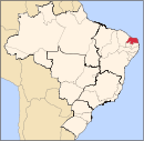
 Cerro Corá Location in Brazil | |
| Coordinates: 6°02′45″S 36°20′45″W | |
| Country | Brazil |
| Region | Northeast |
| State | Rio Grande do Norte |
| Area | |
| • Total | 394 km2 (152 sq mi) |
| Population (2020 [1]) | |
| • Total | 11,181 |
| • Density | 28/km2 (73/sq mi) |
| Time zone | UTC-03:00 (BRT) |
References
This article needs additional citations for verification. (January 2021) |
This Rio Grande do Norte, Brazil location article is a stub. You can help Wikipedia by expanding it. |
На других языках
- [en] Cerro Corá, Rio Grande do Norte
[ru] Серру-Кора (Риу-Гранди-ду-Норти)
Серру-Кора (порт. Cerro Corá) — муниципалитет в Бразилии, входит в штат Риу-Гранди-ду-Норти. Составная часть мезорегиона Центр штата Риу-Гранди-ду-Норти. Входит в экономико-статистический микрорегион Серра-ди-Сантана.Текст в блоке "Читать" взят с сайта "Википедия" и доступен по лицензии Creative Commons Attribution-ShareAlike; в отдельных случаях могут действовать дополнительные условия.
Другой контент может иметь иную лицензию. Перед использованием материалов сайта WikiSort.org внимательно изучите правила лицензирования конкретных элементов наполнения сайта.
Другой контент может иметь иную лицензию. Перед использованием материалов сайта WikiSort.org внимательно изучите правила лицензирования конкретных элементов наполнения сайта.
2019-2025
WikiSort.org - проект по пересортировке и дополнению контента Википедии
WikiSort.org - проект по пересортировке и дополнению контента Википедии