world.wikisort.org - Brazil
Pau dos Ferros is a municipality in the homonymous microregion, in Rio Grande do Norte state, Northeast Brazil.[4]
Pau dos Ferros | |
|---|---|
The Municipality of Pau dos Ferros | |
 Clockwise: Independence Avenue; Church of Nossa Senhora da Conceição; Tourist Terminal Lindalva Torquato; panoramic view of the Pau dos Ferros; Joaquim Correia House of Popular Culture and Monsignor Caminha Square, with the Obelisk at found. | |
 Flag  Seal | |
| Nickname(s): Princesinha do Oeste (Princess of the West) and PDF | |
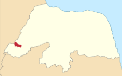 Location in the state of Rio Grande do Norte. | |
 Pau dos Ferros Location in Brazil | |
| Coordinates: 06°06′39″S 38°12′32″W | |
| Country | |
| Region | Nordeste |
| State | Rio Grande do Norte |
| Mesoregion | Oeste Potiguar |
| Microregion | Pau dos Ferros |
| Area | |
| • Total | 259.959 km2 (100.371 sq mi) |
| [1] | |
| Elevation | 193 m (633 ft) |
| Population (2020 [3]) | |
| • Total | 30,600 |
| • Density | 106.73/km2 (276.4/sq mi) |
| Demonym | Pauferrense |
| Time zone | UTC−3 (BRT) |
| Postal Code | 59900-000 |
| Area code | (+55) 84 |
| Website | www.paudosferros.rn.gov.br |
History
The city was founded on September 4, 1856, initially as a village and then the town today is a city that has as its main form of economy the industrial sector and to a lesser extent agriculture.[5]
See also
- List of municipalities in Rio Grande do Norte
References
- "Área Territorial Brasileira - Consulta por Município" (in Portuguese). Brazilian Institute of Geography and Statistics. January 15, 2013. Archived from the original on June 3, 2015. Retrieved August 17, 2015.
- "Latitude e Longitude das cidades Brasileiras" (in Portuguese). Archived from the original on August 18, 2015. Retrieved February 3, 2017.
- IBGE 2020
- "Divisão Territorial do Brasil" (in Portuguese). Divisão Territorial do Brasil e Limites Territoriais, Instituto Brasileiro de Geografia e Estatística (IBGE). July 1, 2008. Retrieved December 17, 2009.
- Pau dos Ferros History in Portuguese
Authority control | |
|---|---|
| General |
|
| National libraries | |
This Rio Grande do Norte, Brazil location article is a stub. You can help Wikipedia by expanding it. |
На других языках
- [en] Pau dos Ferros
[ru] Пау-дус-Феррус
Пау-дус-Феррус (порт. Pau dos Ferros) — муниципалитет в Бразилии, входит в штат Риу-Гранди-ду-Норти. Составная часть мезорегиона Запад штата Риу-Гранди-ду-Норти. Входит в экономико-статистический микрорегион Пау-дус-Феррус. Население составляет 27 663 человека на 2006 год. Занимает площадь 259,960 км². Плотность населения — 106,4 чел./км².Текст в блоке "Читать" взят с сайта "Википедия" и доступен по лицензии Creative Commons Attribution-ShareAlike; в отдельных случаях могут действовать дополнительные условия.
Другой контент может иметь иную лицензию. Перед использованием материалов сайта WikiSort.org внимательно изучите правила лицензирования конкретных элементов наполнения сайта.
Другой контент может иметь иную лицензию. Перед использованием материалов сайта WikiSort.org внимательно изучите правила лицензирования конкретных элементов наполнения сайта.
2019-2025
WikiSort.org - проект по пересортировке и дополнению контента Википедии
WikiSort.org - проект по пересортировке и дополнению контента Википедии