world.wikisort.org - USA
Zeandale is an unincorporated community in Riley County, Kansas, United States.[1] As of the 2020 census, the population of the community and nearby areas was 62.[2] It is located about 6.8 miles (10.9 km) east of Manhattan at the intersection of Tabor Valley Rd and K-18 highway (aka Zeandale Rd).
Zeandale, Kansas | |
|---|---|
Unincorporated community | |
 | |
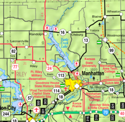 KDOT map of Riley County (legend) | |
 Zeandale  Zeandale | |
| Coordinates: 39°09′34″N 96°25′36″W[1] | |
| Country | United States |
| State | Kansas |
| Counties | Riley |
| Founded | 1855 |
| Elevation | 1,011 ft (308 m) |
| Population (2020)[2] | |
| • Total | 62 |
| Time zone | UTC-6 (CST) |
| • Summer (DST) | UTC-5 (CDT) |
| Area code | 785 |
| FIPS code | 20-80875 [1] |
| GNIS ID | 476415 [1] |
History
Zeandale was named by J.H. Pillsbury who settled the township in 1855.[3] The name is said to have been taken from the Greek, zea meaning "corn" and the English, dale.[4] Zeandale had a post office between 1857 and 1944.[5]

It is also home to Zeandale Community Church, established in 1896. The church was originally associated with the Stone-Campbell Restoration movement (Christian Church), but was re-established in the 1950s as a non-denominational community church.
The community has a rural, volunteer fire department, updated in 2002 with a new building.
Zeandale is home to two 4-H clubs and the Zeandale Community Church. The Zeandale 4-H club meets in the former Zeandale High School, turned community building, and the Pillsbury 4-H club meets in the Pillsbury School one mile south.
Zeandale almost grew by a factor of four in 2005, when a Manhattan developer cited land for sale surrounding Zeandale as prime real-estate for the growing Manhattan market. However, Riley County zoning regulations prevented the subdivision, and inevitable incorporation.
Geography
The elevation of the community is 1,011 feet (308 m) above sea level.[1]
Demographics
| Historical population | |||
|---|---|---|---|
| Census | Pop. | %± | |
| 2020 | 62 | — | |
| U.S. Decennial Census | |||
For statistical purposes, the United States Census Bureau has defined Zeandale as a census-designated place (CDP).
Zeandale is part of the Manhattan Metropolitan Statistical Area.
Education
The community is served by Wamego USD 320 public school district.
References
- "Zeandale, Kansas", Geographic Names Information System, United States Geological Survey, United States Department of the Interior
- "Profile of Zeandale, Kansas (CDP) in 2020". United States Census Bureau. Archived from the original on April 26, 2022. Retrieved April 26, 2022.
- Blackmar, Frank Wilson (1912). Kansas: A Cyclopedia of State History, Volume 2. Standard Publishing Company. p. 954.
- Kansas Place-Names, John Rydjord, University of Oklahoma Press, 1972, p. 209 ISBN 0-8061-0994-7
- "Kansas Post Offices, 1828-1961". Kansas Historical Society. Archived from the original on October 9, 2013. Retrieved 22 June 2014.
Further reading
External links
Municipalities and communities of Riley County, Kansas, United States | ||
|---|---|---|
County seat: Manhattan | ||
| Cities |  | |
| Unincorporated communities |
| |
| Footnotes | †This community is designated a Census-Designated Place (CDP) by the United States Census Bureau. ‡This community also has portions in an adjacent county or counties. | |
| ||
Другой контент может иметь иную лицензию. Перед использованием материалов сайта WikiSort.org внимательно изучите правила лицензирования конкретных элементов наполнения сайта.
WikiSort.org - проект по пересортировке и дополнению контента Википедии