world.wikisort.org - USA
Wilmington Island is a census-designated place (CDP) in Chatham County, Georgia. The population was 15,129 at the time of the 2020 U.S. Census.[1] It is part of the Savannah metropolitan area. The communities of Wilmington Island form a large and affluent suburb of Savannah, where most residents work. The island lies east of Savannah between the town of Thunderbolt and the beach community of Tybee Island.
Wilmington Island, Georgia | |
|---|---|
Census-designated place | |
 Wilmington Island as seen from Skidaway Island - Eureka Club-Farr's Point is on the right, which is on the National Register of Historic Places. | |
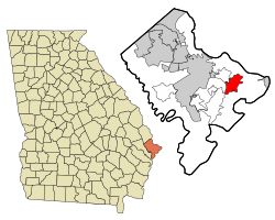 Location in Chatham County and the state of Georgia | |
| Coordinates: 32°0′12″N 80°58′31″W | |
| Country | United States |
| State | Georgia |
| County | Chatham |
| Area | |
| • Total | 9.65 sq mi (24.99 km2) |
| • Land | 8.30 sq mi (21.50 km2) |
| • Water | 1.34 sq mi (3.48 km2) |
| Elevation | 10 ft (3 m) |
| Population (2020) | |
| • Total | 15,129 |
| • Density | 1,822.33/sq mi (703.63/km2) |
| Time zone | UTC-5 (Eastern (EST)) |
| • Summer (DST) | UTC-4 (EDT) |
| ZIP code | 31410 |
| Area code | 912 |
| FIPS code | 13-83168[2] |
| GNIS feature ID | 1867248[3] |
Geography
Wilmington Island is located at 32°00′12″N 80°58′31″W.[4]
According to the United States Census Bureau, the CDP has a total area of 9.5 square miles (24.7 km2), of which 8.2 square miles (21.2 km2) is land and 1.3 square miles (3.4 km2), or 13.94%, is water.[5]
Demographics
| Historical population | |||
|---|---|---|---|
| Census | Pop. | %± | |
| 1970 | 3,284 | — | |
| 1980 | 7,546 | 129.8% | |
| 1990 | 11,230 | 48.8% | |
| 2000 | 14,213 | 26.6% | |
| 2010 | 15,138 | 6.5% | |
| 2020 | 15,129 | −0.1% | |
| U.S. Decennial Census[6] 1990 U.S. Census[7] 1980 U.S Census[8] [9] | |||
2020 census
| Race | Num. | Perc. |
|---|---|---|
| White (non-Hispanic) | 13,052 | 86.27% |
| Black or African American (non-Hispanic) | 406 | 2.68% |
| Native American | 23 | 0.15% |
| Asian | 444 | 2.93% |
| Pacific Islander | 8 | 0.05% |
| Other/Mixed | 654 | 4.32% |
| Hispanic or Latino | 542 | 3.58% |
As of the 2020 United States census, there were 15,129 people, 6,478 households, and 4,322 families residing in the CDP.
2000 census
As of the census[2] of 2000, there were 14,213 people, 5,613 households, and 4,058 families residing in the CDP. The population density was 1,682.9 people per square mile (649.4/km2). There were 5,946 housing units at an average density of 704.0 per square mile (271.7/km2). The racial makeup of the CDP was 92.26% White, 3.93% African American, 0.12% Native American, 2.51% Asian, 0.04% Pacific Islander, 0.35% from other races, and 0.79% from two or more races. Hispanic or Latino of any race were 1.32% of the population.
There were 5,613 households, out of which 35.8% had children under the age of 18 living with them, 60.6% were married couples living together, 8.7% had a female householder with no husband present, and 27.7% were non-families. 22.0% of all households were made up of individuals, and 6.0% had someone living alone who was 65 years of age or older. The average household size was 2.53 and the average family size was 2.99.
In the CDP, the population was spread out, with 25.8% under the age of 18, 6.3% from 18 to 24, 33.6% from 25 to 44, 24.8% from 45 to 64, and 9.5% who were 65 years of age or older. The median age was 37 years. For every 100 females, there were 93.9 males. For every 100 females age 18 and over, there were 91.7 males.
The median income for a household in the CDP was $58,689, and the median income for a family was $67,983. Males had a median income of $47,220 versus $31,836 for females. The per capita income for the CDP was $27,654. About 2.3% of families and 3.6% of the population were below the poverty line, including 2.5% of those under age 18 and 2.3% of those age 65 or over.
See also
References
- "2020 U.S. Gazetteer Files". United States Census Bureau. Retrieved December 18, 2021.
- "U.S. Census website". United States Census Bureau. Retrieved 2008-01-31.
- "US Board on Geographic Names". United States Geological Survey. 2007-10-25. Retrieved 2008-01-31.
- "US Gazetteer files: 2010, 2000, and 1990". United States Census Bureau. 2011-02-12. Retrieved 2011-04-23.
- "Geographic Identifiers: 2010 Demographic Profile Data (G001): Wilmington Island CDP, Georgia". U.S. Census Bureau, American Factfinder. Archived from the original on February 12, 2020. Retrieved July 24, 2014.
- "Census of Population and Housing". Census.gov. Retrieved June 4, 2016.
- "1990 Census of Population" (PDF). Census.gov. Retrieved February 15, 2022.
- "1980 Census of Population" (PDF). Census.gov. Retrieved February 17, 2022.
- https://www2.census.gov/prod2/decennial/documents/1980a_gaABC-01.pdf [bare URL PDF]
- "Explore Census Data". data.census.gov. Retrieved 2021-12-14.
Municipalities and communities of Chatham County, Georgia, United States | ||
|---|---|---|
County seat: Savannah | ||
| Cities |  | |
| Towns | ||
| CDPs | ||
| Unincorporated communities |
| |
| ||
Authority control | |
|---|---|
| General |
|
| National libraries | |
Другой контент может иметь иную лицензию. Перед использованием материалов сайта WikiSort.org внимательно изучите правила лицензирования конкретных элементов наполнения сайта.
WikiSort.org - проект по пересортировке и дополнению контента Википедии