world.wikisort.org - USA
Wheatland is a census-designated place (CDP) in Broadwater County, Montana, United States. The population was 568 according to the 2010 census.[2]
Wheatland, Montana | |
|---|---|
Census-designated place | |
 Wheatland | |
| Coordinates: 45°54′12″N 111°36′0″W | |
| Country | United States |
| State | Montana |
| County | Broadwater |
| Area | |
| • Total | 74.80 sq mi (193.72 km2) |
| • Land | 74.45 sq mi (192.83 km2) |
| • Water | 0.34 sq mi (0.89 km2) |
| Elevation | 4,175 ft (1,273 m) |
| Population (2020) | |
| • Total | 1,103 |
| • Density | 14.81/sq mi (5.72/km2) |
| Time zone | UTC-7 (Mountain (MST)) |
| • Summer (DST) | UTC-6 (MDT) |
| Area code | 406 |
| FIPS code | 30-79695 |
| GNIS feature ID | 2583865 |
Geography
Wheatland occupies a large area in the southern end of Broadwater County. U.S. Route 287 runs north-south through the CDP, intersecting Interstate 90 at Exit 274 of that highway. Montana Highway 2 leads east across the Jefferson River to the city of Three Forks in Gallatin County.
According to the United States Census Bureau, the Wheatland CDP has a total area of 76.2 square miles (197.3 km2), of which 75.6 square miles (195.9 km2) is land and 0.58 square miles (1.5 km2), or 0.74%, is water.[2]
Demographics
| Historical population | |||
|---|---|---|---|
| Census | Pop. | %± | |
| 2020 | 1,103 | — | |
| U.S. Decennial Census[3] | |||
References
- "ArcGIS REST Services Directory". United States Census Bureau. Retrieved September 5, 2022.
- "Geographic Identifiers: 2010 Demographic Profile Data (G001): Wheatland CDP, Montana". U.S. Census Bureau, American Factfinder. Archived from the original on February 12, 2020. Retrieved June 26, 2013.
- "Census of Population and Housing". Census.gov. Retrieved June 4, 2016.
Municipalities and communities of Broadwater County, Montana, United States | ||
|---|---|---|
County seat: Townsend | ||
| City | 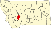 | |
| CDPs | ||
| Unincorporated community | ||
| ||
Текст в блоке "Читать" взят с сайта "Википедия" и доступен по лицензии Creative Commons Attribution-ShareAlike; в отдельных случаях могут действовать дополнительные условия.
Другой контент может иметь иную лицензию. Перед использованием материалов сайта WikiSort.org внимательно изучите правила лицензирования конкретных элементов наполнения сайта.
Другой контент может иметь иную лицензию. Перед использованием материалов сайта WikiSort.org внимательно изучите правила лицензирования конкретных элементов наполнения сайта.
2019-2025
WikiSort.org - проект по пересортировке и дополнению контента Википедии
WikiSort.org - проект по пересортировке и дополнению контента Википедии