world.wikisort.org - USA
West Weber (/ˈwiːbər/ WEE-bər) is a township and unincorporated community in western Weber County, Utah, United States.[1][2]
West Weber, Utah | |
|---|---|
Township | |
 An agricultural field in West Weber, March 2011 | |
 West Weber Location of West Weber within the State of Utah  West Weber West Weber (the United States) | |
| Coordinates: 41°14′56″N 112°04′42″W | |
| Country | United States |
| State | Utah |
| County | Weber |
| Named for | Weber River |
| Elevation | 4,239 ft (1,292 m) |
| GNIS feature ID | 1447187[1] |
Description
The community is located west and northwest of Ogden.[3] West Weber was reportedly organized as a ward in 1877, when it had a population of 700 inhabitants.[4] The community took its name from the Weber River; the name was prefixed with "West" to avoid repetition with other Webers in the territory.[5] The community is located northeast of the intersection of Utah state routes 39 and 134. The nearest major highway is the Interstate 84/Interstate 15 (Veterans Memorial Highway), which Route 39 leads to, about 3.3-mile (5.3 km) to the east.[2]
| Historical population | |||
|---|---|---|---|
| Census | Pop. | %± | |
| 1880 | 603 | — | |
| 1890 | 722 | 19.7% | |
| 1900 | 822 | 13.9% | |
| 1910 | 823 | 0.1% | |
| 1920 | 379 | −53.9% | |
| 1930 | 409 | 7.9% | |
| 1940 | 396 | −3.2% | |
| 1950 | 417 | 5.3% | |
| Source: U.S. Census Bureau[6] | |||
West Weber contains the West Weber Elementary School.[7] The Weber River flows nearby and a bridge was built in 1903 over the river.[8]
A minor accident occurred near West Weber on 17 September 1931 on the 8300 Ms. (20S) Southern Pacific, caused by an emergency airbrake application. Conductor C.A. Peterson was thrown against the cupola stand, injuring his shoulder, and brakeman P.L. Burnette was thrown to the floor.[9]
Economy
The eastern area of West Weber was known for some time as Wilson. John Staker and Ebenezer Wiggins reportedly raised a crop of grain in the area in 1853.[10] The land at West Weber was reported in 1903 to have a reputation as one of the poorest soils between Salt Lake City and Ogden.[11] However, beets are grown in the area, made possible by boring artesian wells for irrigation, aided by the presence of nitrates, as thereby valuable plant food is added to the soil.[12] Archibald McFarland had originally dug a canal in West Weber in 1859 from one of the sloughs bordering the Weber River for irrigation purposes. The earlier settlers spent about $2500 to irrigate ten small farms in the area in 1860–61.[13] In 1903, studies showed that beets having a purity average of 81.3 were raised on soil containing 1880 pounds of alkali within the surface acre-foot, and when the content of alkali was lowered to 376 pounds, the beet purity went up to 84.9.[11]
See also
![]() Utah portal
Utah portal
References
- "West Weber". Geographic Names Information System. United States Geological Survey, United States Department of the Interior.
- "West Weber". Retrieved 9 September 2021 – via Google Maps.
- The Latter-Day Saints' millennial star. P.P. Pratt. 1858. p. 469. Retrieved 31 March 2011.
- Bancroft, Hubert Howe (1889). The Works of Hubert Howe Bancroft: History of Utah. 1889. A. L. Bancroft & company. p. 307. Retrieved 31 March 2011.
- Lund, Anthon Henrik (1922). The Utah Genealogical and Historical Magazine. Geneal. Society of Utah. p. 41.
- "Census of Population and Housing". US Census Bureau. Archived from the original on 12 June 2018. Retrieved 20 October 2011.
- "Home of the Cowboys". West Weber Elementary School. Retrieved 9 September 2021.
- US Geological Survey (1947). Water-supply paper. G.P.O. Retrieved 31 March 2011.
- United States. Congress. Senate (1935). Hearings. G.P.O. p. 76. Retrieved 31 March 2011.
- Historical Records Survey (Utah) (1937). Inventory of the County Archives of Utah: Weber County (Ogden). The Utah Historical Records Survey Project. Retrieved 31 March 2011.
- Sugar. 1903. pp. 25, 54. Retrieved 31 March 2011.
- The Sugar beet. H.C. Baird & co. 1902. p. 219. Retrieved 31 March 2011.
- Sadler, Richard W.; Roberts, Richard C. (April 1994). The Weber River Basin: grass roots democracy and water development. Utah State University Press. ISBN 978-0-87421-164-1. Retrieved 31 March 2011.
External links
![]() Media related to West Weber, Utah at Wikimedia Commons
Media related to West Weber, Utah at Wikimedia Commons
Municipalities and communities of Weber County, Utah, United States | ||
|---|---|---|
County seat: Ogden | ||
| Cities | 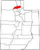 | |
| Town | ||
| Townships | ||
| CDPs | ||
| Unincorporated communities | ||
| ||
На других языках
[de] West Weber (Utah)
West Weber ist eine Unincorporated Community im Weber County, Utah in den Vereinigten Staaten.[1] Die Ortschaft liegt etwa 13 km nordwestlich von Ogden.[2] West Weber, das damals rund 700 Einwohner hatte, wurde 1877 als mormonischer Gemeindebezirk gebildet.[3] Die Ortschaft liegt nordöstlich der Kreuzung von Utah State Route 134 und Utah State Route 39. Die nächstgelegene Autobahn ist der Veterans Memorial Highway (Interstate 84/Interstate 15), der über die Route 39 erreicht wird, etwa acht Kilometer weiter im Osten.- [en] West Weber, Utah
Другой контент может иметь иную лицензию. Перед использованием материалов сайта WikiSort.org внимательно изучите правила лицензирования конкретных элементов наполнения сайта.
WikiSort.org - проект по пересортировке и дополнению контента Википедии