world.wikisort.org - USA
Welty is an unincorporated community in Okfuskee County, Oklahoma, United States.[2] Named for the town developer, Edwin A. Welty, its post office was established October 12, 1905, with Jerimiah D. Wilson as the first postmaster.[citation needed]
Welty | |
|---|---|
Unincorporated community | |
 Welty Location within the state of Oklahoma  Welty Welty (the United States) | |
| Coordinates: 35°37′28″N 96°24′19″W | |
| Country | United States |
| State | Oklahoma |
| County | Okfuskee |
| Area | |
| • Total | 2.39 sq mi (6.19 km2) |
| • Land | 2.37 sq mi (6.14 km2) |
| • Water | 0.02 sq mi (0.05 km2) |
| Elevation | 725 ft (221 m) |
| Population (2020) | |
| • Total | 131 |
| • Density | 55.27/sq mi (21.34/km2) |
| Time zone | UTC-6 (Central (CST)) |
| • Summer (DST) | UTC-5 (CDT) |
| FIPS code | 40-80000 |
| GNIS feature ID | 1099488 [2] |
Welty is south of Bristow and north of Castle on the west side of Oklahoma State Highway 48 off E 960 Rd.[3]
Okemah Lake, southeast of town,[3] features swimming, boating, hunting, fishing, and camping.[4]
Demographics
| Historical population | |||
|---|---|---|---|
| Census | Pop. | %± | |
| 2020 | 131 | — | |
| U.S. Decennial Census[5] | |||
References
- "ArcGIS REST Services Directory". United States Census Bureau. Retrieved September 20, 2022.
- U.S. Geological Survey Geographic Names Information System: Welty, Oklahoma
- "Welty, Oklahoma". Google Maps. Retrieved August 9, 2020.
- "Okemah Lake". City of Okemah. Retrieved July 3, 2020.
- "Census of Population and Housing". Census.gov. Retrieved June 4, 2016.
Municipalities and communities of Okfuskee County, Oklahoma, United States | ||
|---|---|---|
County seat: Okemah | ||
| City | 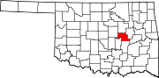 | |
| Towns | ||
| CDP | ||
| Other communities | ||
| Indian reservation |
| |
| Footnotes | ‡This populated place also has portions in an adjacent county or counties | |
| ||
This Oklahoma state location article is a stub. You can help Wikipedia by expanding it. |
Текст в блоке "Читать" взят с сайта "Википедия" и доступен по лицензии Creative Commons Attribution-ShareAlike; в отдельных случаях могут действовать дополнительные условия.
Другой контент может иметь иную лицензию. Перед использованием материалов сайта WikiSort.org внимательно изучите правила лицензирования конкретных элементов наполнения сайта.
Другой контент может иметь иную лицензию. Перед использованием материалов сайта WikiSort.org внимательно изучите правила лицензирования конкретных элементов наполнения сайта.
2019-2026
WikiSort.org - проект по пересортировке и дополнению контента Википедии
WikiSort.org - проект по пересортировке и дополнению контента Википедии