world.wikisort.org - USA
Pharoah is an unincorporated community in Okfuskee County, Oklahoma, United States.[1] It is nine miles east of Okemah[2] just south of Interstate 40 on US Route 75.[3]The community was named after a rancher and cattleman, O.J. Pharoah.[2][4] Oil and gas production have historically been important industries in Okfuskee County, and, in the 1920s, oil wells were drilled around Pharoah.[5] A post office opened in Pharoah on June 8, 1921;[5] the current nearest post office is in Weleetka.[6]
Pharoah | |
|---|---|
Unincorporated community | |
 Pharoah Location within the state of Oklahoma  Pharoah Pharoah (the United States) | |
| Coordinates: 35°25′13″N 96°07′23″W | |
| Country | United States |
| State | Oklahoma |
| County | Okfuskee |
| Elevation | 768 ft (234 m) |
| Time zone | UTC-6 (Central (CST)) |
| • Summer (DST) | UTC-5 (CDT) |
| GNIS feature ID | 1096590 |
References
- U.S. Geological Survey Geographic Names Information System: Pharoah, Oklahoma
- Shirk, George H. (1987). Oklahoma Place Names (Revised ed.). Norman, Oklahoma: University of Oklahoma Press. p. 191. ISBN 9780806120287.
- "Pharoah, OK". Google Maps. Retrieved June 30, 2020.
- "Oklahoma's Strangely Named Towns—Pharoah, OK". Gary Horcher, The Oklahoman, August 19, 2000. Retrieved June 30, 2020.
- Wilson, Linda D. "Okfuskee County," Encyclopedia of Oklahoma History and Culture. Oklahoma Historical Society. Accessed October 7, 2016.
- "Find USPS Locations (using Pharoah, Oklahoma as the search term)". U.S. Postal Service. Retrieved June 3, 2021.
Municipalities and communities of Okfuskee County, Oklahoma, United States | ||
|---|---|---|
County seat: Okemah | ||
| City | 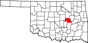 | |
| Towns | ||
| CDP | ||
| Other communities | ||
| Indian reservation |
| |
| Footnotes | ‡This populated place also has portions in an adjacent county or counties | |
| ||
This Oklahoma state location article is a stub. You can help Wikipedia by expanding it. |
Текст в блоке "Читать" взят с сайта "Википедия" и доступен по лицензии Creative Commons Attribution-ShareAlike; в отдельных случаях могут действовать дополнительные условия.
Другой контент может иметь иную лицензию. Перед использованием материалов сайта WikiSort.org внимательно изучите правила лицензирования конкретных элементов наполнения сайта.
Другой контент может иметь иную лицензию. Перед использованием материалов сайта WikiSort.org внимательно изучите правила лицензирования конкретных элементов наполнения сайта.
2019-2026
WikiSort.org - проект по пересортировке и дополнению контента Википедии
WikiSort.org - проект по пересортировке и дополнению контента Википедии