world.wikisort.org - USA
Wayne Township is one of thirteen townships in Noble County, Indiana. As of the 2010 census, its population was 10,260 and it contained 4,554 housing units.[3]
Wayne Township | |
|---|---|
Township | |
 | |
| Coordinates: 41°28′47″N 85°15′20″W | |
| Country | United States |
| State | Indiana |
| County | Noble |
| Government | |
| • Type | Indiana township |
| Area | |
| • Total | 36.37 sq mi (94.2 km2) |
| • Land | 35.46 sq mi (91.8 km2) |
| • Water | 0.91 sq mi (2.4 km2) |
| Elevation | 984 ft (300 m) |
| Population (2010) | |
| • Total | 10,260 |
| • Density | 289.3/sq mi (111.7/km2) |
| Time zone | UTC-5 (Eastern (EST)) |
| • Summer (DST) | UTC-4 (EDT) |
| Area code(s) | 260 |
| FIPS code | 18-81836[2] |
| GNIS feature ID | 454037 |
Geography
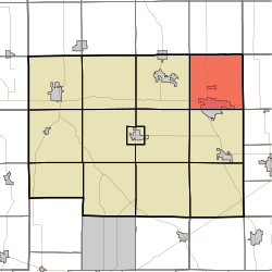
According to the 2010 census, the township has a total area of 36.37 square miles (94.2 km2), of which 35.46 square miles (91.8 km2) (or 97.50%) is land and 0.91 square miles (2.4 km2) (or 2.50%) is water.[3] Sand Hill, the second highest named point in Indiana, is located in northeastern Wayne Township, near the intersection of county roads 1000E and 1100N.
Cities and towns
- Kendallville (north side)
Unincorporated towns
- Wakeville Village at 41.4631053°N 85.2569196°W
- Wayne Center at 41.4817166°N 85.2508083°W
(This list is based on USGS data and may include former settlements.)
Major highways
 U.S. Route 6
 Indiana State Road 3
Education
Wayne Township residents may obtain a free library card from the Kendallville Public Library in Kendallville.[4]
References
- "US Board on Geographic Names". United States Geological Survey. 2007-10-25. Retrieved 2008-01-31.
- "U.S. Census website". United States Census Bureau. Retrieved 2008-01-31.
- "Population, Housing Units, Area, and Density: 2010 - County -- County Subdivision and Place -- 2010 Census Summary File 1". United States Census. Archived from the original on 2020-02-12. Retrieved 2013-05-10.
- "Kendallville Public Library Cards". Kendallville Public Library. Retrieved 14 March 2018.
External links
Municipalities and communities of Noble County, Indiana, United States | ||
|---|---|---|
County seat: Albion | ||
| Cities |  | |
| Towns |
| |
| Townships | ||
| CDP | ||
| Unincorporated communities |
| |
| Footnotes | ‡This populated place also has portions in an adjacent county or counties | |
| ||
This Noble County, Indiana location article is a stub. You can help Wikipedia by expanding it. |
Другой контент может иметь иную лицензию. Перед использованием материалов сайта WikiSort.org внимательно изучите правила лицензирования конкретных элементов наполнения сайта.
WikiSort.org - проект по пересортировке и дополнению контента Википедии