world.wikisort.org - USA
Wall Township is one of twelve townships in Ford County, Illinois, USA. As of the 2010 census, its population was 209 and it contained 82 housing units.[2] The township was formed from Patton Township on June 12, 1867.

Wall Township | |
|---|---|
Township | |
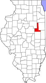
 Location in Ford County | |
 Ford County's location in Illinois | |
| Coordinates: 40°31′25″N 88°10′56″W | |
| Country | United States |
| State | Illinois |
| County | Ford |
| Established | June 12, 1867 |
| Area | |
| • Total | 36.72 sq mi (95.1 km2) |
| • Land | 36.68 sq mi (95.0 km2) |
| • Water | 0.04 sq mi (0.1 km2) 0.11% |
| Elevation | 771 ft (235 m) |
| Population (2010) | |
| • Estimate (2016)[1] | 200 |
| • Density | 5.7/sq mi (2.2/km2) |
| Time zone | UTC-6 (CST) |
| • Summer (DST) | UTC-5 (CDT) |
| ZIP codes | 60948, 60952, 60957 |
| FIPS code | 17-053-78474 |
Geography
According to the 2010 census, the township has a total area of 36.72 square miles (95.1 km2), of which 36.68 square miles (95.0 km2) (or 99.89%) is land and 0.04 square miles (0.10 km2) (or 0.11%) is water.[2]
Airports and landing strips
- Beherns Airport
Demographics
| Historical population | |||
|---|---|---|---|
| Census | Pop. | %± | |
| 2016 (est.) | 200 | [1] | |
| U.S. Decennial Census[3] | |||
School districts
- Gibson City-Melvin-Sibley Community Unit School District 5
- Paxton-Buckley-Loda Community Unit School District 10
Political districts
- Illinois' 15th congressional district
- State House District 105
- State Senate District 53
References
- "Wall Township, Ford County, Illinois". Geographic Names Information System. United States Geological Survey. Retrieved 2010-01-16.
- United States Census Bureau 2007 TIGER/Line Shapefiles
- United States National Atlas
- "Population and Housing Unit Estimates". Retrieved June 9, 2017.
- "Population, Housing Units, Area, and Density: 2010 - County -- County Subdivision and Place -- 2010 Census Summary File 1". United States Census. Archived from the original on 2020-02-12. Retrieved 2013-05-28.
- "Census of Population and Housing". Census.gov. Retrieved June 4, 2016.
External links
Places adjacent to Wall Township, Ford County, Illinois | ||||||||||||||||
|---|---|---|---|---|---|---|---|---|---|---|---|---|---|---|---|---|
| ||||||||||||||||
Municipalities and communities of Ford County, Illinois, United States | ||
|---|---|---|
County seat: Paxton | ||
| Cities |
|  |
| Villages |
| |
| Townships |
| |
| Unincorporated communities |
| |
| Footnotes | ‡This populated place also has portions in an adjacent county or counties | |
| ||
Текст в блоке "Читать" взят с сайта "Википедия" и доступен по лицензии Creative Commons Attribution-ShareAlike; в отдельных случаях могут действовать дополнительные условия.
Другой контент может иметь иную лицензию. Перед использованием материалов сайта WikiSort.org внимательно изучите правила лицензирования конкретных элементов наполнения сайта.
Другой контент может иметь иную лицензию. Перед использованием материалов сайта WikiSort.org внимательно изучите правила лицензирования конкретных элементов наполнения сайта.
2019-2025
WikiSort.org - проект по пересортировке и дополнению контента Википедии
WikiSort.org - проект по пересортировке и дополнению контента Википедии