world.wikisort.org - USA
Waldo was a ghost town in Santa Fe County, New Mexico, United States.[1]
This article needs additional citations for verification. (June 2019) |
Waldo, New Mexico | |
|---|---|
ghost town | |
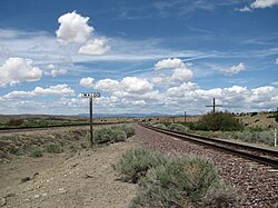
 Waldo sign along the BNSF tracks | |
 Waldo, New Mexico | |
| Coordinates: 35°26′57″N 106°8′58″W | |
| Country | United States |
| State | New Mexico |
| County | Santa Fe |
| Elevation | 5,640 ft (1,720 m) |
| Time zone | UTC-7 (Mountain (MST)) |
| • Summer (DST) | UTC-6 (MDT) |
| Area code | 505 |
| GNIS feature ID | 918402[1] |
Description
The community was created along the Atchison, Topeka and Santa Fe Railway just west of Cerrillos. Today little remains, although the name appears on a freeway exit on Interstate 25, some distance to the west. Today, Waldo is a siding along the line of the BNSF Railway, which bought out the Atchison, Topeka and Santa Fe Railway.
Waldo was at the junction of the AT&SF main east-west line and the Madrid spur. There were coke ovens in Waldo, supplied by coal from Madrid. The spur itself no longer exists. The ovens were on the south side of the mail line, and the town on the north. The rail line parallels the Galisteo River.
See also
![]() New Mexico portal
New Mexico portal
References
- "Waldo". Geographic Names Information System. United States Geological Survey, United States Department of the Interior.
External links
Wikimedia Commons has media related to Waldo, New Mexico.
Текст в блоке "Читать" взят с сайта "Википедия" и доступен по лицензии Creative Commons Attribution-ShareAlike; в отдельных случаях могут действовать дополнительные условия.
Другой контент может иметь иную лицензию. Перед использованием материалов сайта WikiSort.org внимательно изучите правила лицензирования конкретных элементов наполнения сайта.
Другой контент может иметь иную лицензию. Перед использованием материалов сайта WikiSort.org внимательно изучите правила лицензирования конкретных элементов наполнения сайта.
2019-2025
WikiSort.org - проект по пересортировке и дополнению контента Википедии
WikiSort.org - проект по пересортировке и дополнению контента Википедии
