world.wikisort.org - USA
Wahak Hotrontk also known as San Simon (O'odham) name translates as "Road Dips", is a census-designated place in Pima County, in the U.S. state of Arizona.[2][3] The population was 120 as of the 2020 census.[4] It is located along Arizona State Route 86 on the Tohono O'odham Nation reservation.
Wahak Hotrontk, Arizona | |
|---|---|
Census-designated place | |
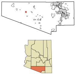 Location of Wahak Hotrontk in Pima County, Arizona. | |
 Wahak Hotrontk | |
| Coordinates: 32°10′58″N 112°21′56″W | |
| Country | United States |
| State | Arizona |
| County | Pima |
| Area | |
| • Total | 1.54 sq mi (3.99 km2) |
| • Land | 1.54 sq mi (3.99 km2) |
| • Water | 0.00 sq mi (0.00 km2) |
| Elevation | 1,939 ft (591 m) |
| Population (2020) | |
| • Total | 88 |
| • Density | 57.11/sq mi (22.05/km2) |
| Time zone | UTC-7 (Mountain (MST)) |
| Area code(s) | 520 |
| GNIS feature ID | 13276 |
Geography
According to the U.S. Census Bureau, the community has an area of 1.541 square miles (3.99 km2), all land.[4]
Located on the west end of the traditional historical village is the San Simon Health Clinic and Tohono O'odham High School.[5][6] Recently, the fifth convenience store and gas station located on the reservation also opened west of the community.[7]
Population
At the 2020 census there were 120 people, 35 households, and 22 families living in the CDP. The population density was 78 people per square mile. There were 48 housing units.
The median household income was $22,683. The per capita income for the CDP was $13,577.[8]
Demographics
| Historical population | |||
|---|---|---|---|
| Census | Pop. | %± | |
| 2020 | 88 | — | |
| U.S. Decennial Census[9] | |||
References
- "2020 U.S. Gazetteer Files". United States Census Bureau. Retrieved October 29, 2021.
- Bright, William (2013). Native American Placenames of the United States. University of Oklahoma Press. p. 119. ISBN 978-0806124445.
- "Wahak Hotrontk". Geographic Names Information System. United States Geological Survey.
- "2010 Census Gazetteer Files – Places: Arizona". U.S. Census Bureau. Retrieved February 26, 2017.
- "San Simon". Ihs.gov. 2021. Retrieved 2021-09-05.
- "Tohono O'odham High School". Bie.edu. 2021. Retrieved 2021-09-05.
- "Traveling Eagle Inc". Travelingeaglellc.com. 2021. Retrieved 2021-09-05.
- "Anegam, AZ Profile: Facts & Data". Arizona.hometownlocator.com. 2021. Retrieved 2021-08-24.
- "Census of Population and Housing". Census.gov. Retrieved June 4, 2016.
Municipalities and communities of Pima County, Arizona, United States | ||
|---|---|---|
County seat: Tucson | ||
| Cities |
|  |
| Towns |
| |
| CDPs |
| |
| Populated places |
| |
| Indian reservations |
| |
| Ghost towns |
| |
| ||
Другой контент может иметь иную лицензию. Перед использованием материалов сайта WikiSort.org внимательно изучите правила лицензирования конкретных элементов наполнения сайта.
WikiSort.org - проект по пересортировке и дополнению контента Википедии