world.wikisort.org - USA
Wacousta is an unincorporated community and census-designated place (CDP) in Clinton County in the U.S. state of Michigan. The CDP is located within Watertown Charter Township. As of the 2010 census, it had a population of 1,440.[4]
Wacousta, Michigan | |
|---|---|
Census-designated place (CDP) & unincorporated community | |
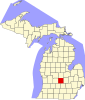
 Location within Clinton County | |
 Wacousta Location within the state of Michigan  Wacousta Location within the United States | |
| Coordinates: 42°49′40″N 84°42′02″W | |
| Country | United States |
| State | Michigan |
| County | Clinton |
| Township | Watertown |
| Area | |
| • Total | 8.99 sq mi (23.29 km2) |
| • Land | 8.91 sq mi (23.09 km2) |
| • Water | 0.08 sq mi (0.20 km2) |
| Elevation | 797 ft (243 m) |
| Population (2020) | |
| • Total | 1,532 |
| • Density | 171.85/sq mi (66.35/km2) |
| Time zone | UTC-5 (Eastern (EST)) |
| • Summer (DST) | UTC-4 (EDT) |
| ZIP code(s) | 48820 (DeWitt) 48822 (Eagle) 48837 (Grand Ledge) |
| Area code | 517 |
| FIPS code | 26-82680[2] |
| GNIS feature ID | 1615648[3] |
History
The community of Wacousta was listed as a newly-organized census-designated place for the 2010 census, meaning it now has officially defined boundaries and population statistics for the first time.[5]
Geography
The Wacousta CDP has a total area of 8.99 square miles (23.28 km2), of which 8.91 square miles (23.08 km2) is land and 0.08 square miles (0.21 km2) (0.89%) is water.[4]
The Looking Glass River flows from east to west across the CDP.
Demographics
| Historical population | |||
|---|---|---|---|
| Census | Pop. | %± | |
| 2020 | 1,532 | — | |
| U.S. Decennial Census[6] | |||
This section needs expansion. You can help by adding to it. (January 2021) |
References
- "2020 U.S. Gazetteer Files". United States Census Bureau. Retrieved May 21, 2022.
- "Geographic Identifiers: 2010 Demographic Profile Data (G001): Wacousta CDP, Michigan". U.S. Census Bureau, American Factfinder. Archived from the original on February 12, 2020. Retrieved October 1, 2014.
- U.S. Geological Survey Geographic Names Information System: Wacousta, Michigan
- "Michigan: 2010 Population and Housing Unit Counts 2010 Census of Population and Housing" (PDF). 2010 United States Census. United States Census Bureau. September 2012. p. 19 Michigan. Retrieved January 9, 2021.
- "Michigan: 2010 Population and Housing Unit Counts 2010 Census of Population and Housing" (PDF). 2010 United States Census. United States Census Bureau. September 2012. p. III-5. Retrieved January 8, 2021.
- "Census of Population and Housing". Census.gov. Retrieved June 4, 2016.
Municipalities and communities of Clinton County, Michigan, United States | ||
|---|---|---|
County seat: St. Johns | ||
| Cities |
|  |
| Villages |
| |
| Charter townships | ||
| Civil townships | ||
| CDPs | ||
| Other communities |
| |
| Footnotes | ‡This populated place also has portions in an adjacent county or counties | |
| ||
Текст в блоке "Читать" взят с сайта "Википедия" и доступен по лицензии Creative Commons Attribution-ShareAlike; в отдельных случаях могут действовать дополнительные условия.
Другой контент может иметь иную лицензию. Перед использованием материалов сайта WikiSort.org внимательно изучите правила лицензирования конкретных элементов наполнения сайта.
Другой контент может иметь иную лицензию. Перед использованием материалов сайта WikiSort.org внимательно изучите правила лицензирования конкретных элементов наполнения сайта.
2019-2026
WikiSort.org - проект по пересортировке и дополнению контента Википедии
WikiSort.org - проект по пересортировке и дополнению контента Википедии