world.wikisort.org - USA
Wabash Township is one of thirteen townships in Parke County, Indiana, United States. As of the 2010 census, its population was 818 and it contained 353 housing units.[2]
Wabash Township | |
|---|---|
Township | |
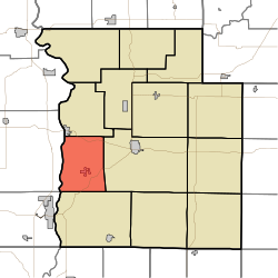 Location in Parke County | |
| Coordinates: 39°43′56″N 87°20′00″W | |
| Country | |
| State | |
| County | Parke |
| Government | |
| • Type | Indiana township |
| Area | |
| • Total | 27.79 sq mi (72.0 km2) |
| • Land | 27.49 sq mi (71.2 km2) |
| • Water | 0.3 sq mi (0.8 km2) 1.08% |
| Elevation | 620 ft (189 m) |
| Population (2010) | |
| • Total | 818 |
| • Density | 29.8/sq mi (11.5/km2) |
| Time zone | UTC-5 (Eastern (EST)) |
| • Summer (DST) | UTC-4 (EDT) |
| ZIP codes | 47860, 47862, 47872 |
| Area code(s) | 765 |
| GNIS feature ID | 453966 |
History
When General William Henry Harrison took an army from Vincennes to the Battle of Tippecanoe in late 1811, Zachariah Cicott served as a scout. Cicott was familiar with the area because of his time trading up and down the Wabash River starting circa 1801. The trail taken by Harrison's army passed through the area that later became Parke County on its way to and from the battle site in Tippecanoe County. The settlement of Armiesburg was so named because Harrison and his army crossed the Raccoon Creek and camped near there on their way to the battle.[3]
The Phillips Covered Bridge and Sim Smith Covered Bridge were listed on the National Register of Historic Places in 1978.[4]
Geography
According to the 2010 census, the township has a total area of 27.79 square miles (72.0 km2), of which 27.49 square miles (71.2 km2) (or 98.92%) is land and 0.3 square miles (0.78 km2) (or 1.08%) is water.[2]
Cities, towns, villages
- Mecca
- Montezuma (south edge)
Unincorporated towns
- Arabia at 39.766150°N 87.321960°W
- Armiesburg at 39.763372°N 87.351128°W
- Bradfield Corner at 39.732261°N 87.298905°W
- Midway at 39.775317°N 87.317516°W
(This list is based on USGS data and may include former settlements.)
Cemeteries
The township contains these four cemeteries: Arabia, Armiesburg, Hixon and Watts.
Major highways
 U.S. Route 36
 U.S. Route 41
School districts
- Southwest Parke Community School Corporation
Political districts
- State House District 42
- State Senate District 38
References
- "Wabash Township, Parke County, Indiana". Geographic Names Information System. United States Geological Survey. Retrieved 2009-11-01.
- United States Census Bureau 2009 TIGER/Line Shapefiles
- IndianaMap
- "US Board on Geographic Names". United States Geological Survey. October 25, 2007. Retrieved 2017-05-09.
- "Population, Housing Units, Area, and Density: 2010 - County -- County Subdivision and Place -- 2010 Census Summary File 1". United States Census. Archived from the original on 2020-02-12. Retrieved 2013-05-10.
- Bowen 1913, pp. 52–53, 221.
- "National Register Information System". National Register of Historic Places. National Park Service. July 9, 2010.
Bibliography
- History of Parke and Vermillion Counties Indiana. Indianapolis: B. F. Bowen and Company. 1913. pp. 25–225. Retrieved 2010-12-17.
External links
- Indiana Township Association
- United Township Association of Indiana
- City-Data.com page for Wabash Township
Places adjacent to Wabash Township, Parke County, Indiana | ||||||||||||||||
|---|---|---|---|---|---|---|---|---|---|---|---|---|---|---|---|---|
| ||||||||||||||||
Municipalities and communities of Parke County, Indiana, United States | ||
|---|---|---|
County seat: Rockville | ||
| Towns |  | |
| Townships | ||
| Unincorporated communities |
| |
| Ghost town |
| |
| Footnotes | ‡This populated place also has portions in an adjacent county or counties | |
| ||
Другой контент может иметь иную лицензию. Перед использованием материалов сайта WikiSort.org внимательно изучите правила лицензирования конкретных элементов наполнения сайта.
WikiSort.org - проект по пересортировке и дополнению контента Википедии