world.wikisort.org - USA
Victoria is a city in Carver County, Minnesota, United States. The population was 7,345 at the 2010 census.[4]
Victoria | |
|---|---|
City | |
 Downtown Victoria | |
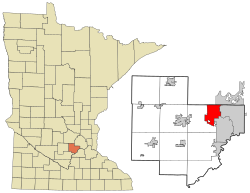 Location of the city of Victoria within Carver County, Minnesota | |
| Coordinates: 44°51′51″N 93°38′57″W | |
| Country | United States |
| State | Minnesota |
| County | Carver |
| Area | |
| • Total | 10.69 sq mi (27.70 km2) |
| • Land | 8.71 sq mi (22.57 km2) |
| • Water | 1.98 sq mi (5.13 km2) |
| Elevation | 988 ft (329.3 m) |
| Population (2020) | |
| • Total | 10,546 |
| • Density | 1,210.38/sq mi (467.34/km2) |
| Time zone | UTC-6 (Central (CST)) |
| • Summer (DST) | UTC-5 (CDT) |
| ZIP code | 55386 |
| Area code | 952 |
| FIPS code | 27-67036[2] |
| GNIS feature ID | 0653650[3] |
| Website | City of Victoria |
Geography

According to the United States Census Bureau, the city has an area of 9.79 square miles (25.36 km2), of which 8.01 square miles (20.75 km2) is land and 1.78 square miles (4.61 km2) is water.[5]
State Highways 5 and 7 are two of Victoria's main routes.
Victoria has been nicknamed "The City of Lakes and Parks" because it has over 200 acres (0.81 km2) of reserved land, 13 parks and nine lakes within its borders. Victoria is also home to the 1,800-acre (7.3 km2) Carver Park Reserve.
In the 1850s, Victoria's rich soil attracted many farmers from Germany, Switzerland, and the Netherlands.
History
Michael Diethelm is believed to be the first settler in Victoria after setting up a shelter for his wife and two children in 1851 near the present-day St. Victoria Church. The city itself is named after the church, built on 30 acres (120,000 m2) of land just north of Lake Bavaria in 1857. A year later, steamboats from St. Paul began bringing in additional supplies for early settlers. The settlement continued to grow as the rich soil attracted farmers. Also in 1858, the Laketown Moravian Brethren's Church was established and is now on the National Register of Historic Places.[6] Eventually the steamboats to Chaska and the St. Paul railroad helped transform the area into a thriving community.[7]
Demographics
| Historical population | |||
|---|---|---|---|
| Census | Pop. | %± | |
| 1920 | 206 | — | |
| 1930 | 240 | 16.5% | |
| 1940 | 276 | 15.0% | |
| 1950 | 302 | 9.4% | |
| 1960 | 425 | 40.7% | |
| 1970 | 850 | 100.0% | |
| 1980 | 1,425 | 67.6% | |
| 1990 | 2,354 | 65.2% | |
| 2000 | 4,025 | 71.0% | |
| 2010 | 7,345 | 82.5% | |
| 2020 | 10,546 | 43.6% | |
| US Population at | |||
2010 census
As of the census[8] of 2010, there were 7,345 people, 2,435 households, and 2,055 families living in the city. The population density was 917.0 inhabitants per square mile (354.1/km2). There were 2,545 housing units at an average density of 317.7 per square mile (122.7/km2). The racial makeup of the city was 95.6% White, 0.5% African American, 0.1% Native American, 2.0% Asian, 0.3% from other races, and 1.5% from two or more races. Hispanic or Latino of any race were 2.0% of the population.
There were 2,435 households, of which 49.4% had children under the age of 18 living with them, 76.7% were married couples living together, 5.4% had a female householder with no husband present, 2.3% had a male householder with no wife present, and 15.6% were non-families. 12.6% of all households were made up of individuals, and 4.3% had someone living alone who was 65 years of age or older. The average household size was 2.99 and the average family size was 3.27.
The median age in the city was 38.9 years. 32.9% of residents were under the age of 18; 4.5% were between the ages of 18 and 24; 25.5% were from 25 to 44; 28.6% were from 45 to 64; and 8.5% were 65 years of age or older. The gender makeup of the city was 49.7% male and 50.3% female.
2000 census
As of the census[2] of 2000, there were 4,025 people, 1,367 households, and 1,141 families living in the city. The population density was 575.4 people per square mile (222.3/km2). There were 1,410 housing units at an average density of 201.6 per square mile (77.9/km2). The racial makeup of the city was 97.91% White, 0.27% African American, 0.12% Native American, 0.84% Asian, 0.37% from other races, and 0.47% from two or more races. Hispanic or Latino of any race were 0.99% of the population.
There were 1,367 households, out of which 47.0% had children under the age of 18 living with them, 76.0% were married couples living together, 5.3% had a female householder with no husband present, and 16.5% were non-families. 11.3% of all households were made up of individuals, and 3.4% had someone living alone who was 65 years of age or older. The average household size was 2.90 and the average family size was 3.17.
In the city, the population was spread out, with 31.7% under the age of 18, 4.2% from 18 to 24, 33.5% from 25 to 44, 24.0% from 45 to 64, and 6.6% who were 65 years of age or older. The median age was 36 years. For every 100 females, there were 99.4 males. For every 100 females age 18 and over, there were 97.8 males.
The median income for a household in the city was $86,772, and the median income for a family was $91,681. Males had a median income of $60,931 versus $34,519 for females. The per capita income for the city was $38,929. About 1.3% of families and 2.3% of the population were below the poverty line, including 2.1% of those under age 18 and 2.2% of those age 65 or over.
Politics
| Year | Republican | Democratic | Third parties |
|---|---|---|---|
| 2020 | 51.7% 3,638 | 46.1% 3,243 | 2.2% 157 |
| 2016 | 53.7% 2,808 | 37.6% 1,968 | 8.7% 453 |
| 2012 | 65.0% 3,011 | 34.0% 1,574 | 1.0% 49 |
| 2008 | 61.3% 2,510 | 37.3% 1,527 | 1.4% 56 |
| 2004 | 68.0% 2,303 | 31.2% 1,057 | 0.7% 25 |
| 2000 | 62.6% 1,470 | 33.3% 782 | 4.1% 95 |
| 1996 | 48.9% 857 | 38.8% 680 | 12.3% 216 |
| 1992 | 40.5% 619 | 29.1% 444 | 30.4% 464 |
| 1988 | 65.7% 735 | 34.3% 383 | 0.0% 0 |
| 1984 | 71.1% 678 | 28.9% 276 | 0.0% 0 |
| 1980 | 56.8% 415 | 33.6% 245 | 9.6% 70 |
| 1976 | 59.2% 308 | 37.1% 193 | 3.7% 19 |
| 1972 | 62.1% 264 | 33.9% 144 | 4.0% 17 |
| 1968 | 62.1% 225 | 34.0% 123 | 3.9% 14 |
| 1964 | 46.6% 96 | 53.4% 110 | 0.0% 0 |
| 1960 | 39.9% 73 | 60.1% 110 | 0.1% 1 |
Education
District 112 schools have an elementary school, Victoria Elementary.
Chanhassen High School serves the majority of Victoria.[24]
Waconia Public Schools operates area public schools serving other parts of Victoria,[25] including Waconia High School.
The city is home to the co-ed college preparatory high school Holy Family Catholic High School.
References
- "2020 U.S. Gazetteer Files". United States Census Bureau. Archived from the original on July 24, 2022. Retrieved July 24, 2022.
- "U.S. Census website". United States Census Bureau. Archived from the original on 1996-12-27. Retrieved 2008-01-31.
- "US Board on Geographic Names". United States Geological Survey. 2007-10-25. Archived from the original on 2012-02-04. Retrieved 2008-01-31.
- "2010 Census Redistricting Data (Public Law 94-171) Summary File". American FactFinder. United States Census Bureau. Retrieved 27 April 2011.[dead link]
- "US Gazetteer files 2010". United States Census Bureau. Archived from the original on 2011-02-20. Retrieved 2012-11-13.
- Lofstrom, Ted (January 1978). "Minnesota Historic Properties Inventory Form: Laketown Moravian Brethren's Church". National Park Service. Archived from the original on 2022-02-24. Retrieved 2016-01-30.
- "City of Victoria, MN: History of Victoria". City of Victoria. Archived from the original on May 8, 2015. Retrieved April 11, 2015.
- "U.S. Census website". United States Census Bureau. Archived from the original on 1996-12-27. Retrieved 2012-11-13.
- "Minnesota Secretary of State - 2020 Precinct Results Spreadsheet". Archived from the original on 2021-04-10. Retrieved 2021-04-16.
- "Minnesota Secretary of State - 2016 Precinct Results Spreadsheet". Archived from the original on 2021-04-10. Retrieved 2021-04-16.
- "Minnesota Secretary of State - 2012 Precinct Results Spreadsheet". Archived from the original on 2021-04-10. Retrieved 2021-04-16.
- "Minnesota Secretary of State - 2008 Precinct Results Spreadsheet". Archived from the original on 2021-04-10. Retrieved 2021-04-16.
- "Minnesota Secretary of State - 2004 Precinct Results Spreadsheet". Archived from the original on 2021-04-10. Retrieved 2021-04-16.
- "Minnesota Secretary of State - 2000 Precinct Results Spreadsheet". Archived from the original on 2021-04-10. Retrieved 2021-04-16.
- "Archived copy" (PDF). Archived (PDF) from the original on 2021-04-10. Retrieved 2021-04-16.
{{cite web}}: CS1 maint: archived copy as title (link) - "Archived copy" (PDF). Archived (PDF) from the original on 2021-04-10. Retrieved 2021-04-16.
{{cite web}}: CS1 maint: archived copy as title (link) - "Archived copy" (PDF). Archived (PDF) from the original on 2021-04-10. Retrieved 2021-04-16.
{{cite web}}: CS1 maint: archived copy as title (link) - "Archived copy" (PDF). Archived (PDF) from the original on 2021-04-10. Retrieved 2021-04-16.
{{cite web}}: CS1 maint: archived copy as title (link) - "Archived copy" (PDF). Archived (PDF) from the original on 2021-04-10. Retrieved 2021-04-16.
{{cite web}}: CS1 maint: archived copy as title (link) - "Archived copy" (PDF). Archived (PDF) from the original on 2021-04-10. Retrieved 2021-04-16.
{{cite web}}: CS1 maint: archived copy as title (link) - "Archived copy" (PDF). Archived (PDF) from the original on 2021-04-10. Retrieved 2021-04-16.
{{cite web}}: CS1 maint: archived copy as title (link) - "Archived copy" (PDF). Archived (PDF) from the original on 2021-04-10. Retrieved 2021-04-16.
{{cite web}}: CS1 maint: archived copy as title (link) - "Archived copy" (PDF). Archived (PDF) from the original on 2021-04-10. Retrieved 2021-04-16.
{{cite web}}: CS1 maint: archived copy as title (link) - "Chanhassen High School - School Boundaries Map (School Attendance Zone)". Minnesota HomeTownLocator. Archived from the original on 8 June 2020. Retrieved 8 June 2020.
- "Why Waconia". Waconia Public Schools. Archived from the original on 2020-03-29. Retrieved 2020-03-28.
Municipalities and communities of Carver County, Minnesota, United States | ||
|---|---|---|
County seat: Chaska | ||
| Cities |  | |
| Townships | ||
| CDP | ||
| Unincorporated communities |
| |
| Ghost town |
| |
| Footnotes | ‡This populated place also has portions in an adjacent county or counties | |
| ||
| Authority control |
|
|---|
На других языках
[de] Victoria (Minnesota)
Victoria ist eine Stadt im Carver County im US-Bundesstaat Minnesota.- [en] Victoria, Minnesota
[ru] Виктория (город, Миннесота)
Виктория (англ. Victoria) — город в округе Карвер, штат Миннесота, США. На площади 22,1 км² (18,1 км² — суша, 4 км² — вода), согласно переписи 2002 года, проживают 4025 человек. Плотность населения составляет 222,2 чел./км².Другой контент может иметь иную лицензию. Перед использованием материалов сайта WikiSort.org внимательно изучите правила лицензирования конкретных элементов наполнения сайта.
WikiSort.org - проект по пересортировке и дополнению контента Википедии