world.wikisort.org - USA
Union Township is one of twelve townships in Clark County, Indiana, United States. As of the 2010 census, its population was 3,507 and it contained 1,415 housing units.[3]
Union Township | |
|---|---|
Township | |
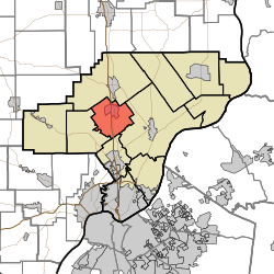 Location of Union Township in Clark County | |
| Coordinates: 38°28′26″N 85°46′01″W | |
| Country | United States |
| State | Indiana |
| County | Clark |
| Government | |
| • Type | Indiana township |
| Area | |
| • Total | 21.08 sq mi (54.6 km2) |
| • Land | 20.85 sq mi (54.0 km2) |
| • Water | 0.23 sq mi (0.6 km2) |
| Elevation | 512 ft (156 m) |
| Population (2010) | |
| • Total | 3,507 |
| • Density | 168.2/sq mi (64.9/km2) |
| FIPS code | 18-77174[2] |
| GNIS feature ID | 453909 |
History
Union Township was organized in 1858.[4] Its name was given from the fact that this township was created through the merger or "union" of land given by three neighboring townships.[5]
Geography
According to the 2010 census, the township has a total area of 21.08 square miles (54.6 km2), of which 20.85 square miles (54.0 km2) (or 98.91%) is land and 0.23 square miles (0.60 km2) (or 1.09%) is water.[3]
Cities and towns
Unincorporated towns
- Perry Crossing
- Slatecut
- Sylvan Grove
(This list is based on USGS data and may include former settlements.)
Adjacent townships
- Monroe Township (north)
- Charlestown Township (east)
- Silver Creek Township (south)
- Carr Township (southwest)
Major highways
 Interstate 65
 U.S. Route 31
Cemeteries
The township contains three cemeteries: Black and White (aka Weir or Wilson), Bowery, Ebenezer Methodist Episcopal Church.[6]
References
- "US Board on Geographic Names". United States Geological Survey. 2007-10-25. Retrieved 2008-01-31.
- "U.S. Census website". United States Census Bureau. Retrieved 2008-01-31.
- "Population, Housing Units, Area, and Density: 2010 - County -- County Subdivision and Place -- 2010 Census Summary File 1". United States Census. Archived from the original on 2020-02-12. Retrieved 2013-05-10.
- History of the Ohio Falls Cities and Their Counties: Precincts of Jefferson County, Ky. General histories of Clark and Floyd counties, Ind. New Albany and Floyd County. Clark County and Jeffersonville. L. A. Williams & Company. 1882. p. 503.
- Biographical and Historical Souvenir for the Counties of Clark, Crawford, Harrison, Floyd, Jefferson, Jennings, Scott, and Washington, Indiana. Chicago Printing Company. 1889. pp. 17–18.
- Mauk, Lois. "Clark County, Indiana Cemeteries". usgennet.org. USGenNet. Retrieved 7 September 2014.
External links
Municipalities and communities of Clark County, Indiana, United States | ||
|---|---|---|
County seat: Jeffersonville | ||
| Cities |
|  |
| Towns |
| |
| Townships | ||
| CDPs |
| |
| Unincorporated communities |
| |
| Footnotes | ‡This populated place also has portions in an adjacent county or counties | |
| ||
Другой контент может иметь иную лицензию. Перед использованием материалов сайта WikiSort.org внимательно изучите правила лицензирования конкретных элементов наполнения сайта.
WikiSort.org - проект по пересортировке и дополнению контента Википедии