world.wikisort.org - USA
Union Township is one of fifteen townships in Barton County, Missouri, USA. As of the 2000 census, its population was 347.
Union Township | |
|---|---|
Township | |
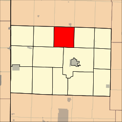 Location in Barton County | |
| Coordinates: 37°35′09″N 094°17′31″W | |
| Country | United States |
| State | Missouri |
| County | Barton |
| Area | |
| • Total | 36.18 sq mi (93.7 km2) |
| • Land | 36.06 sq mi (93.41 km2) |
| • Water | 0.11 sq mi (0.29 km2) 0.31% |
| Elevation | 948 ft (289 m) |
| Population (2000) | |
| • Total | 347 |
| • Density | 9.6/sq mi (3.7/km2) |
| GNIS feature ID | 0766288 |
Union Township was formed by means of merger, or "union" of existing townships, hence the name.[1]
Geography
Union Township covers an area of 36.18 square miles (93.7 km2) and contains no incorporated settlements. According to the USGS, it contains one cemetery, Bakers Grove.
The streams of Bucks Run Creek, Little Creek and Moores Branch run through this township.
References
- "Barton County Place Names, 1928-1945 (archived)". The State Historical Society of Missouri. Archived from the original on 24 June 2016. Retrieved 31 August 2016.
External links
Municipalities and communities of Barton County, Missouri, United States | ||
|---|---|---|
County seat: Lamar | ||
| Cities |
|  |
| Villages |
| |
| Townships |
| |
| CDPs |
| |
| Other communities |
| |
| Ghost towns |
| |
| ||
This Barton County, Missouri state location article is a stub. You can help Wikipedia by expanding it. |
Текст в блоке "Читать" взят с сайта "Википедия" и доступен по лицензии Creative Commons Attribution-ShareAlike; в отдельных случаях могут действовать дополнительные условия.
Другой контент может иметь иную лицензию. Перед использованием материалов сайта WikiSort.org внимательно изучите правила лицензирования конкретных элементов наполнения сайта.
Другой контент может иметь иную лицензию. Перед использованием материалов сайта WikiSort.org внимательно изучите правила лицензирования конкретных элементов наполнения сайта.
2019-2025
WikiSort.org - проект по пересортировке и дополнению контента Википедии
WikiSort.org - проект по пересортировке и дополнению контента Википедии