world.wikisort.org - USA
Tyhee is a census-designated place in Bannock County, Idaho, United States. Its population was 1,123 as of the 2010 census.[1]
Tyhee, Idaho | |
|---|---|
Census-designated place | |
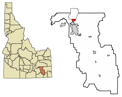 Location of Tyhee in Bannock County, Idaho. | |
 Tyhee, Idaho | |
| Coordinates: 42°57′06″N 112°27′59″W | |
| Country | United States |
| State | Idaho |
| County | Bannock |
| Area | |
| • Total | 2.878 sq mi (7.45 km2) |
| • Land | 2.871 sq mi (7.44 km2) |
| • Water | 0.007 sq mi (0.02 km2) |
| Elevation | 4,462 ft (1,360 m) |
| Population (2010)[1] | |
| • Total | 1,123 |
| • Density | 390/sq mi (150/km2) |
| Time zone | UTC-7 (Mountain (MST)) |
| • Summer (DST) | UTC-6 (MDT) |
| Area code(s) | 208, 986 |
| GNIS feature ID | 397287[2] |
The community was named after a Bannock Indian chieftain.[3]
Demographics
| Historical population | |||
|---|---|---|---|
| Census | Pop. | %± | |
| U.S. Decennial Census[4] | |||
Education
Tyhee is in the Pocatello/Chubbuck School District. Residents are zoned to Tyhee and Ellis Elementary Schools in Tyhee,[5] Hawthorne Middle School in Pocatello,[6] and Highland High School in Pocatello.[7]
References
- "U.S. Census website". U.S. Census Bureau. Retrieved 23 March 2011.
- U.S. Geological Survey Geographic Names Information System: Tyhee, Idaho
- Rees, John E. (1918). Idaho Chronology, Nomenclature, Bibliography. W.B. Conkey Company. p. 117.
- "Census of Population and Housing". Census.gov. Retrieved June 4, 2016.
- "School District 25 Elementary School Boundaries Archived 2011-12-02 at the Wayback Machine." Pocatello/Chubbuck School District. Retrieved on February 22, 2012.
- "School District 25 Middle School Boundaries Archived 2011-12-02 at the Wayback Machine." Pocatello/Chubbuck School District. Retrieved on February 22, 2012.
- "School District 25 High School Boundaries Archived 2011-12-19 at the Wayback Machine." Pocatello/Chubbuck School District. Retrieved on February 22, 2012.
Municipalities and communities of Bannock County, Idaho, United States | ||
|---|---|---|
County seat: Pocatello | ||
| Cities |
|  |
| CDPs | ||
| Unincorporated communities |
| |
| Indian reservation |
| |
| Ghost town |
| |
| Footnotes | ‡This populated place also has portions in an adjacent county or counties | |
| ||
Authority control | |
|---|---|
| General |
|
| National libraries | |
This Bannock County, Idaho state location article is a stub. You can help Wikipedia by expanding it. |
Текст в блоке "Читать" взят с сайта "Википедия" и доступен по лицензии Creative Commons Attribution-ShareAlike; в отдельных случаях могут действовать дополнительные условия.
Другой контент может иметь иную лицензию. Перед использованием материалов сайта WikiSort.org внимательно изучите правила лицензирования конкретных элементов наполнения сайта.
Другой контент может иметь иную лицензию. Перед использованием материалов сайта WikiSort.org внимательно изучите правила лицензирования конкретных элементов наполнения сайта.
2019-2026
WikiSort.org - проект по пересортировке и дополнению контента Википедии
WikiSort.org - проект по пересортировке и дополнению контента Википедии