world.wikisort.org - USA
Twin Lakes is a census-designated place in Greene County, Virginia, United States. The population as of the 2010 census was 1,647.[1]
Twin Lakes, Virginia | |
|---|---|
Census-designated place | |
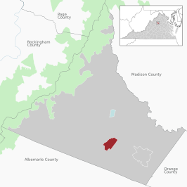 Location of the Twin Lakes CDP within the Greene County | |
 Twin Lakes  Twin Lakes | |
| Coordinates: 38°14′56″N 78°26′37″W | |
| Country | |
| State | |
| County | Greene |
| Area | |
| • Total | 1.28 sq mi (3.32 km2) |
| • Land | 1.19 sq mi (3.08 km2) |
| • Water | 0.09 sq mi (0.24 km2) |
| Elevation | 585 ft (178 m) |
| Population (2010) | |
| • Total | 1,647 |
| • Density | 1,385/sq mi (534.7/km2) |
| Time zone | UTC−5 (Eastern (EST)) |
| • Summer (DST) | UTC−4 (EDT) |
| ZIP code | 22968 |
| FIPS code | 51-79768 |
| GNIS feature ID | 2629848 |
Geography
Twin Lakes is located in southern Greene County around a set of small reservoirs built on Quarter Creek, a southwest-flowing tributary of Swift Run, which in turn runs south to the North Fork of the Rivanna River, part of the James River watershed. The community is 4 miles (6 km) south of Stanardsville, the Greene County seat, and 21 miles (34 km) north of Charlottesville.
According to the U.S. Census Bureau, the Twin Lakes CDP has a total area of 1.3 square miles (3.3 km2), of which 1.2 square miles (3.1 km2) are land and 0.1 square miles (0.2 km2), or 7.28%, are water.[1]
References
- "Geographic Identifiers: 2010 Demographic Profile Data (G001): Twin Lakes CDP, Virginia". American Factfinder. U.S. Census Bureau. Retrieved March 29, 2017.[dead link]
External links
Municipalities and communities of Greene County, Virginia, United States | ||
|---|---|---|
County seat: Stanardsville | ||
| Town |
|  |
| CDPs |
| |
| Unincorporated communities |
| |
| ||
This Greene County, Virginia state location article is a stub. You can help Wikipedia by expanding it. |
Другой контент может иметь иную лицензию. Перед использованием материалов сайта WikiSort.org внимательно изучите правила лицензирования конкретных элементов наполнения сайта.
WikiSort.org - проект по пересортировке и дополнению контента Википедии