world.wikisort.org - USA
The Pinery is an unincorporated community and a census-designated place (CDP) located in and governed by Douglas County, Colorado, United States. The CDP is a part of the Denver–Aurora–Lakewood, CO Metropolitan Statistical Area. The population of The Pinery CDP was 10,517 at the United States Census 2010.[4] Douglas County governs the unincorporated community. The Parker post office (Zip Code 80134) serves the area.[3]
The Pinery, Colorado | |
|---|---|
Census Designated Place | |
 Entrance sign at North Pinery Parkway and State Highway 83. | |
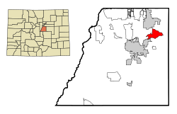 Location of The Pinery CDP in Douglas County, Colorado. | |
 The Pinery Location of The Pinery CDP in the United States. | |
| Coordinates: 39°26′46″N 104°45′33″W[1] | |
| Country | |
| State | |
| County | Douglas County |
| Government | |
| • Type | unincorporated community |
| Area | |
| • Total | 10.416 sq mi (26.978 km2) |
| • Land | 10.379 sq mi (26.882 km2) |
| • Water | 0.037 sq mi (0.096 km2) |
| Elevation | 6,066 ft (1,849 m) |
| Population (2010) | |
| • Total | 10,517 |
| • Density | 1,013/sq mi (391/km2) |
| Time zone | UTC-7 (MST) |
| • Summer (DST) | UTC-6 (MDT) |
| ZIP Code[3] | Parker 80134 |
| Area codes | 303 & 720 |
| GNIS feature[2] | The Pinery, Colorado |
Geography
The Pinery is bordered to the north by the town of Parker and to the southwest by the town of Castle Rock, the Douglas County seat. Colorado State Highway 83 runs through the center of the CDP, leading north 4 miles (6 km) to the center of Parker and south 4 miles to Franktown. The center of Castle Rock is 11 miles (18 km) to the south and west via Franktown.
The Pinery CDP has an area of 6,670 acres (26.98 km2), including 24 acres (0.096 km2) of water.[1]
Demographics
The United States Census Bureau initially defined The Pinery CDP for the 1990 United States Census.
| Year | Pop. | ±% |
|---|---|---|
| 1990 | 4,885 | — |
| 2000 | 7,253 | +48.5% |
| 2010 | 10,517 | +45.0% |
| 2020 | — | |
| Source: United States Census Bureau | ||
Education
The Douglas County School District serves the Pinery.
See also
- Outline of Colorado
- Index of Colorado-related articles
- State of Colorado
- Colorado cities and towns
- Colorado census designated places
- Colorado counties
- List of statistical areas in Colorado
- Front Range Urban Corridor
- North Central Colorado Urban Area
- Denver-Aurora-Boulder, CO Combined Statistical Area
- Denver-Aurora-Broomfield, CO Metropolitan Statistical Area
- Colorado cities and towns
References
- "State of Colorado Census Designated Places - BAS20 - Data as of January 1, 2020". United States Census Bureau. Retrieved December 21, 2020.
- "U.S. Board on Geographic Names: Domestic Names". United States Geological Survey. Retrieved December 15, 2020.
- "Zip Code 80134 Map and Profile". zipdatamaps.com. 2020. Retrieved December 21, 2020.
- "2010: DEC Summary File 1". United States Census Bureau. Retrieved December 21, 2020.
External links
 Definitions from Wiktionary
 Media from Commons
 News from Wikinews
 Quotations from Wikiquote
 Texts from Wikisource
 Textbooks from Wikibooks
 Resources from Wikiversity
Municipalities and communities of Douglas County, Colorado, United States | ||
|---|---|---|
County seat: Castle Rock | ||
| Cities |  | |
| Towns | ||
| CDPs | ||
| Unincorporated communities |
| |
| Footnotes | ‡This populated place also has portions in an adjacent county or counties | |
| ||
Другой контент может иметь иную лицензию. Перед использованием материалов сайта WikiSort.org внимательно изучите правила лицензирования конкретных элементов наполнения сайта.
WikiSort.org - проект по пересортировке и дополнению контента Википедии