world.wikisort.org - USA
Tebbetts is an unincorporated community in southern Callaway County, Missouri, United States. It is part of the Jefferson City, Missouri Metropolitan Statistical Area. Tebbetts is located on Route 94, approximately eight miles east of Jefferson City, on the north edge of the Missouri River floodplain,[3] at 38°37′14″N 91°57′45″W.[4]
Tebbetts, Missouri | |
|---|---|
Census-Designated Place | |
 Tebbetts, Missouri Bank Spring 2012 | |
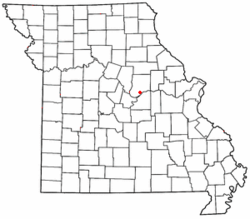 Location of Tebbetts in Missouri | |
| Country | United States |
| State | Missouri |
| County | Callaway |
| Area | |
| • Total | 0.68 sq mi (1.75 km2) |
| • Land | 0.65 sq mi (1.68 km2) |
| • Water | 0.03 sq mi (0.07 km2) |
| Population (2020) | |
| • Total | 64 |
| • Density | 98.46/sq mi (37.99/km2) |
| FIPS code | 29-70342 |
| GNIS feature ID | 727509[2] |
A post office called Tebbetts has been in operation since 1895.[5] The community was named after a railroad employee.[6]
The Cote Sans Dessein Archeological Site and Oakley Chapel African Methodist Episcopal Church are listed on the National Register of Historic Places.[7]

Demographics
| Historical population | |||
|---|---|---|---|
| Census | Pop. | %± | |
| 2020 | 64 | — | |
| U.S. Decennial Census[8] | |||
References
- "ArcGIS REST Services Directory". United States Census Bureau. Retrieved September 5, 2022.
- U.S. Geological Survey Geographic Names Information System: Tebbetts, Missouri
- Missouri Atlas & Gazetteer, DeLorme, 2007, Third edition, p. 38, ISBN 0-89933-353-2
- U.S. Geological Survey Geographic Names Information System: Tebbetts, Missouri
- "Post Offices". Jim Forte Postal History. Retrieved 7 September 2016.
- "Callaway County Place Names, 1928–1945 (archived)". The State Historical Society of Missouri. Archived from the original on 24 June 2016. Retrieved 7 September 2016.
{{cite web}}: CS1 maint: bot: original URL status unknown (link) - "National Register Information System". National Register of Historic Places. National Park Service. July 9, 2010.
- "Census of Population and Housing". Census.gov. Retrieved June 4, 2016.
Municipalities and communities of Callaway County, Missouri, United States | ||
|---|---|---|
County seat: Fulton | ||
| Cities |  | |
| Village | ||
| Townships | ||
| CDP | ||
| Other communities |
| |
| Ghost towns |
| |
| Footnotes | ‡This populated place also has portions in an adjacent county or counties | |
| ||
This Callaway County, Missouri state location article is a stub. You can help Wikipedia by expanding it. |
Текст в блоке "Читать" взят с сайта "Википедия" и доступен по лицензии Creative Commons Attribution-ShareAlike; в отдельных случаях могут действовать дополнительные условия.
Другой контент может иметь иную лицензию. Перед использованием материалов сайта WikiSort.org внимательно изучите правила лицензирования конкретных элементов наполнения сайта.
Другой контент может иметь иную лицензию. Перед использованием материалов сайта WikiSort.org внимательно изучите правила лицензирования конкретных элементов наполнения сайта.
2019-2026
WikiSort.org - проект по пересортировке и дополнению контента Википедии
WikiSort.org - проект по пересортировке и дополнению контента Википедии