world.wikisort.org - USA
Tat Momoli (O'odham: Taḍ Memelkuḍ) is a census-designated place located in Pinal County, Arizona, United States, on the Tohono Oʼodham Indian Reservation. As of the Census of 2010 it had a population of 10 with a population density of 4.16 people per km2.[2]
Tat Momoli, Arizona | |
|---|---|
CDP | |
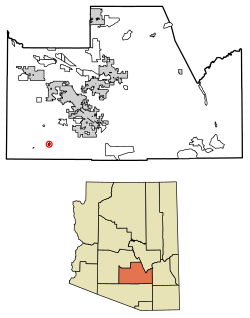 Location of Tat Momoli in Pinal County, Arizona. | |
| Country | United States |
| State | Arizona |
| County | Pinal |
| Area | |
| • Total | 0.93 sq mi (2.41 km2) |
| • Land | 0.93 sq mi (2.41 km2) |
| • Water | 0.00 sq mi (0.00 km2) |
| Population (2020) | |
| • Total | 18 |
| • Density | 19.38/sq mi (7.48/km2) |
| Time zone | UTC-7 (MST (no DST)) |
| FIPS code | 04-72280 |
Geography
Tat Momoli is located at 32°36′4″N 111°53′10″W. According to the United States Census Bureau, Tat Momoli has a total area of 2.41 km2, all land.[3]
Demographics
| Historical population | |||
|---|---|---|---|
| Census | Pop. | %± | |
| 2020 | 18 | — | |
| U.S. Decennial Census[4] | |||
According to the Census of 2010,[5] there were 10 people living in Tat Momoli. The population density was 4.16 people/km2. Of the 10 residents, Tat Momoli was composed of 10% whites, 60% American Indians or Alaska Natives, and 30% were some other race. Out of the total population 30% were Hispanic or Latino of any race.[6]
References
- "2020 U.S. Gazetteer Files". United States Census Bureau. Retrieved October 29, 2021.
- "US Gazetteer files: 2010, 2000, and 1990". United States Census Bureau. 2011-02-12. Retrieved 2011-04-23.
- "Find a County". National Association of Counties. Retrieved 2011-06-07.
- "Census of Population and Housing". Census.gov. Retrieved June 4, 2016.
- "U.S. Census website". United States Census Bureau. Retrieved 2008-01-31.
- "US Board on Geographic Names". United States Geological Survey. 2007-10-25. Retrieved 2008-01-31.
Municipalities and communities of Pinal County, Arizona, United States | ||
|---|---|---|
County seat: Florence | ||
| Cities |
|  |
| Towns |
| |
| CDPs |
| |
| Populated places |
| |
| Indian reservations |
| |
| Ghost towns |
| |
| Footnotes | ‡This populated place also has portions in an adjacent county or counties | |
| ||
Текст в блоке "Читать" взят с сайта "Википедия" и доступен по лицензии Creative Commons Attribution-ShareAlike; в отдельных случаях могут действовать дополнительные условия.
Другой контент может иметь иную лицензию. Перед использованием материалов сайта WikiSort.org внимательно изучите правила лицензирования конкретных элементов наполнения сайта.
Другой контент может иметь иную лицензию. Перед использованием материалов сайта WikiSort.org внимательно изучите правила лицензирования конкретных элементов наполнения сайта.
2019-2025
WikiSort.org - проект по пересортировке и дополнению контента Википедии
WikiSort.org - проект по пересортировке и дополнению контента Википедии