world.wikisort.org - USA
Tasco is an unincorporated community in Sheridan County, Kansas, United States.[1] It is located about 7 miles east of Hoxie and south of U.S. Route 24 highway, next to an abandoned railroad.
Tasco, Kansas | |
|---|---|
Unincorporated community | |
 KDOT map of Sheridan County (legend) | |
 Tasco  Tasco | |
| Coordinates: 39°21′8″N 100°18′10″W[1] | |
| Country | United States |
| State | Kansas |
| County | Sheridan |
| Elevation | 2,500 ft (800 m) |
| Time zone | UTC-6 (CST) |
| • Summer (DST) | UTC-5 (CDT) |
| Area code | 785 |
| FIPS code | 20-70025 [1] |
| GNIS ID | 471276 [1] |
History
Originally named Guy was issued a post office in 1887.[2][1] The post office was renamed Tasco in 1923, then discontinued in 1953.[3]
Education
The community is served by Hoxie USD 412 public school district.
References
- "Tasco, Kansas", Geographic Names Information System, United States Geological Survey
- "Origin of Town Names" (PDF). Solomon Valley Highway 24 Heritage Alliance. p. 6. Retrieved 9 April 2018.
- "Kansas Post Offices, 1828-1961". Kansas Historical Society. Retrieved 2018-01-02.[permanent dead link]
Further reading
External links
Municipalities and communities of Sheridan County, Kansas, United States | ||
|---|---|---|
County seat: Hoxie | ||
| Cities | 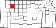 | |
| Unincorporated communities | ||
| Ghost towns | ||
| Townships |
| |
| ||
Текст в блоке "Читать" взят с сайта "Википедия" и доступен по лицензии Creative Commons Attribution-ShareAlike; в отдельных случаях могут действовать дополнительные условия.
Другой контент может иметь иную лицензию. Перед использованием материалов сайта WikiSort.org внимательно изучите правила лицензирования конкретных элементов наполнения сайта.
Другой контент может иметь иную лицензию. Перед использованием материалов сайта WikiSort.org внимательно изучите правила лицензирования конкретных элементов наполнения сайта.
2019-2026
WikiSort.org - проект по пересортировке и дополнению контента Википедии
WikiSort.org - проект по пересортировке и дополнению контента Википедии