world.wikisort.org - USA
Sumner Township is one of sixteen townships in Buchanan County, Iowa, USA. As of the 2000 census, its population was 3,148.
Sumner Township, Buchanan County | |
|---|---|
Township | |
 | |
| Coordinates: 42°25′25″N 091°53′40″W | |
| Country | |
| State | |
| County | Buchanan |
| Area | |
| • Total | 34.31 sq mi (88.85 km2) |
| • Land | 34.02 sq mi (88.12 km2) |
| • Water | 0.28 sq mi (0.73 km2) |
| Elevation | 932 ft (284 m) |
| Population (2000) | |
| • Total | 3,148 |
| • Density | 92.5/sq mi (35.7/km2) |
| FIPS code | 19-94047[2] |
| GNIS feature ID | 0468765 |
Geography
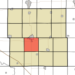
Sumner Township covers an area of 34.31 square miles (88.9 km2) and contains the southern half of the city of Independence. According to the USGS, it contains four cemeteries: Mount Hope, Oakwood, State Hospital and Wilson.
References
- "US Board on Geographic Names". United States Geological Survey. 2007-10-25. Retrieved 2008-01-31.
- "U.S. Census website". United States Census Bureau. Retrieved 2008-01-31.
External links
Municipalities and communities of Buchanan County, Iowa, United States | ||
|---|---|---|
County seat: Independence | ||
| Cities |
|  |
| Townships |
| |
| Unincorporated communities |
| |
| Ghost towns |
| |
| Footnotes | ‡This populated place also has portions in an adjacent county or counties | |
| ||
This article about the geography of Buchanan County, Iowa is a stub. You can help Wikipedia by expanding it. |
Текст в блоке "Читать" взят с сайта "Википедия" и доступен по лицензии Creative Commons Attribution-ShareAlike; в отдельных случаях могут действовать дополнительные условия.
Другой контент может иметь иную лицензию. Перед использованием материалов сайта WikiSort.org внимательно изучите правила лицензирования конкретных элементов наполнения сайта.
Другой контент может иметь иную лицензию. Перед использованием материалов сайта WikiSort.org внимательно изучите правила лицензирования конкретных элементов наполнения сайта.
2019-2026
WikiSort.org - проект по пересортировке и дополнению контента Википедии
WikiSort.org - проект по пересортировке и дополнению контента Википедии